
7.1.4 Coastal Dunefields (Boneo, The Cups, Cerberus)
7. Eastern Plains (EP)
7.1 Central Sunklands
| Coastal dunefields are the major feature of the southern part of the Nepean Peninsula. The soils developed on the most recent calcareous dunes adjoining the Bass Strait coastline are strongly alkaline and may contain hard sheets of calcrete (Calcarosols). Further away from the coast, the dunes are older and the calcium carbonate has been leached down the soil profile. These dunes are siliceous and acidic, with the soils often having a hard dark brown B horizon of “coffee rock”, composed of organic matter and aluminium and/or iron compounds (Podosols). These differences in pH, together with soils drainage, give rise to a number of distinct types of vegetation communities, including coastal alkaline scrub in the area known as “The Cups” and deep sands herb rich woodland around Boneo and on the western flank of the Selwyn Fault. As horticulture becomes displaced from the sandy soils closer to Melbourne, these soils are becoming increasingly used for this purpose. The northern part of French Island is also regarded as a coastal dunefield but here the sands are siliceous and the soils acidic, generally with a pronounced “coffee rock” layer in the subsoil (Podosols). The north-eastern part is mostly uncleared and is a State Park. | 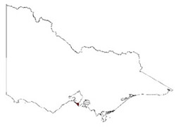 |
© State of Victoria (Agriculture Victoria) 1996 - .

This work, Victorian Resources Online, is licensed under a Creative Commons Attribution 4.0 licence. You are free to re-use the work under that licence, on the condition that you credit the State of Victoria (Agriculture Victoria) as author, indicate if changes were made and comply with the other licence terms.
The licence does not apply to ‘branding’ or some ‘images or photographs’ that may be owned by third parties. We ask you to seek prior approval to use images using the VRO feedback form. Access to higher quality images can also be provided on request.
This page was last updated on .