
7. Eastern Plains (EP)
Victoria's Geomorphological Framework (VGF)
7.1 Central sunklands
7.2 South eastern riverine plains
7.3 High level terraces and fans
| South of the Eastern Victorian Uplands and east of Port Phillip Bay lie the Eastern Plains (EP) and most of the Southern Uplands (SU). The Southern Uplands, which are described elsewhere, comprise the Strzelecki and Hoddle Ranges, much of the Mornington Peninsula and Wilson’s Promontory as well as the Otway Ranges west of Port Phillip Bay (see Division 3). On either side of the uplands east of Port Phillip Bay lie the Eastern Plains. They are mostly of low relief, ranging from undulating rises to almost level plains. The surficial sediments are mostly alluvial and range in age from Quaternary to Recent. These mainly comprise sediments derived from the Eastern Uplands (EU) to the north. The youngest sediments are the flood plains, swamps and morasses associated with the present rivers and streams. In the Western Port and Port Phillip Bay Sunklands, swamp and lagoonal deposits were drained only after European settlement. Recent aeolian deposits include the calcareous and siliceous dunes of the Western Mornington Peninsula and those extending from Corner Inlet to Lake Tyers, behind which elongated lagoons and salt marshes often occur (see also Division 8 – Coasts). | 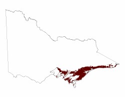 |
Between Traralgon and Bairnsdale, mostly north of the La Trobe River, are extensive Quaternary terraces associated with the earlier rivers and streams, most originating from Eastern Uplands . A number of terraces have been identified; the earliest suggested being the result of the Kosciusko Uplift. Later terraces are attributed to sea level changes associated with glacial periods that occurred during the Quaternary. The most widespread terrace is believed to date from the Early Quaternary and is a high-level terrace extending from Stratford to Bairnsdale. Parts are mantled by sand dunes. This sand accumulated downwind from the beds of the south-flowing streams, mainly the Perry River. The areas mantled by sand become smaller towards Bairnsdale.
Extensive Quaternary high terraces and fans occur in the northern, southern and eastern parts of the Eastern Plains. In the southern and eastern parts they are mantled by siliceous sand sheets and dunes, generally trending East-West. The most extensive dunefields extend north-east from the Eastern Uplands and cover much of a broad, low, uplifted north-easterly trending fault block defined by the Rosedale and Wonwron Monoclines The maximum elevation of this ridge is about 300 m where it adjoins the Balook block of the Southern Uplands. These sand sheets are presently quite stable but were probably active during the arid Last Glacial period. Reworking and deflation of immediately underlying Quaternary sediments was the likely source of this sand.
© State of Victoria (Agriculture Victoria) 1996 - .

This work, Victorian Resources Online, is licensed under a Creative Commons Attribution 4.0 licence. You are free to re-use the work under that licence, on the condition that you credit the State of Victoria (Agriculture Victoria) as author, indicate if changes were made and comply with the other licence terms.
The licence does not apply to ‘branding’ or some ‘images or photographs’ that may be owned by third parties. We ask you to seek prior approval to use images using the VRO feedback form. Access to higher quality images can also be provided on request.
This page was last updated on .