
6.1.1 Eruption points; maars, scoria cones and lava shields, including associated ash and scoria deposits (Lake Purrumbete, Mt. Elephant, Mt. Cottrell)
6. Western Plains (WP)
6.1 Volcanic plains
| The most obvious features — scoria cones, lava shields, composite cones (of both scoria and lava), and maars — indicate the most recent eruptive activity. Mount Anakie (398 m) and Mount Elephant (393 m) on the eastern and western boundary of the Corangamite CMA region respectively, form the highest cones. Some of the maars have lakes in their wide craters, such as Lake Purrumbete, Lake Bullen Merri and Lake Gnotuk. The young volcanoes, with their craters, flows and ash deposits, are from less than one million years in age and were active almost up to the present day Associated soil types include shallow to moderately deep friable (black, red or brown) gradational soils (Dermosols, Ferrosols) often stony. | 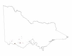 |
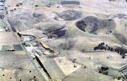 The deep central crater and quarries at Mt Noorat. | 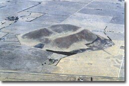 Breached crater of Mount Elephant. | 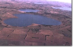 The Maar Crater Lakes of Bullen Merri (foreground) and Gnotuk. |
Eruption Points of the Newer Volcanics - Rosengren 1994
© State of Victoria (Agriculture Victoria) 1996 - .

This work, Victorian Resources Online, is licensed under a Creative Commons Attribution 4.0 licence. You are free to re-use the work under that licence, on the condition that you credit the State of Victoria (Agriculture Victoria) as author, indicate if changes were made and comply with the other licence terms.
The licence does not apply to ‘branding’ or some ‘images or photographs’ that may be owned by third parties. We ask you to seek prior approval to use images using the VRO feedback form. Access to higher quality images can also be provided on request.
This page was last updated on .