
3.3.1 Plateau (Bellarine Peninsula, Cape Liptrap, Moorooduc Plains; including Mt Martha and Mt Eliza)
3. Southern Uplands (SU)
3.3 Very low relief (very low elevation, generally less than 100 m)
| West of Port Phillip Bay The uplifted block of the Bellarine Peninsula forms a very weakly dissected undulating plain of low elevation (less than 150 m). Drainage from the remnant basalts of the Palaeogene Older Volcanics forms a vaguely radial pattern on the elevated plateau. A narrow strip of deeply weathered Cretaceous Otway Group rocks occurs in outcrop along the southern edge of the Curlewis Monocline, which forms the northern boundary of the peninsula. Landslides and narrow gullies have formed along the northern edge of the monocline. A sheet of marine sands of Late Neogene age covers the southern portion of the uplifted Bellarine block. East of Colac the Pliocene sand has been uplifted along the Colac Monocline to form a gently undulating plateau fringing the southern edge of the volcanic plain and the north-western edge of the Otway Ranges. The plateau had been dissected by the tributaries to the Barwon River south of Birregurra to Whooreel. Further south, this unit is transitional to the rolling hills geomorphological unit (3.3.2). Soil types include mottled (and occasionally sodic) texture contrast soils (Chromosols, Sodosols) on the Neogene sediments and black self-mulching soils (Vertosols) on the Palaeogene Older Volcanics. | 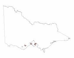 |
East of Port Phillip Bay
Most of the northern Mornington Peninsula is a weakly dissected undulating plain of low elevation, mostly less than 100 m. However on the western side there are two prominent granite hills, Mt Martha and Mt Eliza, both about 150 m high. Apart from these small areas of Palaeozoic granite, Palaeozoic sediments occur over the whole area, but Neogene sediments mostly overlie these. Often the Palaeozoic sediments are exposed by the stream incisions but elsewhere they occur above the level of the plain, e.g. east of Langwarrin and west of Balcombe. Between Somerville and Devon Meadows there are sand sheets of Late Neogene age that partly cover the underlying sediments, often the lower parts of the landscape.
Apart from the soils on the sands, most of the soils on sediments are mottled yellow and brown texture contrast soils, occasionally sodic (Chromosols and Sodosols). The sandy soils are strongly acid with bleached sandy subsoil and a hard, dark brown “B” horizon of “coffee rock” at about 0.8 m, composed of organic matter and aluminium and/or iron compounds (Podosols).
Prior to European settlement most of the area was covered with Grassy Woodland, with Lowland Forest in the southern part. The sands were covered by a Heathy Woodland. Outside the urban areas, most is cleared for grazing with areas of viticulture on the better drained soils. Vegetable and flower growing occurs on the sandy soils.
© State of Victoria (Agriculture Victoria) 1996 - .

This work, Victorian Resources Online, is licensed under a Creative Commons Attribution 4.0 licence. You are free to re-use the work under that licence, on the condition that you credit the State of Victoria (Agriculture Victoria) as author, indicate if changes were made and comply with the other licence terms.
The licence does not apply to ‘branding’ or some ‘images or photographs’ that may be owned by third parties. We ask you to seek prior approval to use images using the VRO feedback form. Access to higher quality images can also be provided on request.
This page was last updated on .