
3.2.1 Plateau and broad ridges (Arthur's Seat, Grantville-Drouin, Cape Woolamai)
3. Southern Uplands (SU)
3.2 Low relief (low elevation, about 100 - 250 m)
| These plateau and broad ridges occur both on the southern Mornington Peninsula and from near Grantville to north of Warragul. Mornington Peninsula The dissected plateau that extends from Arthur’s Seat and Red Hill to Flinders and Cape Schanck is mostly formed on Palaeogene basalt (see sections 3.2.3 and 3.3.3), with the north-western part around Arthur’s Seat being comprised of Upper Devonian granite. It is bounded by faults on the east and west. On the western flank of the plateau, a deep layer of sand, continuous with the low lying tongue of the Nepean sand bar to the west, was blown up the escarpment during the Neogene by the prevailing on-shore winds and covers the underlying rock. Annual rainfall varies from about 700 to 1000 mm. On the granite are the soils gritty texture contrast soils (Chromosols) with gradational soils (Dermosols) on the steeper slopes. The deep sands on the western escarpment and the western part of the plateau are acidic sands with bleached subsoil and a dark brown “B” horizon of “coffee rock” at about 0.8 m, composed of organic matter and aluminium and/or iron compounds (Podosols). | 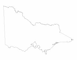 |
Much of the original vegetation remains. On the shallower soils at Arthur’s Seat the vegetation is Grassy Woodland, with Lowland Forest occupying the main part of the plateau. Most of this area is State Park. On the sandy soils there is a large area set aside as a National Park known as Green’s Bush. Here the vegetation is described as deep sands Herb-rich woodland. However most of the area of the plateau is basalt capped (see 3.2.3), mostly cleared and subdivided into small allotments for “recreational farming” and, increasingly, for viticulture.
Grantville-Drouin
This dissected plateau is part of an earlier paleosurface that possibly developed during the Late Palaeogene to Early Neogene prior to the extensive faulting that resulted in the southern uplands. The scarp pf the Heath Hill fault forming the western boundary is a conspicuous landscape feature. Most of the northern half of the plateau around Drouin and Warragul is capped with mid Tertiary Palaeogene basalt (see 3.2.3) with some Palaeozoic sediments north and west of Drouin. The southern part is mostly comprised of lower Cretaceous sediments that may be mantled with sand on the western flank from about Grantville to Heath Hill. Some Late Paleogene to Neogene fluvial sediments occur within the southern part of the plateau and are extensively mined for sand and gravel.
Most of the soils on both Palaeozoic and Cretaceous sediments are acidic mottled yellow and brown texture gradational soils (Dermosols) but a large proportion of them are acidic mottled brown and yellow contrast soils (Kurosols). The deep sands on the western escarpment from Grantville to Heath Hill are similar to those on the western slopes of the Mornington Peninsula in that they are acidic sands with bleached subsoil and a dark brown “B” horizon of “coffee rock” (Podosols). The non-basaltic soils have been regarded in the past as being among the poorer soils because many are acidic. The clearing of remnants of the former forest has continued until fairly recently.
The southern part of the plateau receives an annual rainfall of between 700 and 1 000 mm but north of Nyora it exceeds 1 000 mm. The deep sands in the south supported damp Heathy Woodland that retains remnants of native vegetation. South of Drouin the vegetation was originally Lowland Forest, but in the on the northern part of the plateau it was Damp Forest.
Cape Woolamai
Cape Woolamai is a low relief granitic plateau with a discontinuous sandy surface. Steep rocky cliffs occur on the southern coastline. As this area is a State Faunal Reserve with mutton bird rookeries, the vegetation (Coastal Headland Scrub, Coastal Dune Scrub and Succulent Herbland Mosaic) is mostly intact.
© State of Victoria (Agriculture Victoria) 1996 - .

This work, Victorian Resources Online, is licensed under a Creative Commons Attribution 4.0 licence. You are free to re-use the work under that licence, on the condition that you credit the State of Victoria (Agriculture Victoria) as author, indicate if changes were made and comply with the other licence terms.
The licence does not apply to ‘branding’ or some ‘images or photographs’ that may be owned by third parties. We ask you to seek prior approval to use images using the VRO feedback form. Access to higher quality images can also be provided on request.
This page was last updated on .