
2.3.1 Low relief, low drainage density (Dundas East, Chatsworth)
2. Western Uplands (WU)
2.3 Low elevation plateaux (Tablelands)
| Sections of the western Dundas Tableland occur in the Wimmera CMA region along the south-western boundary of the catchment (e.g. Kadnook). Fault scarps and a monocline (Kanawinka Monocline) towards the South Australian border delineate the western extent of the Dundas Tableland. Importantly, these occurrences within the Wimmera CMA region occur on the northern margin of the Glenelg River and reflect the extreme dissection of the tablelands. Sandy rises and plains of the stranded beach ridges along with the Douglas Depression neighbour these artefacts of a once much larger peneplain that may have extended across much of Western Victoria including the upper Wimmera River catchment. The western block of the Dundas Tablelands (elevation at 320-360 m (Quinn 1977) comprises an elevated low plateau that resulted from domal uplift of underlying Palaeozoic and Mesozoic rocks that are largely obscured by overlying Cainozoic deposits. Uplift in the Neogene and sea-level falls during the Quaternary (Joyce 1992) resulted in incision of the main rivers (Glenelg and Wannon) forming deep narrow valleys. This deep incision and dissection of the peneplain coupled with domal warping allows distinction of the western Dundas Tablelands against its eastern block. | 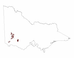 |
Slopes are gentle to very gentle with little significant relief across the landscape, however majestic red gum occupy slopes and plains along with groundwater discharge in lower topographic reaches are extremely prominent features of this landscape. Surface drainage into the Douglas Depression is through a series of dendritic stream systems that supply White Lake and Centre Lake in the south of the depression.
Intense weathering during the Palaeogene and Neogene has resulted in deep regolith profiles that are characterised by basal kaolinitic saprolite with strong cementation of ferromanganiferous nodules (ferricrete) in the upper profile. The blanketing of the underlying bedrock with deep regolith is known as the Dundas Surface (Hill 1939, 1975).
The Cainozoic duricrust of the Dundas Tablelands represents the product of weathering from late Palaeogene times to present. The ferruginisation of strandlines left behind during the Pliocene regression lies above a surface that has experienced isovolumetric alteration preserving original rock structures (Joyce et al. 2003). Slightly weathered to fresh bedrock degrades into a weathering surface with an alteration rind common along joints and fractures. A pallid zone of completely decomposed bedrock with bedrock features preserved in white kaolinite formed from oxidising and reducing condition of water table fluctuations (Paine 1995). Completely weathered fractured rock with iron enriched cores then graduates into the upper mottled zone with prominent ‘tiger mottles’ of enriched iron layers alternating with iron depleted clays in a lateral sequence. Sandy loams with variable quantities of ferromanganiferous nodules highlight surface sequences of this prominent regolith sequence.
Soils are gradational to texture contrast soils with sandy surfaces and heavy subsoils (Dermosols, Chromosols). With acidic profile trends, ferricrete and ferruginous segregations (buckshot) are common features of once larger palaeosurface. The distinctive red and pale grey mottling of subsoils is recognised as ‘tiger mottling’ and is a feature found across the tablelands in these texture contrast soils.
Vegetation of these undulating to steeper slopes is largely savannah woodlands (Heathy woodlands) with remnant Red Gum scattered across the peneplain and concentrated along drainage lines within deep valleys. Plains Sedgy Woodland, Seasonally Inundated Shrubby Woodland and Shallow Sands Woodland occur on poorly drained soils.
Related information on VRO
- A Study of the Land in the Grampians Area (G T Sibley 1967)
© State of Victoria (Agriculture Victoria) 1996 - .

This work, Victorian Resources Online, is licensed under a Creative Commons Attribution 4.0 licence. You are free to re-use the work under that licence, on the condition that you credit the State of Victoria (Agriculture Victoria) as author, indicate if changes were made and comply with the other licence terms.
The licence does not apply to ‘branding’ or some ‘images or photographs’ that may be owned by third parties. We ask you to seek prior approval to use images using the VRO feedback form. Access to higher quality images can also be provided on request.
This page was last updated on .