
1.4.3 Escarpments, gorges (Mt Buffalo escarpment/gorge, Erinundra escarpment, Genoa, Mitchell, Moroka gorges and Snowy River gorges)
1. Eastern Uplands (EU)
1.4 Dissected landscapes at a range of elevations
| In the headwaters of the major streams, and especially where the streams leave the high plateaus, steep gorges may be formed (e.g. the gorges of Rocky Valley and Pretty Valley Creeks where they leave the Bogong High Plains), and distinctive knick points are sometimes apparent. Other gorges have formed where streams are cutting through erosion-resistant rock. The escarpments on the eastern slopes of granitic Mt Buffalo and the gorge are well known examples of this unit on the northern side of the Divide. The escarpment on the eastern fall from the Cobbler plateau is also well known for its waterfall. Many of the major streams on the southern side of the Divide have gorges and/or escarpments, e.g. The Snowy River above Buchan, the Little River, a tributary of the Snowy above Wulgulmerang, the Genoa River upstream of Genoa, the Mitchell River between Tabberabbera and Glenaladale, and the Moroka River after it leaves the Wellington Plain area and joins the Wonnangatta River. | 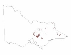 |
South of the Great Divide, an escarpment of vertical rhyolite columns of Upper Devonian age forms the western edge of the Wellington Plateau and an escarpment crowns the northern side of Snowy Bluff (1 385 m), rising above the junction of the Moroka and Wonnangatta Rivers. The eastern edge of the Snowy Range is marked by a pronounced escarpment in slightly inclined Upper Devonian sandstone, with vertical cliffs and a waterfall at Bryces Gorge adjoining Bryces Plain. An escarpment face in similar rocks is found at The Bluff overlooking the Howqua River and north of Mt. Howitt.
Gorges and escarpments such as these are dramatic and significant landforms that terminate or link major geomorphic units, but they are not easily mapped on small-scale maps.
On exposed aspects these are typically dry and hot environments, although on sheltered aspects, and where seepage through fissures in the rock occurs, more mesic vegetation may occur, e.g. mosses and ferns. Although there may be taller tree vegetation where deeper soils have formed, more commonly, stunted trees and heathy shrubs may grow in deep crevasses and where enough soil provides sufficient moisture to sustain permanent plant growth. Hardy perennial and annual herbs and grasses also grow in these sites, but where there is little or no soil, the more common vegetative cover is provided by mosses and lichens. The road to the Mt. Buffalo plateau passes through a good example of an exposed escarpment.
Because of the steepness of the slopes, bare rock surfaces are widespread. Soils persist where obstructions such as ledges and crevasses trap sediment / debris. They are typically shallow and stony and usually lack profile development except for some organic material at the surface (Rudosols).
© State of Victoria (Agriculture Victoria) 1996 - .

This work, Victorian Resources Online, is licensed under a Creative Commons Attribution 4.0 licence. You are free to re-use the work under that licence, on the condition that you credit the State of Victoria (Agriculture Victoria) as author, indicate if changes were made and comply with the other licence terms.
The licence does not apply to ‘branding’ or some ‘images or photographs’ that may be owned by third parties. We ask you to seek prior approval to use images using the VRO feedback form. Access to higher quality images can also be provided on request.
This page was last updated on .