
Digital Elevation Models
Digital Elevation Models (DEMs) have become a widely used tool and product in the last 20 years. They provide a snap shot of the landscape and landscape features while also providing elevation values. They have allowed us to better visualise and interrogate topographic features.
A Digital Elevation Model (DEM) is generically described as a spatially geo-referenced data set that is a popular way of encoding the topography for environmental modelling purposes. They are also directly compatible with remotely sensed data sources and are able to represent complex terrain units given the DEM has an adequate resolution.
Generally, DEMs have been derived from topographic data using contour data, spot heights, hydrology and boundaries (shore line, state, tile). The Victorian 1:25 000 DEMs have been formulated using this topographic information and the software package called ANUDEM (developed at the Australian National University by Michael Hutchinson).
DEMs developed using ANUDEM contain a derived value for elevation. They differ from a digital terrain model (DTM) due to their hydrologic correction (stream enforcement) with respect to flow direction and scale of hydrologic features.
For the 1:25 000 DEMs, the interpolation of topographic data is to a 20x20 m grid. The planimetric accuracy of DEMs is the direct result of a sum of errors from three sources of topographic data:
Source Data: 1:25 000 topographic maps. Horizontal accuracy - 90% of well defined points will fall within +/- 12.5m of true position. Vertical accuracy - 90% of elevations will fall within +/- 0.5 of a contour interval which are at 10 m.
Digital Data: Any departure between the digital and source material (measured between centrelines) will not exceed 0.5 mm at map scale (ie. 12.5 m at 1:25,000) with a root mean square of 0.12 mm for any random sample.
Some general derivatives from digital elevation models include:
Slope, slope length and slope position.
Aspect.
Drainage network / Catchment boundaries.
Hydrological indices and water table indices.
Climate variables.
Input to estimation of soil parameters.
Input to land component and soil type mapping.
Viewshed analysis.
Visualisation.
Environment modelling - including salinity, species distribution, spread models, etc.
One of the most useful properties of digital elevation models is the ability to reclassify data sets. Slope, aspect, elevation, etc can be classified to meet requirements or parameters of landscape components.
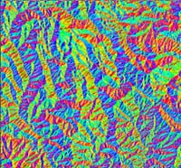 Aspect classification. | 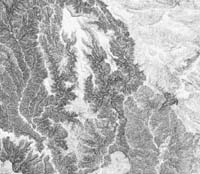 Slope classification. |
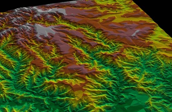
3-D Digital Elevation Model.
Soft photogrammetric Digital Terrain Models (DTMs)
With the increasing demands for high accuracy elevation and terrain information, new technologies have satisfied these requests. One such technology that has developed is soft photogrammetry. Here the high-end software image packages has enabled the generation of superior quality orthophoto's that provide accurate, high resolution, orthographically corrected images.
Colour matching and radiometric levelling are used to remove tonal imbalances across each image producing seamless orthophoto mosaics. Combined with ground control points, this software enables the creation of high accuracy DTMs. The accuracy of these DTMs in the horizontal and vertical axis is dependent upon the scale of photography used and quantity/quality of ground control points.
An example of this provided below highlight differences between a hydrologically corrected dem and a soft-photogrammetry dtm for the same area in the Wimmera.
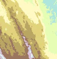 Hydrologically Corrected DEM | 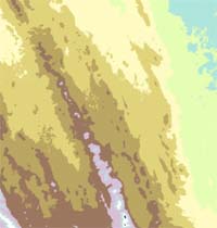 Soft-Photogrammetry DTM |
© State of Victoria (Agriculture Victoria) 1996 - .

This work, Victorian Resources Online, is licensed under a Creative Commons Attribution 4.0 licence. You are free to re-use the work under that licence, on the condition that you credit the State of Victoria (Agriculture Victoria) as author, indicate if changes were made and comply with the other licence terms.
The licence does not apply to ‘branding’ or some ‘images or photographs’ that may be owned by third parties. We ask you to seek prior approval to use images using the VRO feedback form. Access to higher quality images can also be provided on request.
This page was last updated on .