
Cups
Cups - Symbol: Cp
The unique landscape near and west of Truemans Road, known locally as “The Cups”, is comprised of a strongly undulating dunefield with steep short slopes and enclosed depressions. The sands are late Pleistocene in origin and were most likely windblown sands blown in from Bass Strait when it was dry land during the last glacial period. All of the soils are deep sands and all become calcareous with depth. The pH of the surface soils is around 7.0 to 8.0 but at about 500 mm depth the pH increases to between 8.0 to 8.5.
The surface soils are generally grey to pale grey sands and the subsoils are pale grayish brown to pale yellowish brown, generally with lime nodules. High amounts of lime may occur deeper, and this lime was used in lime kilns along the Port Phillip Bay coastline from Rye to Point Nepean. These soils are best described as Shelly Calcarosols using the Australian Soil Classification.
The remnant vegetation is calcarenite dune woodland. Because of its topography, the land is little used for vegetable growing, but is used for grazing. A number of golf courses and associated residential developments have been constructed near the coast.
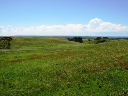 Example of the landscape of the 'Cups' | 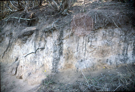 Example of a profile in the 'Cups' |

© State of Victoria (Agriculture Victoria) 1996 - .

This work, Victorian Resources Online, is licensed under a Creative Commons Attribution 4.0 licence. You are free to re-use the work under that licence, on the condition that you credit the State of Victoria (Agriculture Victoria) as author, indicate if changes were made and comply with the other licence terms.
The licence does not apply to ‘branding’ or some ‘images or photographs’ that may be owned by third parties. We ask you to seek prior approval to use images using the VRO feedback form. Access to higher quality images can also be provided on request.
This page was last updated on .