
Boneo
Boneo - Symbol: Bo
This mapping unit is confined to an intensively farmed area around Boneo. It contains an area of low dunes comprising sands from the early Pleistocene. All the surface soils are loamy sands or sands and these continue to a considerable depth. Variations in surface colour are mainly due to organic matter differences. The immediate subsoil colours range from pale greyish brown to brownish yellow. The pH of the surface soils is generally around 7 (i.e. neutral), with the pH increasing with depth. The soils are best described as sandy Tenosols using the Australian Soil Classification.
These soils have a very low inherent fertility and because they are sandy they retain little water. However, with irrigation, fertilizers and additional organic matter they become highly productive. The main attraction of these soils is that they can be cultivated over most of the year. Most of this mapping unit is used for vegetable production with a wide range of vegetables being grown – and usually two or three crops per year. Most of the irrigation water is derived from deep bores reaching into the underlying basalt.
No remnant vegetation occurs on this mapping unit.
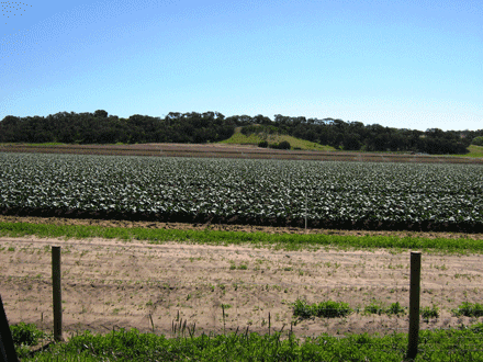 Boneo' landscape in foreground with 'Cups' landscape in background | 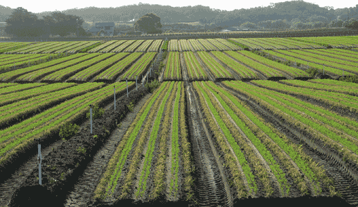 Vegetable cropping near Boneo |

© State of Victoria (Agriculture Victoria) 1996 - .

This work, Victorian Resources Online, is licensed under a Creative Commons Attribution 4.0 licence. You are free to re-use the work under that licence, on the condition that you credit the State of Victoria (Agriculture Victoria) as author, indicate if changes were made and comply with the other licence terms.
The licence does not apply to ‘branding’ or some ‘images or photographs’ that may be owned by third parties. We ask you to seek prior approval to use images using the VRO feedback form. Access to higher quality images can also be provided on request.
This page was last updated on .