
The Vegetation and Pastures of the Lexton Landcare Area
Back to Bet Bet Creek Catchment Homepage
To view the information PDF requires the use of a PDF reader. This can be installed for free from the Adobe website (external link).
This report on 'The Vegetation and Pastures of the Lexton Landcare Area' was prepared for the Lexton Landcare Group by M. Westbrooke and N. Hives from the University of Ballarat in 1991. This study was undertaken as part of an inventory of the natural resources f the Landcare area at a scale suitable for interpretation at a regional level. The purpose of this inventory is to enable more efficient planning of revegetation and soil improvement programs as part of the Lexton Landcare Rehabilitation Strategy Project.
 | Foreword | ||
| Acknowledgements (PDF 182KB) | |||
1. | The Natural Vegetation of the Lexton Landcare Area (PDF 320KB) 1.1 Summary 1.2 Introduction 1.2.1 Historical Perspective 1.2.2 The Legacy 1.2.3 Values of Remnant Vegetation 1.2.4 Roadside Vegetation 1.3 Methods 1.3.1 Vegetation Cover 1.3.2 Roadside Vegetation Assessment 1.4 Results 1.4.1 Native Vegetation of the Lexton Landcare Area 1.4.2 Roadside Assessment 1.5 Discussion 1.5.1 Factors affecting the decline of plants 1.5.2 Vegetation on Public Land 1.5.3 Roadside Vegetation' 1.5.4 Vegetation on Private Land | ||
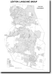
2. | Pastures of the Lexton Landcare Area (PDF 130KB) 2.1 Background 2.2 Pasture Assessment 2.3 Results | ||
| References (PDF (PDF 113KB) | |||
| Appendix 1 - Native Trees and Shrubs of the Caralulup State Forest (PDF 113KB | |||
| Appendix 2 - Letter to Landowners regarding Pastures (PDF 174KB) |
© State of Victoria (Agriculture Victoria) 1996 - .

This work, Victorian Resources Online, is licensed under a Creative Commons Attribution 4.0 licence. You are free to re-use the work under that licence, on the condition that you credit the State of Victoria (Agriculture Victoria) as author, indicate if changes were made and comply with the other licence terms.
The licence does not apply to ‘branding’ or some ‘images or photographs’ that may be owned by third parties. We ask you to seek prior approval to use images using the VRO feedback form. Access to higher quality images can also be provided on request.
This page was last updated on .