
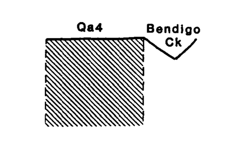
Marong map unit Qa4
Back to: A Land Capability Study of the Rural City of Marong
| Map Unit: | Quaternary alluvium, terrace (Bendigo Creek) | Map Unit Symbol: | Qa4 |
| % of Study Area: | 0.1 |
General Description:
A small narrow terrace associated with the Bendigo Creek. The soils represent three distinct periods of deposition. Brown silty clays barns overly loamy sands which overly silty clay loamy and light clays. This terrace is still prone to flooding and a levee bank lines a section of the creek. Saline discharge, probably caused by clearing in nearby sedimentary hills, occurs in the unit.
Site characteristics:
| Parent material age: | Quaternary | Depth seasonal watertable: | < 2 m |
| Lithology: | Alluvium | Potential recharge to groundwater: | High |
| Landform Pattern: | Alluvial terrace | Flooding risk: | Moderate |
| Element: | Flat | Drainage: | Well drained |
| Slope common: | 0% | Depth to hardrock: | > 2 m |
| Slope range: | 0-1% | ||
| Rock outcrop: | 0% |
Major vegetation: Yellow Gum, Yellow Box, Red Gum, Peppercorn, Spiny Rush, Rushes
Present land use: Grazing - cattle and sheep
| Land degradation: | Water erosion | Wind erosion | Salting | Acidification | |
Sheet/rill | Gully | ||||
| Susceptibility | Low | Low | Low | Moderate | Moderate |
| Incidence | Low | Nil | Low | Moderate | Low |
Soil profile characteristics:
| Permeability (measured - average, range): | 1630, 3330 - 460 mm/day |
| Permeability (estimated): | - |
| Available water capacity: | 306 mm H2O |
| Linear shrinkage (B horizon): | 10.4 % |
Soil profile description:
| 1A | 0-13 cm | Brownish black (10YR3/2) silty clay loam with fine sand, weak structure,subangular blocky peds 5-10 mm, smooth fabric, moderately weak consistence, moderate organic matter, pH 6.75. Clear transition to |
| 1B | 13-38 cm | Dull yellowish brown (10YR5/4) silty clay loam with fine sand, weak structure, subangular blocky peds 5-10 mm, smooth fabric, moderately weak consistence, pH 6.9. Clear transition to |
| 2C | 38-84 cm | Dull yellowish brown (10YR5/4) loamy sand, apedal, sandy fabric, pH 7.4. Clear transition to |
| 3A | 84-100 cm | Dull yellowish brown (10YR5/3) silty clay loam with fine sand, a few fine faint orange mottles, apedal, sandy fabric, pH 7.4. Clear transition to |
| 3B | 100-120+ cm | Dull yellowish brown (10YR5/4) light day, a few fine faint orange mottles, apedal, sandy fabric, pH 7.5 |
Soil classification:
| Factual Key (Northcote): | Um/Uc/G |
| Australian Soil Classification: | Rudosol; very deep, thin, silty, non-gravelly |
| Unified Soil Group: | CL |
Interpretation of soil analyses*
Horizon | pH | Gravel % | E.C. (salts) | Nutrient Status | P | K | Al | Organic Matter | Dispersibility |
| 1A | 6.75 | 0 | VL | M (estimation) | S | S | S | M | L |
| 1B | 6.9 | 0 | VL | L (estimation) | S | S | S | L | H |
| 2C | 7.4 | 0 | VL | VL (estimation) | S | S | S | L | L |
| 3A | 7.4 | 0 | VL | L (estimation) | S | S | S | L | M |
| 3B | 7.5 | 0 | VL | L (estimation) | S | S | S | L | H |
Land capability assessment
Land Use | Class | Major limiting feature(s)/ landuse |
| Agriculture (CTS values) | C3T1S4 | Low permeability index |
| Effluent disposal (septic tanks) | 3 | Moderate risk of flooding, very rapid permeability - risk of polluting groundwater and adjacent stream |
| Farm dams (earthen) | 5 | High seasonal watertable, very rapid permeability |
| Building foundations - slab | 3 | High seasonal watertable. moderate risk of flooding |
| Building foundations - stumps/footings | 3 | High seasonal watertable. moderate risk of flooding |
| Secondary roads | 3 | Moderate risk of flooding, moderate depth to seasonal watertable, Universal Soil Group |
| Urban residential | 3 | Secondary roads, building foundations |
| Rural residential | 5 | Farm dams |
The high resolution PDF file provided on this page can be viewed using the free Adobe PDF reader, this software can be installed for free from the Adobe website (external link).
A Land Capability Study of the Rural City of Marong - map unit Qa4 - (PDF - 41.3 KB)
© State of Victoria (Agriculture Victoria) 1996 - .

This work, Victorian Resources Online, is licensed under a Creative Commons Attribution 4.0 licence. You are free to re-use the work under that licence, on the condition that you credit the State of Victoria (Agriculture Victoria) as author, indicate if changes were made and comply with the other licence terms.
The licence does not apply to ‘branding’ or some ‘images or photographs’ that may be owned by third parties. We ask you to seek prior approval to use images using the VRO feedback form. Access to higher quality images can also be provided on request.
This page was last updated on .