
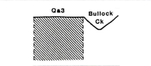
Marong map unit Qa3
Back to: A Land Capability Study of the Rural City of Marong
| Map Unit: | Quaternary alluvium, terrace (Bullock Creek) | Map Unit Symbol: | Qa3 |
| % of Study Area: | 0.3 |
General Description:
This narrow alluvial terrace extends along the length of Bullock Creek. The soils are young and consequently have not developed properties such as structure or mottles. The buried profile consists of four separate layers each representing different periods of deposition. A dark silty clay loam top soil has been deposited over a yellow brown fine sandy loam, a yellow orange clayey sand and a greyish brown fine sandy loam. The uses of this map unit are restricted because of its size and proximity to the creek.
Site characteristics:
| Parent material age: | Quaternary | Depth seasonal watertable: | > 2 m |
| Lithology: | Alluvium | Potential recharge to groundwater: | Moderate |
| Landform Pattern: | Alluvial terrace | Flooding risk: | High |
| Element: | Flat | Drainage: | Well drained |
| Slope common; | 0% | Depth to hardrock: | > 1.6 m |
| Slope range: | 0-2% | ||
| Rock outcrop: | 0% |
Major vegetation: Red Gum, Grey Box, Blackwood, Onion Grass
Present land use: Recreation (major), grazing (minor)
| Land degradation: | Water erosion | Wind erosion | Salting | Acidification | |
Sheet/rill | Gully | ||||
| Susceptibility | Low | Low | Low | Low | Low |
| Incidence | Low | Nil | Nil | Low | Nil |
Soil profile characteristics:
| Permeability (measured - average, range): | 2503, 267-8573 mm/day |
| Permeability (estimated): | - |
| Available water capacity: | 365 mm H20 |
| Linear shrinkage (B horizon): | 1.6 % |
Soil profile description:
| 1A | 0-7 cm | Brownish black (10YR3/1) silty clay loam, weak structure, subangular blocky peds 5-10 mm, smooth fabric, moderately firm consistence, high organic matter, pH 6.7. Clear transition to |
| 2A | 7-19 cm | Greyish yellow brown (10YR4/2) fine sandy loam, weak structure, angular blocky peds 2-5 mm, smooth fabric, moderately weak consistence, pH 6.7. Clear transition to |
| 3A | 19-68 cm | Dull yellow orange (10YR6/3) clayey sand, bleached (10YR8/3) when dry, apedal, sandy fabric, very weak consistence, pH 6.7. Clear transition to |
| 4A | 68-160+ cm | Greyish brown (7.5YR4/2) fine sandy loam, apedal, sandy fabric, very strong consistence, pH 6.7. |
Soil classification:
| Factual Key (Northcote): | Um/Uc |
| Australian Soil Classification: | Rudosol; very deep, thin, silty, non-gravelly |
| Unified Soil Group: | ML (68 - 160) cm |
Interpretation of soil analyses*
Horizon | pH | Gravel % | E.C. (salts) | Nutrient Status | P | K | Al | Organic Matter | Dispersibility |
| 1A | 6.7 | 1.4 | VL | M | D | S | S | H | L |
| 2A | 6.7 | < 1 | VL | L | D | S | S | L | L |
| 3A | 6.7 | < 1 | VL | VL | D | S | S | VL | L |
| 4A | 6.7 | < 1 | VL | L | D | S | S | VL | H |
Land capability assessment
Land Use | Class | Major limiting feature(s)/ landuse |
| Agriculture (CTS values) | C3T1S4 | Low permeability index |
| Effluent disposal (septic tanks) | 5 | High risk of flooding, very rapid permeability - risk of polluting groundwater and adjacent stream |
| Farm dams (earthen) | 5 | Very rapid permeability |
| Building foundations - slab | 5 | High risk of flooding |
| Building foundations - stumps/footings | 5 | High risk of flooding |
| Secondary roads | 5 | High risk of flooding |
| Urban residential | 5 | Secondary roads, building foundations |
| Rural residential | 5 | Farm dams, effluent disposal, secondary roads, building foundations |
The high resolution PDF file provided on this page can be viewed using the free Adobe PDF reader, this software can be installed for free from the Adobe website (external link).
A Land Capability Study of the Rural City of Marong - map unit Qa3 - (PDF - 51 KB)
© State of Victoria (Agriculture Victoria) 1996 - .

This work, Victorian Resources Online, is licensed under a Creative Commons Attribution 4.0 licence. You are free to re-use the work under that licence, on the condition that you credit the State of Victoria (Agriculture Victoria) as author, indicate if changes were made and comply with the other licence terms.
The licence does not apply to ‘branding’ or some ‘images or photographs’ that may be owned by third parties. We ask you to seek prior approval to use images using the VRO feedback form. Access to higher quality images can also be provided on request.
This page was last updated on .