
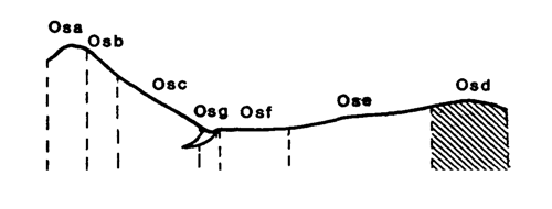
Marong map unit Osd
Back to: A Land Capability Study of the Rural City of Marong
| Map Unit: | Ordovcian sediments, gentle crest | Map Unit Symbol: | Osd |
| % of Study Area: | 2.5 |
General Description:
The soils on the sedimentary crests are dominantly yellow duplex with hardsetting fine sandy loam top soils, bleached, hardsetting A2 horizons and bright brown medium clay subsoils. Angular sedimentary fragments are common throughout the profile. A common variation of this soil type is the presence of a red clay subsoil. Along the centre of higher altitude crests bedrock is close to the surface and even outcrops. The shallow gravelly barns associated with the bedrock run in narrow bands.
Site characteristics:
| Parent material age: | Ordovician | Depth seasonal watertable: | > 5 m |
| Lithology: | Sediments | Potential recharge to groundwater: | Moderate |
| Landform Pattern: | Undulating low hils | Flooding risk: | Nil |
| Element: | Crests | Drainage: | Well drained |
| Slope common: | < 1 % | Depth to hardrock: | 0.5 m |
| Slope range: | 0 - 1% | ||
| Rock outcrop: | 0% |
Major vegetation: Grey Box, Yellow Box, Yellow Gum, Red Ironbark, Golden Wattle, Buloke, Spreading Wattle, Cat's Claw Grevillea, Black-anther Flax-lily, Wallaby Grass
Present land use: Native forest, grazing, residential (major), cropping (minor)
| Land degradation: | Water erosion | Wind erosion | Salting | Acidification | |
Sheet/rill | Gully | ||||
| Susceptibility | Moderate | Low | Low | Low | Low |
| Incidence | Moderate | Low | Low | Low | Low |
Soil profile characteristics:
| Permeability (measured - average, range): | 1330, 380 - 2144 mm/day |
| Permeability (estimated): | - |
| Available water capacity: | 79 mm H2O |
| Linear shrinkage (B horizon): | 4.7% |
Soil profile description:
| A1 | 0-8 cm | Hardsetting greyish brown (7.5YR4/2) loam fine sandy, weak structure, subangular blocky peds 5-10 mm, smooth fabric, moderately weak consistence, very few organic segregations, common angular sedimentary gravel fragments, moderate organic matter, pH 4.7. Abrupt transition to |
| A2 | 8-18 cm | Hardsetting orange (5YR6/6) loam fine sandy, sporadically bleached when dry, weak structure, angular blocky peds 5-10 mm, smooth fabric, moderately firm consistence, a few organic segregations throughout, common angular coarse sedimentary gravel, pH 4.7. Clear transition to |
| B21 | 18-37 cm | Bright brown (2.5YR5/6) light day, moderate structure, subangular blocky peds 5-10 mm, smooth fabric, moderately firm consistence, 2-10% organic segregations, common angular coarse sedimentary gravel, pH 4.8. Clear transition to |
| B22 | 37-50 cm | Bright brown (2.5YR5/6) light medium clay, a few faint fine orange mottles, moderate structure, subangular block peds 5-10 mm, smooth fabric, moderately firm consistence, less than 2% organic segregations, common angular coarse sedimentary gravel, pH 5.3. Sharp transition to |
| C | 50 cm | Rock |
Soil classification:
| Factual Key (Northcote): | Dy2.41 (major) Dr2.31 /3 (minor) |
| Australian Soil Classification: | Haplic, Magnesic, Red, Kurosol; moderate, medium,loamy, gravelly |
| Unified Soil Group: | ML |
Interpretation of soil analyses*
Horizon | pH | Gravel % | E.C. (salts) | Nutrient Status | P | K | Al | Organic Matter | Dispersibility |
| A1 | 4.7** | 30.1 | VL | VL | D | S | T | H | L |
| A2 | 4.7** | 31 | VL | VL | D | D | T | H | H |
| B21 | 4.8** | 26.9 | L | VL | D | D | T | M | H |
| B22 | 5.3 | 22.7 | L | L | D | D | T | M | VH |
Land capability assessment
Land Use | Class | Major limiting feature(s)/ landuse |
| Agriculture (CTS values) | C3T1S4 | Shallow depth to hard rock, low available water capacity |
| Effluent disposal (septic tanks) | 4 | Shallow depth to hard rock, very rapid permeability – risk of polluting groundwater |
| Farm dams (earthen) | 5 | Shallow depth to hardrock, very low suitability of subsoil, very rapid permeability, very dispersible subsoil |
| Building foundations - slab | 3 | Shallow depth to hardrock |
| Building foundations - stumps/footings | 3 | Shallow depth to hardrock |
| Secondary roads | 4 | Universal Soil Group |
| Urban residential | 4 | Secondary roads |
| Rural residential | 5 | Farm dams |
The high resolution PDF file provided on this page can be viewed using the free Adobe PDF reader, this software can be installed for free from the Adobe website (external link).
A Land Capability Study of the Rural City of Marong - map unit Osd - (PDF - 39.5 KB)
© State of Victoria (Agriculture Victoria) 1996 - .

This work, Victorian Resources Online, is licensed under a Creative Commons Attribution 4.0 licence. You are free to re-use the work under that licence, on the condition that you credit the State of Victoria (Agriculture Victoria) as author, indicate if changes were made and comply with the other licence terms.
The licence does not apply to ‘branding’ or some ‘images or photographs’ that may be owned by third parties. We ask you to seek prior approval to use images using the VRO feedback form. Access to higher quality images can also be provided on request.
This page was last updated on .