
Marong map unit Dgf
Back to: A Land Capability Study of the Rural City of Marong
| Map Unit: | Devonian granodiorite, very gentle slope | Map Unit Symbol: | Dgf |
| % of Study Area: | 0.6 |
General Description:
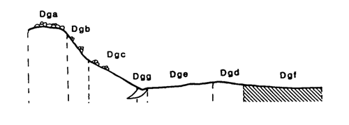
Very gentle slopes are uncommon in this granitic land system. They occur in the lower positions of the landscape. Like the gentle crests and slopes the soils are yellow duplex with hardsetting bleached horizons and mottled heavy clay subsoils. Minor drainage lines have been included within this unit when they are too small to map individually. They often have similar soil types but are slightly wetter and may have uniform sandy soils. Outcropping tors occur occasionally and at random.
Site characteristics:
| Parent material age: | Devonian | Depth seasonal watertable: | > 2 m |
| Lithology: | Granodiorite | Potential recharge to groundwater: | Low |
| Landform Pattern: | Undulating low hills | Flooding risk: | Nil |
| Element: | Slope | Drainage: | Moderately well drained |
| Slope common: | 2% | Depth to hardrock: | 1.2 m |
| Slope range: | 1 - 3% | ||
| Rock outcrop: | < 2% |
Major vegetation: Grey Box, Long-leaf Box, Red Gum, Yellow Box, Yellow Gum, Lightwood, Melaleuca spp. Rye Grass, Wallaby Grass, Onion Grass
Present land use: Sheep grazing (major)
| Land degradation: | Water erosion | Wind erosion | Salting | Acidification | |
Sheet/rill | Gully | ||||
| Susceptibility | Low | High | High | Low | Low |
| Incidence | Low | Moderate | Low | Low | Low |
Soil profile characteristics:
| Permeability (measured - average, range): | 7, 3 - 12 mm/day |
| Permeability (estimated): | |
| Available water capacity: | 210 mm H2O |
| Linear shrinkage (B horizon): | 14.2 % |
Soil profile description:
| A1 | 0-9 cm | Greyish yellow brown (10YR4/2) sandy loam, weak structure, angular blocky peds 10-20 mm, rough fabric, very weak consistence, pH 5.0 Clear transition to |
| A21 | 9-23 cm | Dull yellow orange (10YR6/3) sandy loam, bleached (7.5YR8/4) when dry, weak structure, subangular blocky peds 10-20 mm, rough fabric, very weak consistence, pH 5.3. Clear transition to |
| A22 | 23-38 cm | Dull yellow orange (10YR7/3) sandy loam, bleached when dry, apedal, sandy fabric, loose consistence, common granitic fragments, pH 5.7. Clear transition to |
| B23 | 8-76 cm | Greyish yellow brown (10YR6/2) heavy clay, many distinct medium sized red mottles, weak structure, subangular blocky peds 20-50 mm, smooth fabric, very firm consistence, pH 5.6. Clear transition to |
| B3 | 76-120 cm | Greyish brown (7.5YR5/2) light day, many faint coarse red mottles, moderate structure, angular blocky peds 10-20 mm, smooth fabric, moderately firm consistence, many coarse granitic fragments; pH 5.1. |
| C | 120 cm | Hardpan |
Soil classification:
| Factual Key (Northcote): | Dy 3.41 |
| Australian Soil Classification: | Bleached-Sodic, Mesotrophic, Grey, Chromosol; deep, thick, loamy, non-gravelly |
| Unified Soil Group: | CH |
Interpretation of soil analyses*
Horizon | pH | Gravel % | E.C. (salts) | Nutrient Status | P | K | Al | Organic Matter | Dispersibility |
| A1 | 5.0** | 3.1 | VL | VL | U | S | S | H | L |
| A21 | 5.3** | 7.3 | M | VL | D | D | S | L | L |
| A22 | 5.7 | 15.1 | H | D | D | D | S | L | L |
| B23 | 5.6 | 6.3 | H | M | D | S | S | VL | H |
| B3 | 5.1** | 14.4 | H | M | D | S | S | VL | H |
Land capability assessment
Land Use | Class | Major limiting feature(s)/ landuse |
| Agriculture (CTS values) | C3T2S4 | Highly susceptible to wind and gully erosion, high electrical conductivity in subsoil |
| Effluent disposal (septic tanks) | 5 | Very slow permeability |
| Farm dams (earthen) | 4 | Shallow depth to hardpan, highly dispersible subsoil, low suitability of subsoil |
| Building foundations - slab | 3 | Moderate drainage |
| Building foundations - stumps/footings | 3 | Moderate drainage, moderate linear shrinkage |
| Secondary roads | 3 | Moderate drainage, moderate linear shrinkage, Universal Soil Group |
| Urban residential | 3 | Secondary roads, building foundations |
| Rural residential | 5 | Effluent disposal |
The high resolution PDF file provided on this page can be viewed using the free Adobe PDF reader, this software can be installed for free from the Adobe website (external link).
A Land Capability Study of the Rural City of Marong - map unit Dgf - (PDF - 39 KB)
© State of Victoria (Agriculture Victoria) 1996 - .

This work, Victorian Resources Online, is licensed under a Creative Commons Attribution 4.0 licence. You are free to re-use the work under that licence, on the condition that you credit the State of Victoria (Agriculture Victoria) as author, indicate if changes were made and comply with the other licence terms.
The licence does not apply to ‘branding’ or some ‘images or photographs’ that may be owned by third parties. We ask you to seek prior approval to use images using the VRO feedback form. Access to higher quality images can also be provided on request.
This page was last updated on .