
Type G
Type G is an intermediate member of the catena (slope sequence of hill soils). It occupies well-drained intermediate positions on the hills, and its profile is marked by reddish clay in the subsoil. Occasional quartz floaters are found in the surface horizon (compare to Type H). The Ordovician basement rock is deeper than 2 metres. A dense clay layer is a distinctive feature of this soil type. This dense clay layer can also be found in the deep subsoil of Stillards Loam and the soils on the plains.
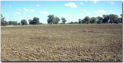 Typical landscape in the Type G mapping unit. |
Type G grades into Stillards Loam and it is often difficult to separate it from this lower member of the catena sequence. Soils with bright and orange-coloured subsoil (B) horizons (with Munsell values in the 5YR range) have been included in Type G, while profiles with brown and yellowish brown colours i.e. colours in the 7.5YR and 10YR range have been assigned to Stillards Loam.
Typical Profile
| Surface | ||
| A1 | 0-17 cm | Dark dull brown to greyish brown (7.5YR4/4) loam, sometimes increasing to clay-loam, with an occasional quartz floater; sometimes weakly bleached to brown or dull reddish brown in the lower part of the horizon; separated by a clear boundary from: |
| Subsoil | ||
| B21 | 17-35 cm | Bright to dark reddish brown (5YR4-5/6 and 5YR5-6/8) clay; friable when moist; grading to: |
| B22 | 35-83 cm | Reddish brown, or brown and brownish yellow, mottled clay; often with small, scattered buckshot; grading to a bright orange-yellow or brownish yellow (2.5YR6/8 - 10YR7/8) markedly friable clay; at depths varying from 68 to 91 cm sharply separated from: |
| B23 | 83-122 cm | Yellowish grey, brown and brownish yellow, mottled clay; dense and well organised into small distinct peds; scattered black inclusions and small calcium carbonate concretions irregularly present; extending down to at least 213 cm. |
Soil Pit Site NE44 is an example of a profile in the Type G mapping unit.
© State of Victoria (Agriculture Victoria) 1996 - .

This work, Victorian Resources Online, is licensed under a Creative Commons Attribution 4.0 licence. You are free to re-use the work under that licence, on the condition that you credit the State of Victoria (Agriculture Victoria) as author, indicate if changes were made and comply with the other licence terms.
The licence does not apply to ‘branding’ or some ‘images or photographs’ that may be owned by third parties. We ask you to seek prior approval to use images using the VRO feedback form. Access to higher quality images can also be provided on request.
This page was last updated on .