
Condah Land System
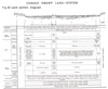 | Condah Land System Figure 43 (PDF - 253KB) To view the information PDF requires the use of a PDF reader. This can be installed for free from the Adobe website (external link). |
In landscapes developed from volcanic rocks in south-western Victoria are drainage lines which have become blocked. The resulting swamps and lakes, if not too deep, support water-loving vegetation, the remains of which cannot be fully decomposed because of water-logging, and the soils which develop are peats. Areas of such peats have been mapped as the Condah Swamp Land-System and it includes about 32,000 acres of land within the survey area, most of which is alienated.
There is a number of separate areas of this land-system. The chief is the Condah Swamp, now drained, between Condah and MacArthur. It covers about 9,500 acres and occupies part of a major drainage line, deeply entrenched in the Hamilton basalt and regarded by Boutakoff (1963) as that originally carrying what is now the Wannon River before its capture by the Glenelg River. Stony rises of the Eccles land-unit have blocked the channel just to the south of Lake Condah, which itself is simply the lowest and wettest part of the swamp. Lava flows extend up the valley for some distance and are mostly covered by the swamp deposits. Peats ramify up all the tributary drainage lines north of Wallacedale and merge imperceptibly with the long tongues of peaty prairie soils and chernozems typical of the valleys of the Branxholme and Hamilton land-systems. Elsewhere, however, the system is sharply-demarcated from the surrounding Branxholme land-system, the boundary being very clear on the aerial photographs.
A nearby smaller area of 1,000 acres is the Louth Swamp west of Byaduk in one of the tributary valleys of the Condah Swamp. The blockage here is caused not by the stony rises of the Eccles land-unit, but by lava from Mount Napier which flowed down the Byaduk valley and backed up the Louth valley. A perusal of the map of the land-units makes this clear.
Another major area is the large semi-circular Buckley's Swamp about six to ten miles south-south-west of Hamilton; together with adjacent swamps to the north, it covers about 10,000 acres. Blockage in this instance is probably by the eastern lava-flows from Mount Napier and a westerly tongue of the Dunkeld basalt in the parish of Croxton West which further curtails an already slow and internal regional drainage.
Gorrie Swamp is a further example of the land-system just to the north of Bessiebelle. It extends up the valley of the Eumeralla River to become a narrow tongue below MacArthur and eventually merges with the lower components of the MacArthur land-unit. As mapped, it covers about 4,500 acres. The naturally poor drainage of the Heywood land-system around Bessiebelle has been even further impeded by the eastern tongue of lava flows from Mount Eccles, to form this swamp.
Isolated small patches of the land-system are along the Eumeralla River, where the drainage has been blocked by the Girringurrup basalt, Whittlebury Swamp near Lake Condah, and Homerton Swamp. The latter is where the Fitzroy River and Darlot's Creek, draining the Cobbobboonee and Eccles basalts respectively, are impeded by the Tyrendarra flow of Eccles basalt.
In all these areas, the topography is flat or almost so, with a slight rise towards the edges, although in some parts, the tops of lava flows may protrude. Most areas are now cleared and drained, but the original vegetation seems to have been a dense wet scrub of woolly tea-tree (Leptospermum lanigerum) and this is still found in some of the valley bottoms of the surrounding Branxholme and Hamilton land-units.
Most soils fall into a range between the dominant carr peats on the one hand and prairie soils and meadow soils on the other, with occasional chernozems. The dense scrubs referred to above have formed the parent material for the carr peat, which is a rare soil in Australia, as most peats are fen peats or bog peats formed from reeds and mosses respectively. Surface horizons of this soil are the more peaty, mineral matter increases with depth and is virtually always of the very fine fraction because the soils of the catchment are volcanic. The transition to the prairie soils and meadow soils is marked by the mineral part of the soil becoming more important and the peat becoming more decomposed and smaller in quantity until it is represented by the high content of organic matter characteristic of surface horizons of chernozems and prairie soils.
As discussed in the chapter on soils, the peats particularly, and the prairie soils also, are high in the nitrogen and potash and are reasonably well supplied with phosphorus.
Minor components are the tops of stony rises protruding through the swamp deposits and the soils formed on them are usually brown earths. An unusual formation encountered elsewhere in the survey area only in the Eccles land-unit and found in the Condah Swamp system only near the junction with the stony rises, is diatomaceous earth, sometimes pure enough to be diatomite. This material is the massed skeletal remains of small diatoms which flourished in shallow lakes associated with basaltic rocks; the "soil" formed on the deposits is a grey laminated silt with some incorporation of organic matter in the surface. Diatomaceous earth may also be incorporated with the other soils of the land-system. In the Lake Gorrie Swamp, Boutakoff (1963) records volcanic ash as contributing to the soil material.
The general relationships described above are shown in Figure 43.
Little or no erosion hazard exists in this land-system, although the Condah Swamp is subject to occasional very severe floods, as run-off waters from a large area to the north are confined to its channel, and both siltation of the swamp and streambank erosion of the main drains may occur. When the peat is drained and becomes dried out, burning also is a hazard and a slow gradual humification is inevitable in any case. Nearby landholders report that already the surface level in the centre of the main Condah Swamp has been lowered by three feet since draining. Also, soil samples show a high salt content which is not surprising considering the area draining into the land-system; however, the very high exchange capacity of the upper horizons probably nullifies the danger.
When drained, this land-system is of high productivity because of the richness of the soils, the abundance of moisture at depth, and the moderate and reliable rainfall which most parts of it enjoy. The Homerton, Gorrie and Whittlebury Swamps have about 30 inches average annual rainfall, the Condah Swamp between 28 inches and 30 inches and Buckley's Swamp about 27 inches. Nevertheless winter temperatures may be somewhat severe around Wallacedale and at Buckley's Swamp, owing to the low positions and distance from the coast.
Condah Swamp itself was subdivided for close and intensive settlement, and some of the farms seem to have been too small, because they have since been consolidated into bigger holdings providing summer0grazing for cattle from the adjacent Branxholme land-system. Around Wallacedale, however, the original small-holdings persist, and here is one of the few localities in the survey where intensive mixed farming with cash crops and a variety of stock is practised. Dairy cattle and pigs are raised, onions are grown and roots for stock, and the grazing is based on perennial clover and ryegrass. On the consolidated areas used for summer grazing, the main problem seems to be to control the growth of rank species in the autumn and spring. Buckley's Swamp has been subdivided for dairying, and the Gorrie Swamp is similarly used. There may be room for more intensive management of high-grade pastures and a shift to meadow hay in some parts, but the difficulties of winter conditions on the peaty soils, even with drainage, are severe.
The land-system may be usefully thought of as the distinct, swampy and low lying parts of a basaltic landscape where the soils vary from black cracking clays to black peat rich in bases. In country with slow regional drainage, the land-system takes the form of rounded swamps, and in dissected country, it occupies filled-in former drainage lines that have been blocked. After drainage, areas of this land-system have a high productive potential; however, there is a hazard of salting, the prospect of loss of material by humification or even by burning, and problems of management under severe winter and spring conditions. It differs from all the other peaty swamp land-systems by being essentially part of a basaltic landscape and with soils of a fertility in accordance therewith.
© State of Victoria (Agriculture Victoria) 1996 - .

This work, Victorian Resources Online, is licensed under a Creative Commons Attribution 4.0 licence. You are free to re-use the work under that licence, on the condition that you credit the State of Victoria (Agriculture Victoria) as author, indicate if changes were made and comply with the other licence terms.
The licence does not apply to ‘branding’ or some ‘images or photographs’ that may be owned by third parties. We ask you to seek prior approval to use images using the VRO feedback form. Access to higher quality images can also be provided on request.
This page was last updated on .