
MM736
| Site: MM736 | Land Unit: Tower Hill |
| Aust. Soil Class.: Ferric, ?, Brown CHROMOSOL (confidence level 3) | |
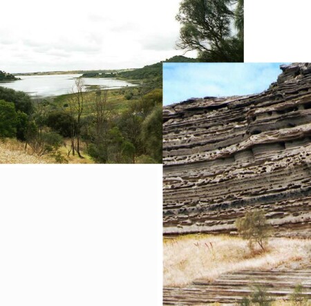 | General Land Unit Description: This land unit consists of the undulating rises and associated slopes around Tower Hill, in the Koroit area. Black Dermosols which contain layers of volcanic ash from approximately 50 cm occur in association with friable Brown or Red Dermosols. Ferric Brown Chromosols may occur on the steeper slopes and Black Vertosols tend to occur on the plains and drainage depressions. |
Site Description:
| Geology: Quaternary scoria | Landform pattern: Rises and plains |
| Position in landscape: Mid slope | Internal drainage: Imperfectly drained |
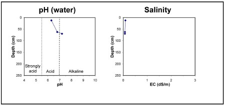
| A1 | 0-25 cm | Very dark greyish brown (10YR3/2) clay loam, moderate blocky structure (5-10 mm), pH 6.3. Clear transition to: |
| A2 | 25-55 cm | Strong brown (7.5YR4/6) light clay, rough fabric, very weak consistence when dry. Clear transition to: |
| Subsoil | ||
| B21 | 55-70 cm | Strong brown (7.5YR4/6) light clay, ferromanganiferous nodules are abundant, pH 6.8. Clear transition to: |
| B22 | 70+ cm | Dark brown (10YR3/3) light clay, ferromanganiferous nodules are abundant, pH 7.2 (water). |
Key profile features:
- Ferromanganiferious are abundant in subsoil
- Subsoil dispersive when dry
© State of Victoria (Agriculture Victoria) 1996 - .

This work, Victorian Resources Online, is licensed under a Creative Commons Attribution 4.0 licence. You are free to re-use the work under that licence, on the condition that you credit the State of Victoria (Agriculture Victoria) as author, indicate if changes were made and comply with the other licence terms.
The licence does not apply to ‘branding’ or some ‘images or photographs’ that may be owned by third parties. We ask you to seek prior approval to use images using the VRO feedback form. Access to higher quality images can also be provided on request.
This page was last updated on .