
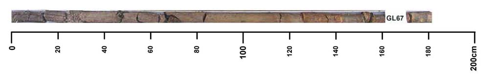
GL67
| Site: GL67 | Land Unit: Monivae Basalt |
| Aust. Soil Class.: Vertic, Mottled-Subnatric, Grey SODOSOL (confidence level 3) | |
 | General Land Unit Description: The level to gently undulating basalt plains between Branxholm and Glenthompson consist of an association of Vertic or Ferric Brown Chromosols and Ferric Brown Sodosols. The Chromosols typically occur on the upper slopes and crests of very slight rises that may have scattered surface boulders, and Sodosols on the lower slopes and depressions. Sodosols or Vertosols, occasionally with a sporadic bleached subsurface horizon, are usually found in open depressions or drainage lines. |
Site Description:
| Slope: 2% | Geology: Quaternary basalt |
| Landform pattern: Level to gently undulating plains | Position in landscape: Mid-slope |
| Internal drainage: Imperfectly drained |
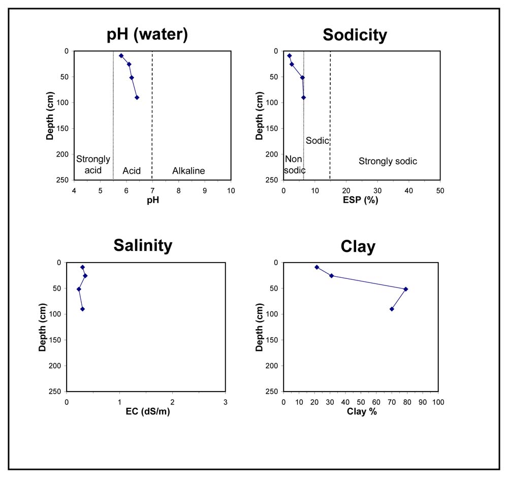
| A1 | 0-25 cm | Dark greyish brown (10YR4/2) clay loam, medium to strong subangular blocky structure (5-10 mm), firm consistence when dry, pH 6.7. Transition to: |
| A3 | 25-35 cm | Dark greyish brown (10YR4/2) silty clay, apedal structure, firm consistence when dry, few small subrounded ferruginious and manganiferous nodules (2-5 mm), pH 5.8. Transition to: |
| Subsoil | ||
| B21 | 35-80 cm | Dark greyish brown (10YR4/2) medium heavy clay, very faint yellow and orange weathered basalt mottles are common, medium to strong polyhedral structure (5-10 mm), very firm consistence when moderately moist, very few ferruginious and manganiferous nodules, pH 6.1. Transition to: |
| B22 | 80-120 cm | Light olive brown (2.5Y5/4) heavy clay, many distinct orange and yellow mottles, very firm consistence when moist, pH 6.2. |
Key profile features:
- Strong texture contrast between topsoil and subsoil
- Mottled subsoil
- A3 horizon dispersive when worked when wet
© State of Victoria (Agriculture Victoria) 1996 - .

This work, Victorian Resources Online, is licensed under a Creative Commons Attribution 4.0 licence. You are free to re-use the work under that licence, on the condition that you credit the State of Victoria (Agriculture Victoria) as author, indicate if changes were made and comply with the other licence terms.
The licence does not apply to ‘branding’ or some ‘images or photographs’ that may be owned by third parties. We ask you to seek prior approval to use images using the VRO feedback form. Access to higher quality images can also be provided on request.
This page was last updated on .