
GL29
| Site: GL29 | Land Unit: Follet Dunes and Plains |
| Aust. Soil Class.: Melacic, Humic, Aeric PODOSOL (confidence level 3) | |
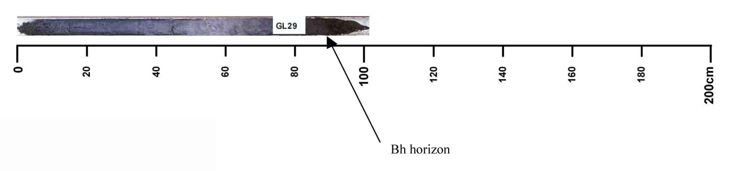 |
The majority of this land unit falls south of the Kanawinka fault. This land unit comprises areas with deep sand deposits. The residual landscape is thought to be influenced by the retreat of the Murray Sea which left stranded beach ridges oriented south west–north east. These were subsequently covered by superficial sand sheets in later depositional phases, which formed the landscape seen today. The major landforms in this land unit are dunes and swales. Podosols and Kurosols or Chromosols are the major soil types found on the dunes and rises. Podosols are soils with a ‘coffee rock’ layer (refer to photograph). The Kurosols or Chromosols tend to have a deep sandy topsoil over the clay. The common soil types on the swales are black cracking clay (Vertosols) or Grey Sodosols. Some Ferric Kurosols or Chromosols can also occur on the swales or lower slopes of the dunes. |
| Slope: 1% | Geology: Quaternary aeolian |
| Landform pattern: Dune | Position in landscape: Crest |
| Internal drainage: Well drained |
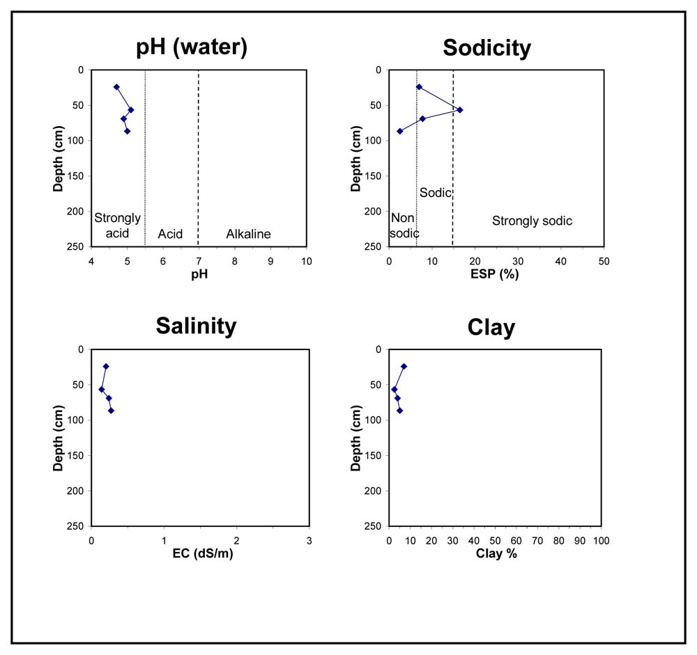
| A1 | 0-50 cm | Very dark grey (2.5Y3/1), sand, apedal, pH 4.7; transition to: |
| A2 | 50-65 cm | Dark grey (2.5Y4/1) when moist to grey (2.5Y6/1) when dry, sand, single structure, pH 5.1; transition to: |
| Subsoil | ||
| B2 | 65-75 cm | Grey (2.5Y5/1) sand, single structure, high organic matter content, pH 4.9; transition to: |
| Bh | 75-100 cm | Black (5YR2.5/1) sand, massive structure, pH 5.0. |
Key profile features:
- Sandy profile throughout
- Deep sandy topsoil
- Strongly acidic topsoil
- Strongly acidic subsoil
© State of Victoria (Agriculture Victoria) 1996 - .

This work, Victorian Resources Online, is licensed under a Creative Commons Attribution 4.0 licence. You are free to re-use the work under that licence, on the condition that you credit the State of Victoria (Agriculture Victoria) as author, indicate if changes were made and comply with the other licence terms.
The licence does not apply to ‘branding’ or some ‘images or photographs’ that may be owned by third parties. We ask you to seek prior approval to use images using the VRO feedback form. Access to higher quality images can also be provided on request.
This page was last updated on .