
GL174
| Site: GL174 | Land Unit: Ararat Granite |
| Aust. Soil Class.: Vertic, Mottled-Subnatric, Grey SODOSOL (confidence level 1) | |
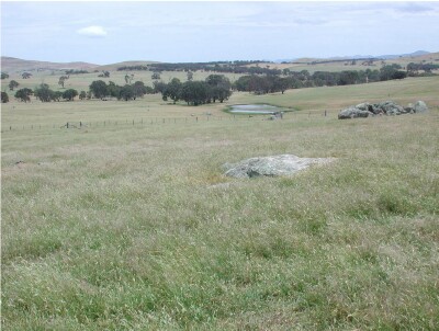 | General Land Unit Description: This land unit consists of granitic hills and rises around Ararat. Granitic tors are common on the crests and at the break of slope in some areas. Landslips are evident on the steeper slopes. The dominant soil type is a Grey Sodosol (similar to this site), often found on the lower slopes, similar to this site. Chromosols are more likely to occur on the crests and steeper slopes. The major limitation for land use at this site is the rock outcrop that commonly occurs at the break of slope, and the relatively shallow soil depth. |
Site Description:
| Slope: 10% | Geology: Ordovician Granodiorite |
| Landform pattern: Rises | Position in landscape: Mid-slope |
| Internal drainage: Imperfectly drained |
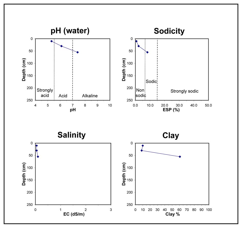
| A1 | 0-20 cm | Very dark greyish brown (10YR3/2) sandy loam, weak subangular structure (5-10 mm), consistence weak to firm when dry pH 5.3; abrupt but wavy transition to: | 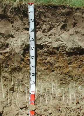 |
| A2 | 20-40 cm | Yellowish brown (10YR5/4) loamy sand, conspicuously bleached (10YR7/2) when dry, massive structure, weak to strong consistence when dry pH 6.1; transition to: | |
| Subsoil | |||
| B2 | 40-70 cm | Dark greyish brown (10YR4/2) heavy clay, many distinct strong brown (7.5YR5/6) and yellowish red (5YR5/8) mottles, strong prismatic (50-100 mm) to strong angular blocky structure (20-50 mm), many slickensides, pH 7.4; transition to: | |
| C | 70-120+ cm |
Key profile features:
- Strong texture contrast between topsoil and subsoil
- Acidic topsoil
- Sodic subsoil
- Mottled subsoil
- Subsoil dispersive when worked when wet
© State of Victoria (Agriculture Victoria) 1996 - .

This work, Victorian Resources Online, is licensed under a Creative Commons Attribution 4.0 licence. You are free to re-use the work under that licence, on the condition that you credit the State of Victoria (Agriculture Victoria) as author, indicate if changes were made and comply with the other licence terms.
The licence does not apply to ‘branding’ or some ‘images or photographs’ that may be owned by third parties. We ask you to seek prior approval to use images using the VRO feedback form. Access to higher quality images can also be provided on request.
This page was last updated on .