Site GL164
General Land Unit Description:
This site is situated on the level surface of the Dundas Tablelands. Red gums are the dominant vegetation. The dominant soil type is a Brown Chromosol, commonly with a ferric horizon which, in some cases, may be cemented (petroferric). The soil is developed over a highly weathered mottled zone. The mottled zone, sometimes referred to as ‘tiger mottling’, is thought to be the result of fluctuating watertables which occurred mainly in the Tertiary period.
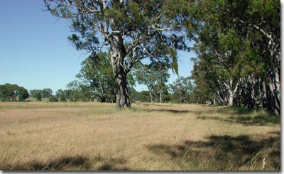 Site GL164 Landscape |
Site Description:
Slope: 0-1%
Geology: Tertiary marine sandstone.
Landform Pattern: Level plain.
Position in Landscape: Flat.
Internal Drainage: Moderately well drained.
Soil Profile Morphology:
Surface Soil
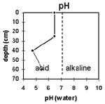
| A1 | 0-25 cm | Very dark grey (7.5YR3/1) sandy loam; weak medium blocky structure; weak consistence (dry); very few medium angular ferruginised nodules (6-20 mm); pH 6.5; clear and wavy change to: | 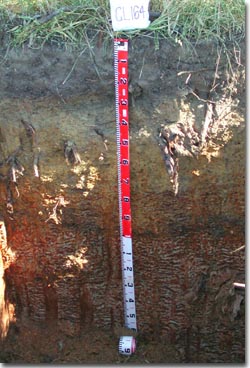 Site GL164 Profile |
| A2 | 25-40 cm | Dark yellowish brown (10YR4/4) fine sandy clay loam; weak to massive medium blocky structure, firm consistence (moist); many medium to coarse ferruginous and manganiferous nodules; pH 4.7; clear and wavy change to: | |
| Subsoil | |||
| B2 | 40-60 cm | Dark yellowish brown (10YR4/6) light medium clay (sandy); weak fine blocky structure; firm consistence (moist); many coarse ferruginous and manganiferous nodules; pH 5.5; clear and wavy change to: | |
| BC | 60-85 cm | Mainly buckshot; ferruginous and manganiferous nodules are abundant; moderately cemented discontinuous; ferricrete pan; abrupt and wavy change to: | |
| C | 85-150 cm | ||
Key Profile Features:
- Strong texture contrast between surface (A) horizons and subsoil (B) horizons.
- Ferric pan at base of subsoil.
pH | Salinity Rating | |||
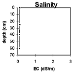
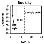
Surface (A1 horizon) | Slightly Acid | Low | Non-Sodic | None |
Subsoil (40-60 cm) | Strongly Acid | Low | Non-Sodic | None |
 |  |  |  |
Horizon | Horizon Depth (cm) | pH (water) | pH (CaCl2) | EC 1:5 | Exchangeable Aluminium mg/kg | Exchangeable Acidity meq/100g | Exchangeable Cations | |||
Ca | Mg | K | Na | |||||||
meq/100g | ||||||||||
A1 | 0-25 | 6.5 | 6.0 | 0.11 | 7.8 | 8.1 | 2.2 | 0.42 | 0.38 | |
A2 | 25-40 | 4.7 | 4.0 | 0.08 | 220 | 11 | 0.54 | 1.7 | 0.12 | 0.4 |
B21 | 40-60 | 5.5 | 4.6 | 0.08 | 53 | 9.8 | 1.4 | 4.0 | 0.16 | 0.68 |
Horizon | Horizon Depth (cm) | Field Capacity pF2.5 | Wilting Point pF4.2 | Coarse Sand (0.2- 2.0 mm) | Fine Sand (0.02- 0.2 mm) | Silt (0.002- 0.02 mm) | Clay (<0.002 mm) |
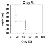
A1 | 0-25 | 20 | 9 | 14 | 54 | 9 | 17 |
A2 | 25-40 | 20 | 9 | 13 | 47 | 8 | 30 |
B21 | 40-60 | 27 | 15 | 10 | 35 | 8 | 47 |
Profile Described By:


