
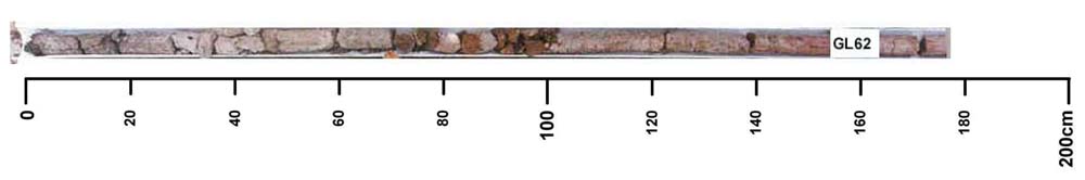
GL62
Location: Heywood
Australian Soil Classification: Bleached-Mottled, Eutrophic, Brown CHROMOSOL (confidence level 1)
General Landscape Description: Undulating plains
Site Description: Mid-slope to lower slope, 7%
Land Unit: Condah Basalt
Geology: Quaternary basalt
General Land Unit Description: The undulating plains and rises of the Condah area mainly consist of Ferric Chromosols. On the lower slopes bleached A2 horizons and mottled subsoils are common. On the broad level crests, gilgai microrelief is common.
| Surface Soil | |||
| A1 | 0-25 cm | Dark brown (10YR3/3); sandy clay loam; massive structure; firm consistence, dry; contains very few subrounded ferric fragments; field pH 6.0; changes to: | |
| A21 | 25-50 | Brown (10YR5/3), bleached, white (10YR8/2d); fine sandy clay loam; massive structure; very firm consistence, dry; very few subrounded ferric fragments; field pH 6.5; changes to: | |
| A22 | 50-60 | Yellowish brown (10YR5/4), sporadically bleached light grey (10YR7/2), with many faint yellow mottles; light clay; weak fine subangular blocky blocky structure; smooth ped fabric; very firm consistence, dry; contains a few subrounded ferric fragments; field pH 6.5 | |
| Subsoil | |||
| B21 | 60-80 cm | Yellowish brown (10YR4/6), with many distinct red and faint yellow mottles; heavy clay; strong fine parting to very fine subangular blocky structure; smooth ped fabric; very firm consistence, dry; contains very few ferric fragrments; field pH 6.0; changes to: | |
| B22 | 80-140 cm | Yellowish brown (10YR4/6), with many prominent red, yellow and orange mottles; heavy clay; strong fine parting to very fine subangular blocky structure; smooth ped fabric; very firm consistence, dry; field pH 7.0; changes to: | |
| B3 | 140+ cm | Pale brown (10YR6/3), with many prominent red mottles; weak structure; strong consistence, dry; field pH6.0. | |
Key profile features:
- Bleached A2 horizon
- Mottled subsoil
- Strong texture contrast between topsoil and subsoil
- Kaolinite at depth
Soil Profile Characteristics:
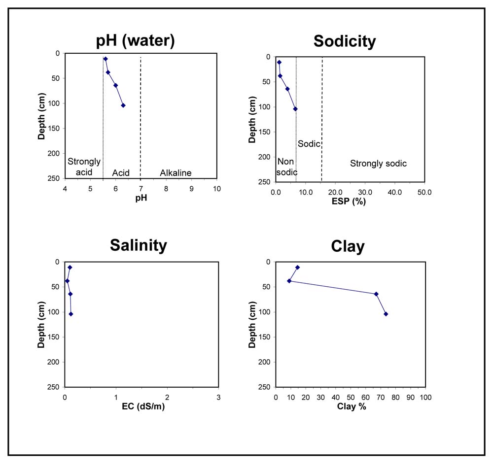
- | pH | Salinity | ||
Surface Soil (A1 horizon) | Moderately Acid | Low | Non-Sodic | None |
Subsoil (B21 Horizon) | Slightly Acid | Very Low | Non-Sodic | None |
Chemical and Physical Analysis:
Horizon | Horizon Depth (cm) | pH (water) | pH (CaCl2) | EC dS/m | Organic Carbon % | Total Nitrogen % | Exchangeable Aluminium ppm | Exchangeable Acididty meq/100g | Exchangeable Cations | Coarse Sand (0.2-2.0 mm) % | Fine Sand (0.02-0.2 mm) % | Silt (0.002-0.02 mm) % | Clay (<0.002 mm) % | Field Capacity % w/w | Wilting Point % w/w | |||
Ca | Mg | K | Na | |||||||||||||||
meq/100g | ||||||||||||||||||
A1 | 0-22 | 5.6 | 4.9 | 0.1 | 5.3 | 0.16 | 14 | 11 | 3.5 | 1.3 | 0.37 | 0.19 | 18 | 45 | 18 | 15 | 24 | 10 |
A21 | 22-54 | 5.7 | 4.9 | <0.05 | 12 | 4.5 | 0.79 | 0.66 | 0.14 | 0.09 | 24 | 48 | 19 | 9 | 17 | 4 | ||
A22 | 54-74 | 6 | 5.4 | 0.11 | 11 | 11 | 3.4 | 8 | 0.28 | 0.94 | 7 | 17 | 8 | 67 | 50 | 28 | ||
B21 | 74-134 | 6.3 | 5.8 | 0.12 | 11 | 9.4 | 3.1 | 9.6 | 0.23 | 1.6 | 6 | 13 | 7 | 74 | 48 | 29 | ||
© State of Victoria (Agriculture Victoria) 1996 - .

This work, Victorian Resources Online, is licensed under a Creative Commons Attribution 4.0 licence. You are free to re-use the work under that licence, on the condition that you credit the State of Victoria (Agriculture Victoria) as author, indicate if changes were made and comply with the other licence terms.
The licence does not apply to ‘branding’ or some ‘images or photographs’ that may be owned by third parties. We ask you to seek prior approval to use images using the VRO feedback form. Access to higher quality images can also be provided on request.
This page was last updated on .