
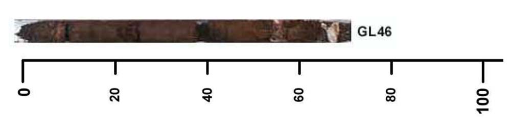
GL46
Location: Drik Drik
Australian Soil Classification: Haplic, Eutrophic, Red FERROSOL (confidence level 1)
General Landscape Description: Undulating plains
Site Description: Crest of Dune
Land Unit: Nelson Plains and Dunes
Geology: Quaternary limestone
General Land Unit Description: This land unit occurs in the south western corner of the region. The land unit is generally composed of siliceous sand dunes and plains over calcareous material. The partly consolidated calcareous deposits were formed in an arcuate band (north west / south east trending) formed by the retreat of the Murray Sea. The siliceous dune and sand sheet material is generally of aeolian origin. Although there is a large area of this land unit in the south west of the study area there are also some isolated patches, mainly mixed amongst the Follet land unit that could not be mapped due to restrictions of scale.
The sand varies from orange (GL48), to red (GL39) to a paler colour. The orange and red sands are usually associated with the calcareous material, whereas the paler sands tend to have less carbonate (e.g. GL51, GL38) or the calcareous material is greater than 2 metres deep (e.g. GL50). Another soil variant occurs on the swales in between the dunes. This soil tends to have a heavier textured subsoil which may or may not have calcareous material underneath.
| Surface Soil
| |||
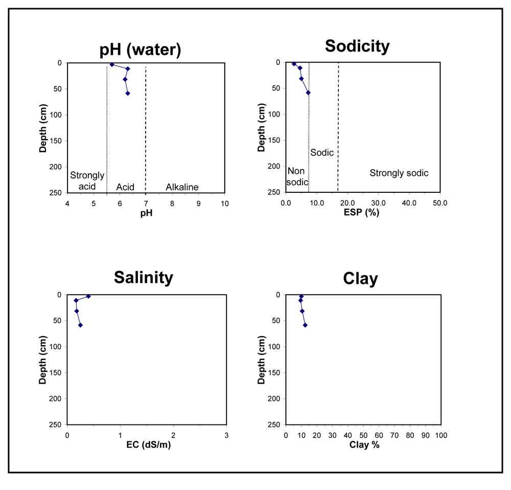
| A0 | 0-6 cm | Sandy; pH 5.7; changes to:
| |
| A1 | 6-16 cm | Dark reddish brown (5YR2.5/2); sandy loam; granular structure; pH 6.3; changes to:
| |
| Subsoil | |||
| B21 | 16-47 cm | Dark reddish brown (2.5YR2.5/3); sandy loam; granular structure; pH 6.2; changes to:
| |
| R | 47-70 | Limestone; pH 6.3. |
Key profile features:
- Sand throughout
- Shallow soil
- Sand over limestone
Soil Profile Characteristics:
- | pH | Salinity | ||
Surface Soil (A1 horizon) | Moderately Acid | High | Non-Sodic | None |
Subsoil (16-47 cm) | Slightly Acid | Medium | Non-Sodic | None |
Deeper Subsoil (47-70 cm) | Slightly Acid | Medium | Sodic | None |
Chemical and Physical Analysis:
Horizon | Horizon Depth (cm) | pH (water) | pH (CaCl2) | EC dS/m | Organic Carbon % | Total Nitrogen % | Exchangeable Aluminium ppm | Exchangeable Acididty meq/100g | Exchangeable Cations | Coarse Sand (0.2-2.0 mm) % | Fine Sand (0.02-0.2 mm) % | Silt (0.002-0.02 mm) % | Clay (<0.002 mm) % | Field Capacity % w/w | Wilting Point % w/w | |||
Ca | Mg | K | Na | |||||||||||||||
meq/100g | ||||||||||||||||||
A0 | 0-6 | 5.7 | 5.2 | 0.40 | 5.7 | 0.31 | 15 | 17 | 11 | 4.1 | 0.5 | 0.9 | 23 | 52 | 4 | 10 | 28.2 | 19.7 |
A1 | 6-16 | 6.3 | 5.6 | 0.17 | 13 | 10 | 5.8 | 1.5 | 0.28 | 0.85 | 21 | 60 | 3 | 10 | 14.5 | 8.6 | ||
B21 | 16-47 | 6.2 | 5.7 | 0.18 | 11 | 7.5 | 3.5 | 1.3 | 0.12 | 0.66 | 21 | 62 | 4 | 11 | 12.6 | 5.4 | ||
R | 47-70 | 6.3 | 5.8 | 0.25 | 11 | 5.8 | 3.5 | 1.6 | 0.17 | 0.87 | 19 | 64 | 3 | 13 | 12.2 | 6.2 | ||
Profile Described By: Natalie Baxter and Grant Boyle, 3rd October 2000.
© State of Victoria (Agriculture Victoria) 1996 - .

This work, Victorian Resources Online, is licensed under a Creative Commons Attribution 4.0 licence. You are free to re-use the work under that licence, on the condition that you credit the State of Victoria (Agriculture Victoria) as author, indicate if changes were made and comply with the other licence terms.
The licence does not apply to ‘branding’ or some ‘images or photographs’ that may be owned by third parties. We ask you to seek prior approval to use images using the VRO feedback form. Access to higher quality images can also be provided on request.
This page was last updated on .