
GRES398
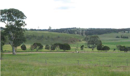
Location: Wy Yung
Australian Soil Classification: Haplic, Lithocalcic, Red DERMOSOL
Previous Site Name: AL13
General Landscape Description: Valley slopes up to 32%
Site Description: Midslope of a low hill, 14% slope
Native Vegetation: Dry valley forest
Geology: Complex of Neogene limestone (Miocene) and alluvial sediments (Pleistocene)
 |
Soil Profile Morphology:
| 0 – 15 cm | Dark reddish brown; light clay; pH 6.3. | 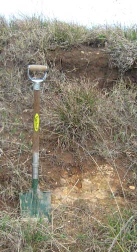 Roadside cutting on the Wy Yung Calulu Road near Calulu | |
| 15 – 40 cm | Red; heavy clay; pH 6.8; | ||
| 40 – 90 cm | Red; medium clay; pH 7.5. |
Chemical and Physical Analysis:
Horizon Depth (cm) | pH (water) | Organic Carbon % | Total Nitrogen % | Exchangeable Cations | Gravel % | Coarse Sand (0.2-2.0 mm) % | Fine Sand (0.02-0.2 mm) % | Silt (0.002-0.02 mm) % | Clay (<0.002 mm) % | |||
Ca | Mg | K | Na | |||||||||
meq/100g | ||||||||||||
0-10 | 6.3 | 4.8 | 0.37 | 15.9 | 2.3 | 1.3 | 0.2 | 2 | 7 | 37 | 14 | 38 |
30-60 | 6.8 | 27.3 | 1.8 | 0.5 | 0.5 | 4 | 2 | 8 | 3 | 86 | ||
80-90 | 7.5 | 29.7 | 1.3 | 0.4 | 0.4 | 6 | 7 | 10 | 9 | 72 | ||
Profile Described By: J.M. Aldrick, 1978.
© State of Victoria (Agriculture Victoria) 1996 - .

This work, Victorian Resources Online, is licensed under a Creative Commons Attribution 4.0 licence. You are free to re-use the work under that licence, on the condition that you credit the State of Victoria (Agriculture Victoria) as author, indicate if changes were made and comply with the other licence terms.
The licence does not apply to ‘branding’ or some ‘images or photographs’ that may be owned by third parties. We ask you to seek prior approval to use images using the VRO feedback form. Access to higher quality images can also be provided on request.
This page was last updated on .