
GL 1 (8522) Red Bluff
|
This information has been developed from the publications:
|
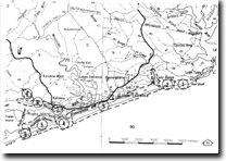
Location: | 934084 (8522). Two kilometres of Lake Tyers. | |
Abstract: | Marine cliffs, Jemmys Point Formation, Haunted Hill Gravels. | |
Access: | Track from Lake Tyers Road. | |
Ownership: | Crown land. | |
Geology: | The cliff section shows Jemmys Point Formation unconformably overlain by Haunted Hill Gravels. The main exposure is of the Jemmys Point Formation which consists of calcareous and micaceous sands and silty sands with strings of pebbles, and clay and gravel lenses. Carbonized wood fragments occur throughout the section and echinoid (Arachnoides incisa) casts are common in the ferruginous sandstone near the top of the formation. | |
Significance: | This is an active marine cliff with eroded rock fragments and an irregular shore platform at the base. The cliff is being undercut by wave action and is subject to rainwash, gullying and slumping in the upper part. | |
Management: | State. This is only site of an active marine cliff in Tertiary sediments in the Gippsland Lakes region. It illustrates clearly the processes which have produced the abandoned marine cliff (marginal bluff) that marks the inner boundary of the Gippsland Lakes. | |
The importance of the site is dependent on continued marine erosion to maintain the cliffed exposures and to illustrate the processes of cliff formation. Erosion poses no threat to property and artificial structures designed to prevent erosion are not necessary as they would lead to accumulation of weathered rock which would ultimately obscure the section. | ||
References: | Jenkin, J.J. (1968). "The geomorphology and upper Cainozoic gelogy of Southeast Gippsland, Victoria", Geol. Surv. Vict. Memoir 27. Douglas, J.G. & Ferguson, J.A. (eds) (1976). Geology of Victoria. Geological Society of Australia, Special Publication No. 5. Bird, E.C.F. (1978). The Geomorphology of the Gippsland Lakes Region. Publication No. 186, Environmental Studies Serices, Ministry for Conservation, Victoria. | |
© State of Victoria (Agriculture Victoria) 1996 - .

This work, Victorian Resources Online, is licensed under a Creative Commons Attribution 4.0 licence. You are free to re-use the work under that licence, on the condition that you credit the State of Victoria (Agriculture Victoria) as author, indicate if changes were made and comply with the other licence terms.
The licence does not apply to ‘branding’ or some ‘images or photographs’ that may be owned by third parties. We ask you to seek prior approval to use images using the VRO feedback form. Access to higher quality images can also be provided on request.
This page was last updated on .