
8822-5 Gabo Island
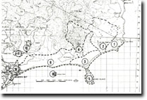
Sites 8822 1 to 10 - Mallacoota to Cape Howe
Page top
This information has been developed from the publications:
|
Location: | 570390. 500 metres south of Telegraph Point. | 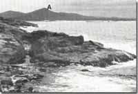 Eastern shore of Gabo Island and Howe Range. |
Abstract: | Low, dune covered granitic island. | |
Access: | Boat landing may be made only at one small harbour on the north-west of the island. The airstrip is suitable for light aircraft. | |
Ownership: | Commonwealth Government Lighthouse Reserve. Prior permission for landing must be obtained from the Commonwealth Department of Transport. | |
Geology: | The island consists of red granite of Late Middle to Early Upper Devonian age similar to that of the Howe Range and includes a small area of lighter coloured (grey) granite. Small lamprophyre dykes occur on the eastern shore. The granite outcrops continuously around the shoreline but on the body of the island it is overlain by quartzose dunes. | |
Geomorphology: | High cliffs occur on the south of the island but the northern coastline apart from one small sand beach sector is a low boulder-strewn ramp. Irregular grass and scrub-covered hummocky dunes, probably remnants of parabolic dunes, form the relief of most of this island. | |
Significance: | Regional. The red granite has been quarried for building stone in the past. The dunes are inactive cliff top dunes. | |
Management: | Maintenance of dune vegetation is required to prevent renewal of dune mobility. | |
© State of Victoria (Agriculture Victoria) 1996 - .

This work, Victorian Resources Online, is licensed under a Creative Commons Attribution 4.0 licence. You are free to re-use the work under that licence, on the condition that you credit the State of Victoria (Agriculture Victoria) as author, indicate if changes were made and comply with the other licence terms.
The licence does not apply to ‘branding’ or some ‘images or photographs’ that may be owned by third parties. We ask you to seek prior approval to use images using the VRO feedback form. Access to higher quality images can also be provided on request.
This page was last updated on .