
8623-9 Errinundra Plateau
|
This information has been developed from the publications:
|
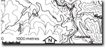
Location: | 640660. Six kilometres north-west of Errinundra. | |
Abstract: | Most southerly extension of Monaro Tableland. | |
Access: | Errinundra Road. | |
Ownership: | Crown Land. | |
Geology/Geomorphology: | The Monaro Tableland includes a large area of gently undulating terrain which extends from Errinundra north into New South Wales. It consists of broad valleys separated by low divides and in the Errinundra area is bounded on the east by a steep dissected scarp which has resulted from rapid downcutting by the Errinundra River along the Queensborough Fault line. | |
Significance: | Regional. Most southerly extension of Monaro Tableland. | |
Management: | Because of the area covered by the site the value of the significant geomorphological features is unlikely to be seriously reduced by localised disturbance, e.g., road works, extractive industries, forestry operations. | |
© State of Victoria (Agriculture Victoria) 1996 - .

This work, Victorian Resources Online, is licensed under a Creative Commons Attribution 4.0 licence. You are free to re-use the work under that licence, on the condition that you credit the State of Victoria (Agriculture Victoria) as author, indicate if changes were made and comply with the other licence terms.
The licence does not apply to ‘branding’ or some ‘images or photographs’ that may be owned by third parties. We ask you to seek prior approval to use images using the VRO feedback form. Access to higher quality images can also be provided on request.
This page was last updated on .