
EG7
| Location: Angus Vale | |
| Australian Soil Classification: Haplic, pedaric, red CHROMOSOL | Great Soil Group: non-calcic brown |
| General Landscape Description: Undulating Rises | Site Description: Upper slope of a low crest (4%) |
| Geology: Upper Devonian rhyolite |
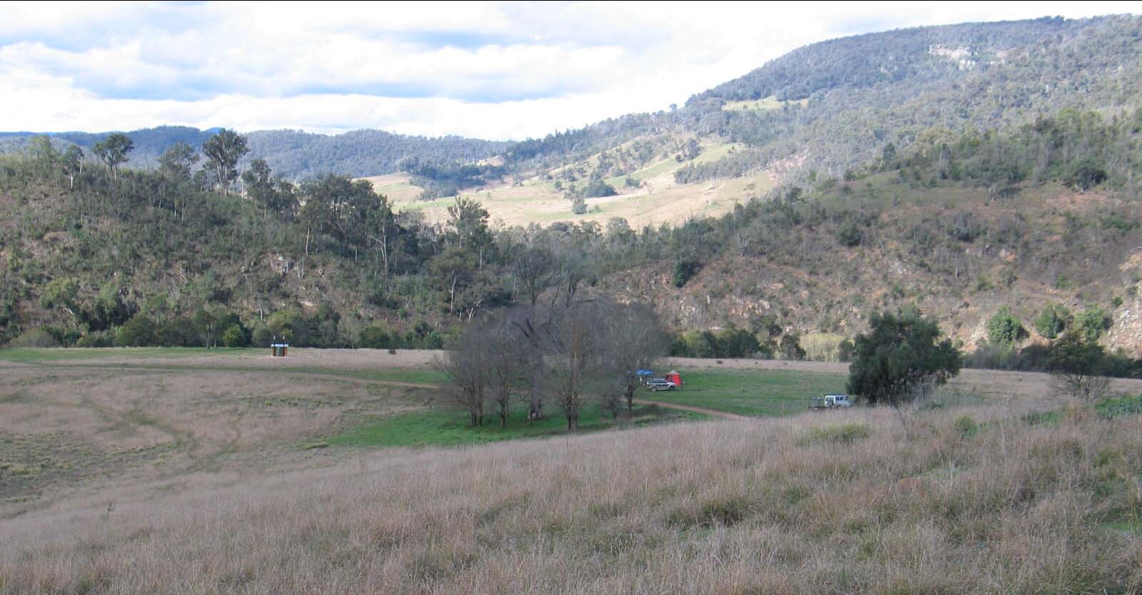 EG7 Landscape - Photo taken from pit site. The terrace of the Mitchell River is in the middle-ground |
Soil Profile Morphology:
Surface Soil
| A11 | 0-15 cm | Dark reddish brown (5YR3/2); fine sandy clay loam; moderate medium granular parting to fine granular structure; weak consistence moist; few angular rhyolite cobbles; pH 5.9; gradual change to: | 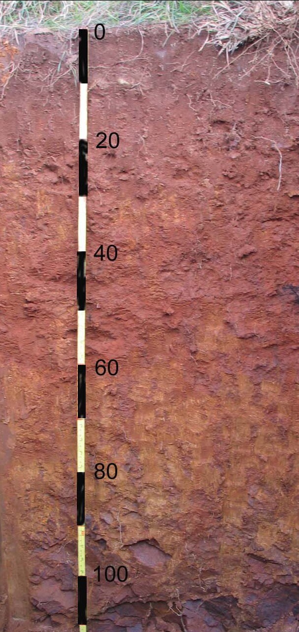 EG7 Profile |
| A22 | 15-30 cm | Reddish brown (5YR4/4); fine sandy clay loam; moderate medium polyhedral structure; weak consistence moist; many angular rhyolite pebbles; pH 6.5; clear change to: | |
| Subsoil | |||
| B2 | 30-55 cm | Reddish brown (2.5YR4/4); medium clay (sandy); medium to strong polyhedral parting to fine polyhedral structure; firm consistence moist; few angular medium rhyolite pebbles; pH 7.1; clear wavy change to: | |
| B3 | 55-90 cm | Reddish brown (5YR4/4); light clay (sandy); weak medium polyhedral structure; firm consistence moist; common angular fine rhyolite pebbles; pH 7.3; clear wavy change to; | |
| C | 90+ cm | Weathering rhyolite. | |
Soil Profile Characteristics:
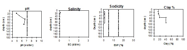
Horizon | Horizon Depth (cm) | pH (water) | pH (CaCl2) | EC 1:5 | Exchangeable Cations | |||
Ca | Mg | K | Na | |||||
meq/100g | ||||||||
A11 | 0-15 | 5.9 | 4.9 | 0.06 | 4.1 | 1.5 | 1.0 | 0.15 |
A12 | 15-30 | 6.5 | 5.4 | <0.05 | 4.9 | 1.8 | 0.58 | 0.13 |
B2 | 30-55 | 7.3 | 6.6 | <0.05 | 12.0 | 8.1 | 0.11 | 0.21 |
B3 | 55-90 | 7.1 | 6.4 | <0.05 | 12.0 | 6.9 | 0.61 | 0.17 |
Horizon | Horizon Depth (cm) | Exchangeable Acidity meq/100g | Org Carbon %w/w | 5Field Capacity pF 2.5 | Wilting Point pF 4.2 | Coarse Sand (0.2-2.0 mm) | Fine Sand (0.02-0.2 mm) | Silt (0.002-0.02 mm) | Clay (<0.002 mm) |
A11 | 0-15 | 12.0 | 2.9 | 31.6 | 10.0 | 24 | 39 | 13 | 15 |
A12 | 15-30 | 6.4 | 0.77 | 23. | 7.1 | 35 | 38 | 10 | 16 |
B2 | 30-55 | 5.2 | 25.7 | 10.1 | 29 | 40 | 10 | 20 | |
B3 | 55-90 | 7.9 | 38.4 | 17.5 | 15 | 30 | 10 | 41 |
© State of Victoria (Agriculture Victoria) 1996 - .

This work, Victorian Resources Online, is licensed under a Creative Commons Attribution 4.0 licence. You are free to re-use the work under that licence, on the condition that you credit the State of Victoria (Agriculture Victoria) as author, indicate if changes were made and comply with the other licence terms.
The licence does not apply to ‘branding’ or some ‘images or photographs’ that may be owned by third parties. We ask you to seek prior approval to use images using the VRO feedback form. Access to higher quality images can also be provided on request.
This page was last updated on .