
EG6
| Location: Fingerboards | |
| Australian Soil Classification: Eutrophic, mottled-subnatric, brown SODOSOL | Great Soil Group: brown soloth |
| General Landscape Description: Undulating Rises | Site Description: North Slope of low rise (4%) |
| Vegetation: Red Gum (E. tereticornis) | Geology: Neogene sediments |
| Mapping Unit: Fernbank |
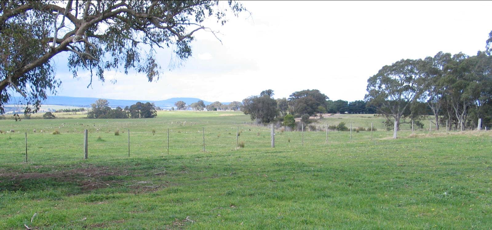 EG6 Landscape | 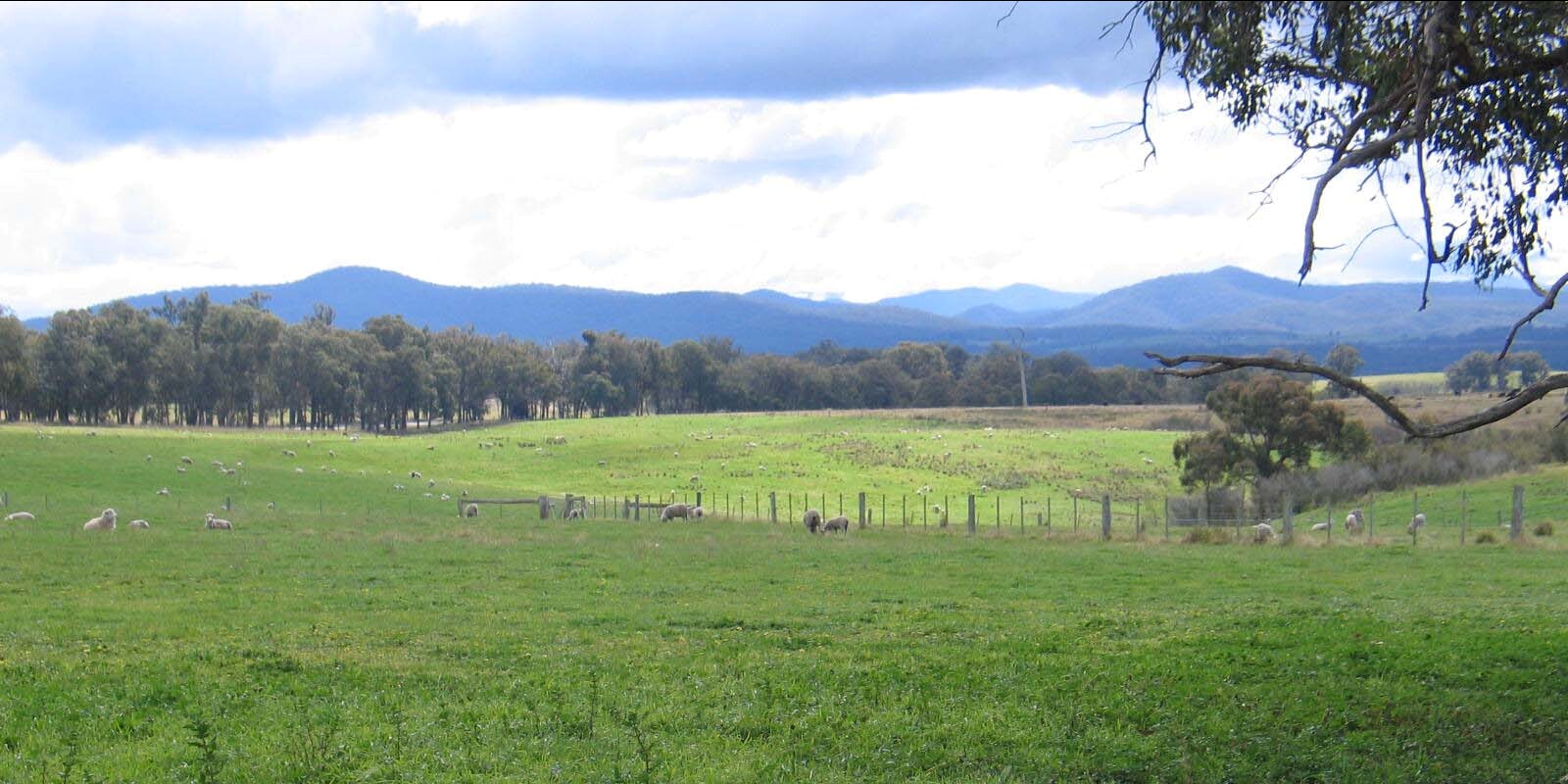 |
Soil Profile Morphology:
Surface Soil
| A1 | 0-15 cm | Very dark greyish brown (2.5YR3/2); loamy sand; moderate fine to medium sub-angular blocky structure; very weak consistence moderately moist; pH 5.7;clear smooth change to: | 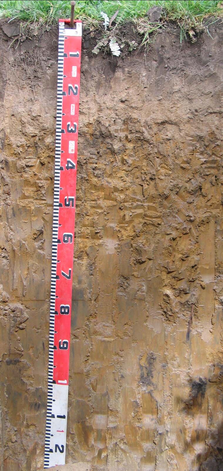 EG6 Profile |
| A2 | 15-27 cm | Pale brown (10YR6/3), light grey (10YR7/2) dry; sand; massive, loose to very weak consistence moist; very few fine quartz gravel; pH 6.0; abrupt wavy change to: | |
| Subsoil | |||
| B21 | 27-90 cm | Yellowish brown (10YR5/4) with many coarse distinct strong brown (5YR5/8) mottles; heavy clay; weak very coarse columnar structure parting to moderate medium; to coarse prismatic structure; firm consistence moist; pH 6.6; diffuse change to: | |
| B22 | 90-120 cm | Yellowish brown (10YR5/4) with common medium distinct grey and red mottles; heavy clay; weak medium prismatic structure; very firm consistence moderately moist; pH 7.2. | |
Soil Profile Characteristics:
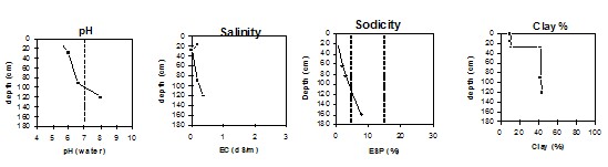
Horizon | Horizon Depth (cm) | pH (water) | pH (CaCl2) | EC 1:5 | Exchangeable Cations | |||
Ca | Mg | K | Na | |||||
meq/100g | ||||||||
A1 | 0-15 | 5.7 | 4.5 | 0.19 | 4.6 | 1.3 | 0.81 | 0.44 |
A2 | 15-27 | 6.0 | 4.5 | <0.05 | 0.85 | 0.36 | 0.24 | 0.11 |
B21 | 27-90 | 6.6 | 6.4 | 0.19 | 1.7 | 8.2 | 0.62 | 1.8 |
B22 | 90-120 | 8.0 | 7.2 | 0.35 | 0.5 | 8.7 | 0.3 | 2.8 |
Horizon | Horizon Depth (cm) | Exchangeable Aluminium mg/kg | Exchangeable Acidity meq/100g | Field Capacity pF 2.5 | Wilting Point pF 4.2 | Coarse Sand (0.2-2.0 mm) | Fine Sand (0.02-0.2 mm) | Silt (0.002-0.02 mm) | Clay (<0.002 mm) |
A1 | 0-15 | 12.0 | 3.6 | 20.4 | 6.9 | 37 | 39 | 7 | 10 |
A2 | 15-27 | 4.3 | 11.3 | 1.8 | 39 | 43 | 7 | 11 | |
B21 | 27-90 | 4.9 | 26.9 | 15.3 | 20 | 27 | 9 | 42 | |
B22 | 90-120 | na | 23.4 | 13.0 | 18 | 26 | 11 | 43 |
© State of Victoria (Agriculture Victoria) 1996 - .

This work, Victorian Resources Online, is licensed under a Creative Commons Attribution 4.0 licence. You are free to re-use the work under that licence, on the condition that you credit the State of Victoria (Agriculture Victoria) as author, indicate if changes were made and comply with the other licence terms.
The licence does not apply to ‘branding’ or some ‘images or photographs’ that may be owned by third parties. We ask you to seek prior approval to use images using the VRO feedback form. Access to higher quality images can also be provided on request.
This page was last updated on .