
Soil/Landform Unit 197
Landform Unit Description
Page top
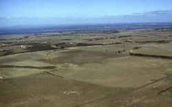 Looking south over Swan Bay and the undulating sedimentary plains of this unit |
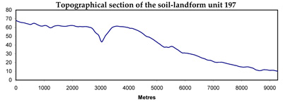
0.39% of CMA region This single unit of level and undulating plains is on the east coast of the Bellarine Peninsula, drains into Swan Bay and receives drainage from the Neogene plateau (Unit 77) and the Palaeogene basaltic low hills (Unit 80) to the west. Some Neogene ferruginised sediments occur on the coast at St Leonards. The soils are strongly sodic mottled brown texture contrast with light surface soils which are susceptible to sheet erosion. Rainfall while relatively low is annually variable. This unit is susceptible to waterlogging where inundation is sufficient. Surface soil nutrient and structure decline and susceptibilities are also concerns. Land use is extensive grazing (beef and sheep) and minor cropping. | 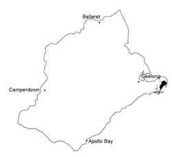 |
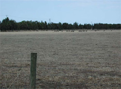 Level plain west of St Leonards | 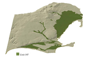 |
 | 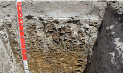 Bleached texture contrast soils are dominant across the unit |
Component | 1 | 2 |
Proportion of soil-landform unit | 80% | 20% |
| CLIMATE Rainfall (mm) | Annual: 620 | |
| Temperature (oC) | Minimum 10, Maximum 19 | |
| Precipitation less than potential evapotranspiration | October–March | |
| GEOLOGY Age and lithology | Recent clay, sand and gravel and coastal sand dunes, Neogene fluvio-marine sand | |
| Geomorphology | ||
| LANDUSE | Uncleared: Nature conservation; passive and active recreation Cleared areas: Sheep and beef cattle grazing; regional development | |
| TOPOGRAPHY Landscape | Level and gently undulating plains | |
| Elevation range (m) | 4–90 | |
| Local relief (m) | 2–5 | |
| Drainage pattern | Dendritic | |
| Drainage density (km/km2) | 1.4 | |
| Landform | Plains/Stagnant plains | |
| Landform element | Flat | Depression |
| Slope and range (%) | 1 (0–1) | 1(0–2) |
| Slope shape | Straight | Concave |
| NATIVE VEGETATION Ecological Vegetation Class | Calcarenite Dune Woodland (1.7%), Plains Grassy Woodland (1.4%), Coastal Saltmarsh (1.0%), Other (0.8%) | |
| SOIL Parent material | Gravel, sand, silt and clay | Sand, silt and clay |
| Description (Corangamite Soil Group) | Sodic brown often mottled texture contrast soils (32) | Black cracking clays (31) and sodic brown, often mottled texture contrast soils (32) |
| Soil type sites | ||
| Surface texture | Fine sandy loam | Light clay, fine sandy loam |
| Permeability | Low | Very low |
| Depth (m) | > 2 | > 2 |
| LAND CHARACTERISTICS, POTENTIAL AND LIMITATIONS | Texture contrast soil, low water holding capacity and low to moderate nutrient holding capacity in upper lighter soil, higher in subsoil. Strongly sodic subsoil, hardsetting, coarse structure. Low subsoil permeability and slow site drainage is common. Susceptible to compaction and structure decline and waterlogging. Some susceptibility to sheet and wind erosion. | Texture contrast soil and expansive clay soil, low water holding capacity and low to moderate nutrient holding capacity in upper lighter soil, higher in subsoil and cracking clay soils. Strongly sodic subsoil, hardsetting, coarse structure. Soils tend to have a low permeability. Very slow site drainage. Susceptible to waterlogging, compaction and structure decline. |
© State of Victoria (Agriculture Victoria) 1996 - .

This work, Victorian Resources Online, is licensed under a Creative Commons Attribution 4.0 licence. You are free to re-use the work under that licence, on the condition that you credit the State of Victoria (Agriculture Victoria) as author, indicate if changes were made and comply with the other licence terms.
The licence does not apply to ‘branding’ or some ‘images or photographs’ that may be owned by third parties. We ask you to seek prior approval to use images using the VRO feedback form. Access to higher quality images can also be provided on request.
This page was last updated on .