
Soil/Landform Unit 123
Landform Unit Description
Page top
 The gently undulating plains with soils derived from ash deposits are used extensively for cropping |
0.21% of CMA region Gently undulating plains in the Alvie area are derived layers of volcanic ash deposited during volcanic eruptions of the Quaternary period. These ash derived volcanic landforms of the Western Plains are characterised by undulating plains and rises with occasional depressions. The ash deposits support the remnant vegetation class Stony Rises Herb-rich Woodland which is unique to this area of Victoria. The relatively young landscape has shallow to moderately deep neutral black gradational soils with minor alkaline friable loams and red gradational soils. As the major parent material of these soils, the ash deposits are generally friable and highly productive (due to high fertility). Rainfall decreases from south to north, influencing grazing intensity for dairying or beef/sheep production and cropping. The land acts as a footslope to the volcanic low hill complex of Unit 101. Erosion hazards are minor, with waterlogging and sheet and rill erosion the major concerns. Soils are susceptible to leaching of nutrients, and compaction is a problem on the lower slopes and depressions. | 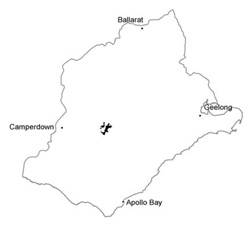 |
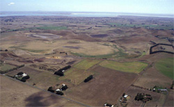
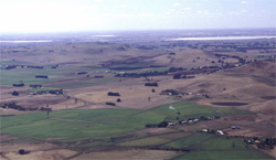
 Gentle plains near Coragulac | 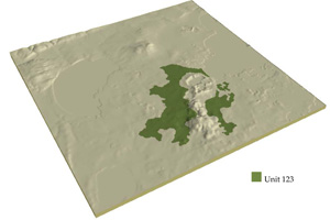 |
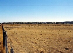
 |  Irrigated plains between Alvie and Lake Corangamite |
Component | 1 | 2 | 3 |
Proportion of soil-landform unit | 70% | 25% | 5% |
| CLIMATE Rainfall (mm) | Annual: 670 | ||
| Temperature (oC) | Minimum 8, Maximum 19 | ||
| Precipitation less than potential evapotranspiration | October-March | ||
| GEOLOGY Age and lithology | Quaternary scoria and basalt | ||
| Geomorphology | |||
| LANDUSE | Uncleared areas: Nature conservation Cleared aras: Sheep and beef cattle grazing; cropping (cereal) | ||
| TOPOGRAPHY Landscape | Gently undulating plains | ||
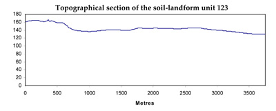
| Elevation range (m) | 117-185 | ||
| Local relief (m) | 60 | ||
| Drainage pattern | Radial | ||
| Drainage density (km/km2) | <0.1 | ||
| Landform | Plains with minor rises | ||
| Landform element | Undulating plains | Low rises | Depressions |
| Slope and range (%) | 2 (0-5) | 4 (2-8) | 1 (0-2) |
| Slope shape | Straight | Convex | Concave |
| NATIVE VEGETATION Ecological Vegetation Class | Stony Rises Herb-rich Woodland (1.2%) | ||
| SOIL Parent material | Basaltic ash | Basaltic ash | Basaltic ash, colluvium and alluvium |
| Description (Corangamite Soil Group) | |||
| Soil type sites | |||
| Surface texture | Clay loam | Clay loam | Clay loam to light clay |
| Permeability | Moderate | High | Low to moderate |
| Depth (m) | <1.5 | <1 | <2 |
| LAND CHARACTERISTICS, POTENTIAL AND LIMITATIONS | Friable structured soil. Soil depth may be moderately deep with limited water holding capacity. Generally well drained and high nutrient holding capacity. Upper soil may be acidic. | Friable structured soil. Soil depth may be moderately deep with limited water holding capacity. Generally well drained and high nutrient holding capacity. Upper soil may be acidic. | Friable structured soil. Soil depth may be moderately deep with limited water holding capacity. Moderately well to imperfectly drained and high nutrient holding capacity. Upper soil may be acidic. May be subject to waterlogging and compaction. |
© State of Victoria (Agriculture Victoria) 1996 - .

This work, Victorian Resources Online, is licensed under a Creative Commons Attribution 4.0 licence. You are free to re-use the work under that licence, on the condition that you credit the State of Victoria (Agriculture Victoria) as author, indicate if changes were made and comply with the other licence terms.
The licence does not apply to ‘branding’ or some ‘images or photographs’ that may be owned by third parties. We ask you to seek prior approval to use images using the VRO feedback form. Access to higher quality images can also be provided on request.
This page was last updated on .