
Soil/Landform Unit 110
Landform Unit Description
Page top
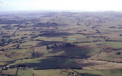 The low hills and gently undulating plains of Bostock Creek catchment between Camperdown and Cobden |
0.34% of CMA region The low hills and gently undulating plains near Camperdown in the south-west of the Corangamite catchment are associated with an eruption complex that includes scoria cones (Unit 98) and maars (Unit 107). The basaltic plains and hills are sought after for their high land versatility and productivity potential. As part of the volcanic Western Plains, the unit is characterised by gentle to undulating slopes with defined drainage lines and depressions. Associated with these landform elements are remnant vegetation that includes Plains Grassy Woodland and Scoria Cone Woodland. A relatively recent landform, the soils are black texture contrast and gradational and are not sodic at depth. Soils of higher topographic positions compared with the lower surrounding terrain are friable and better drained. Land use is quite varied and comprises dairy farming, beef cattle, horticulture and cropping. Residential development also is a minor land use. Seasonal waterlogging on lower slopes and drainage depressions is an issue along with soil compaction. | 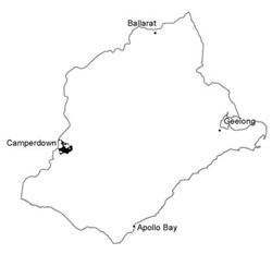 |
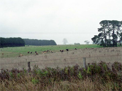 The undulating plains are known for the dominance of dairy farming | 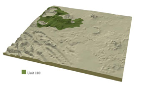 |
 | 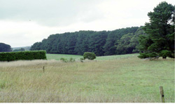 Shelter belts of cypress and radiata pine are common |
Component | 1 | 2 | 3 | 4 |
Proportion of soil-landform unit | 20% | 33% | 44% | 3% |
| CLIMATE Rainfall (mm) | Annual: 790 | |||
| Temperature (oC) | Minimum 8, Maximum 18 | |||
| Precipitation less than potential evapotranspiration | November-March | |||
| GEOLOGY Age and lithology | Quaternary scoria and basalt | |||
| Geomorphology | ||||
| LANDUSE | Uncleared: Nature conservation; water supply; active and passive recreation Cleared: Cropping; beef cattle and sheep grazing; dairy; regional development | |||
| TOPOGRAPHY Landscape | Gently undulating low basalt hills | |||
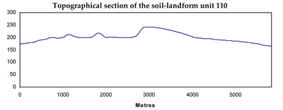
| Elevation range (m) | 120-280 | |||
| Local relief (m) | 60 | |||
| Drainage pattern | Radial | |||
| Drainage density (km/km2) | 0.8 | |||
| Landform | Low hills and rises | Plains | Drainage depressions | |
| Landform element | Upper slopes and crests | Gentle slopes and rises | Undulating plains | Drainage lines and depressions |
| Slope and range (%) | 6 (2-15) | 2 (1-8) | 2 (0-5) | 3 (0-5) |
| Slope shape | Convex | Irregular | Straight | Concave |
| NATIVE VEGETATION Ecological Vegetation Class | Plains Grassy Woodland (3.4%); Scoria Cone Woodland (0.8%) | |||
| SOIL Parent material | Basaltic scoria and ash | Baslatic scoria, ash and hard rock | Basaltic ash and hard rock | Basalt and associated alluvium |
| Description (Corangamite Soil Group) | Neutral and acidic black mottled texture contrast soils and acidic mottled brown and grey texture contrast soils (37) | |||
| Soil type sites | ||||
| Surface texture | Clay loam | Fine sandy clay loam | Fine sandy clay loam | Fine sandy clay loam, light clay |
| Permeability | Moderate | Moderate to low | Low | Very low |
| Depth (m) | <1.3 | <1.5 | <2 | >2 |
| LAND CHARACTERISTICS, POTENTIAL AND LIMITATIONS | Texture contrast, moderate to high water holding capacity and nutrient holding capacity depending on depth and stoniness. Friable, non-sodic soils with fine to moderate structure. Moderate rapid site drainage. Some susceptibility to sheet and rill erosion. | Texture contrast, moderate to high water holding capacity and nutrient holding capacity depending on depth and stoniness. Friable, non-sodic soils with fine to moderate structure. Moderate site drainage. Some susceptibility to sheet and rill erosion. | Texture contrast, moderate to high water holding capacity and nutrient holding capacity depending on depth and stoniness. Non-sodic soils with fine to moderate structure. Moderate site drainage. Some susceptibility to sheet and rill erosion. | Texture contrast and uniform clays, moderate to very high water holding capacity and nutrient holding capacity. Expansive clay subsoils (often self-mulching surface soils). Slow site drainage. Some susceptibility to waterlogging. |
© State of Victoria (Agriculture Victoria) 1996 - .

This work, Victorian Resources Online, is licensed under a Creative Commons Attribution 4.0 licence. You are free to re-use the work under that licence, on the condition that you credit the State of Victoria (Agriculture Victoria) as author, indicate if changes were made and comply with the other licence terms.
The licence does not apply to ‘branding’ or some ‘images or photographs’ that may be owned by third parties. We ask you to seek prior approval to use images using the VRO feedback form. Access to higher quality images can also be provided on request.
This page was last updated on .