
Soil/Landform Unit 104
 Cropping on the slopes of Mount Pollock where few surface stones occur has provide quite productive with high yields. The advent of raised bed cropping in this area provides further advantage with respect to reducing impacts of waterlogged soils. |
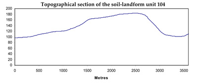
0.03% of CMA region The moderately inclined low cone of Mount Pollock is part of the first areas to be grazed in this part of Victoria. This volcanic eruption point on the Western Plains is located south of Inverleigh at Gnarwarre. Standing at 185 m in elevation, the cone has little remnant vegetation (less than 0.5%) with the major vegetation classes including Plains Grassland and Plains Grassy Woodland. These remnants occur mainly as roadside reserves. The cone has highly fertile side slopes and footslopes that have been used for cereal production. The basaltic rock and scoria support neutral shallow black cracking clays, though basalt floaters and outcrops make cultivation difficult on certain slopes. Grazing and cropping are the main land uses with raised bed farming more prevalent today in order to overcome seasonal soil waterlogging. A large free-range piggery also has developed on the north-east slopes. | 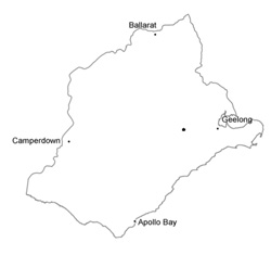 |
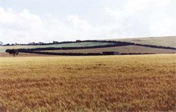
 The moderately inclined cone of Mount Pollock | 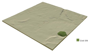 |
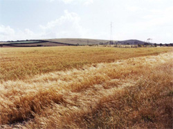
 | 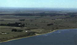 Look across Lake Modewarre towards Mount Pollock |
Component | 1 | 2 | 3 |
Proportion of soil-landform unit | 15% | 30% | 55% |
| CLIMATE Rainfall (mm) | Annual: 610 | ||
| Temperature (oC) | Minimum 9, Maximum 19 | ||
| Precipitation less than potential evapotranspiration | October-April | ||
| GEOLOGY Age and lithology | Quaternary basalt and alluvial | ||
| Geomorphology | |||
| LANDUSE | Uncleared: Nature conservation Cleared: Sheep and cattle grazing; cropping (including raised bed farming) | ||
| TOPOGRAPHY Landscape | Moderately incline low cone | ||
| Elevation range (m) | 105-184 | ||
| Local relief (m) | 90 | ||
| Drainage pattern | Dendritic | ||
| Drainage density (km/km2) | <0.1 | ||
| Landform | Cone | ||
| Landform element | Broad crest of cone | Side slope | Lower footslope |
| Slope and range (%) | 3 (1-5) | 8 (5-15) | 4 (1-10) |
| Slope shape | Convex | Convex | Concave |
| NATIVE VEGETATION Ecological Vegetation Class | Plains Grassland (0.3%), Plains Grassy Woodland (0.2%) | ||
| SOIL Parent material | Basaltic rock and scoria | Baslatic rock and scoria | Basaltic rock, scoria and colluvium |
| Description (Corangamite Soil Group) | Neutral shallow black cracking clays (39) | Neutral shallow black cracking clays (39) | Neutral shallow black cracking clays (39) |
| Soil type sites | SFS2, SFS4, CLRA46 | ||
| Surface texture | Light clay | Light clay | Light clay |
| Permeability | Moderate to high | Moderate | Moderate to low |
| Depth (m) | <1 | <1.5 | <2 |
| LAND CHARACTERISTICS, POTENTIAL AND LIMITATIONS | Expansive clay soil, but shallow and stony. Rapid site drainage. High nutrient holding capacity and moderate water holding capacity. | Expansive clay soil, but moderate depth and stony. Rapid site drainage. High nutrient holding capacity and water holding capacity. | Expansive clay soil, but moderately deep to deep with some stone. Moderate site drainage. High nutrient holding capacity and water holding capacity. Swelling of subsoil more likely (topographic position and thicker clay solum). |
© State of Victoria (Agriculture Victoria) 1996 - .

This work, Victorian Resources Online, is licensed under a Creative Commons Attribution 4.0 licence. You are free to re-use the work under that licence, on the condition that you credit the State of Victoria (Agriculture Victoria) as author, indicate if changes were made and comply with the other licence terms.
The licence does not apply to ‘branding’ or some ‘images or photographs’ that may be owned by third parties. We ask you to seek prior approval to use images using the VRO feedback form. Access to higher quality images can also be provided on request.
This page was last updated on .