
OTR601
|
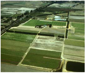
| OTR601 | Ferric, Mesotrophic, Brown Chromosol | |
| Wurdiboluc | |||
| Plateau | |||
| Neogene Hanson Plain Sand | |||
| Flat plain | |||
| 0% | |||
| - | |||
Horizon | Depth (cm) | Description | ||
A1 | 0–20 | Dark yellowish brown (10YR4/3); fine sandy loam; apedal single grain structure; occasional ironstone gravel; clear boundary to: | ||
A3 | 20–30 | Yellowish brown (10YR5/6); with some red (2.5YR5/8); mottles; light clay; moderate very fine (3 mm) subangular blocky structure; ironstone gravel common; gradual boundary to: | ||
B21 | 30–90 | Mottled yellowish brown (10YR5/6); and red (2.5YR5/8); medium clay; strong very fine (2 mm) angular blocky structure; clay skin cutans; abundant ironstone gravel; diffuse boundary to: | ||
B22 | 90+ | Mottled dark yellowish brown (10YR4/6); light–grey (2.5YR7/1); and red (10YR4/6); heavy clay; strong very fine (2 mm) angular blocky structure; abundant ironstone gravel often in layers or floaters of ironstone. | ||
| Management considerations | ||||
| Strong texture contrast between the surface soil and the subsoil is a very important soil feature. This can have a major effect by reducing and/or redirecting the internal drainage and restricting root growth beyond the upper horizons. Options include reduced tillage, improving organic matter content and altering the subsoil through artificial drainage (ripping, mole drainage) and/or chemical amelioration (gypsum) to improve structure. The sandy is likely to have poor plant water holding capacity and poor nutrient holding capacity due to the low level of bonding between soil particles. The surfaces are prone to wind, and sheet and rill erosion (depending on organic matter content and vegetative cover). These soils may be hydrophobic (in conjunction with organic coatings) when dry, taking time to reabsorb moisture. It is helpful to reduce the wetting/drying cycle and as well as increase organic matter and clay content (clay spreading is practiced in western Victoria). Sandy topsoils do however drain rapidly. Maintenance of a vegetative cover is important. Mottled subsoils are common and are an indication of periodic waterlogging, particularly if the mottles are pale (low oxygen conditions). Some brighter mottling may be due to past soil mixing and clay illuviation. Improved drainage, with the application of gypsum for sodic subsoils may be beneficial. | ||||
Analytical data
Site OTR601 | Sample depth | pH | EC | NaCl | Ex Ca | Ex Mg | Ex K | Ex Na | Ex Al | Ex acidity | FC (-10kPa) | PWP (-150kPa) | KS | FS | Z | C | |
Horizon | cm | H2O | CaCl2 | dS/m | % | cmolc/kg | cmolc/kg | cmolc/kg | cmolc/kg | mg/kg | cmolc/kg | % | % | % | % | % | % |
A1 | 0-10 | 5.9 | N/R | 0.035 | N/R | 1.7 | 0.9 | 0.09 | 0.01 | N/R | N/R | N/R | N/R | 22 | 48 | 15 | 10 |
A1 | 10-20 | 5.8 | N/R | 0.034 | N/R | 1.1 | 1.1 | 0.08 | 0.02 | N/R | N/R | N/R | N/R | 18 | 48 | 17 | 15 |
A3 | 20-30 | 5.8 | N/R | 0.050 | N/R | 2.0 | 4.5 | 0.10 | 0.2 | N/R | N/R | N/R | N/R | 10 | 27 | 11 | 50 |
B21 | 50-60 | 5.8 | N/R | 0.070 | N/R | 2.1 | 6.5 | 0.09 | 0.3 | N/R | N/R | N/R | N/R | 7 | 20 | 10 | 63 |
B22 | 110-120 | 5.3 | N/R | 0.073 | N/R | 0.5 | 4.6 | 0.03 | 0.2 | N/R | N/R | N/R | N/R | 7 | 19 | 9 | 63 |
© State of Victoria (Agriculture Victoria) 1996 - .

This work, Victorian Resources Online, is licensed under a Creative Commons Attribution 4.0 licence. You are free to re-use the work under that licence, on the condition that you credit the State of Victoria (Agriculture Victoria) as author, indicate if changes were made and comply with the other licence terms.
The licence does not apply to ‘branding’ or some ‘images or photographs’ that may be owned by third parties. We ask you to seek prior approval to use images using the VRO feedback form. Access to higher quality images can also be provided on request.
This page was last updated on .