
OTR415
|
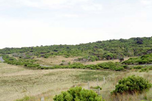
| OTR415 | Ceteric, Regolithic, Shelly Calcarosol | |
| Cape Otway | |||
| Steeply rolling dunes | |||
| Quaternary (Holocene) aeolian sands | |||
| Dune - upper slope | |||
| 5% | |||
| Westerly | |||
Horizon | Depth (cm) | Description | ||
A1 | 0–15 | Black (10YR2/1); sandy loam; apedal single grain structure; clear boundary to: | ||
B2 | 15–75 | Black (10YR2/1); loamy sand; very weak coarse (30 mm) subangular blocky structure; gradual boundary to: | ||
C | 75+ | Pale brown (10YR6/3); coarse sand; apedal single grain structure. | ||
| Management considerations | ||||
| Gradational soil profiles allows water and gas (air) to move without physical limitations, but remains dependent on any chemical or depth restrictions. Deep sandy soils generally have poor plant water/nutrient holding capacities. These soils may be hydrophobic (in conjunction with organic coatings) when dried out, taking time to reabsorb moisture. These soils do however drain rapidly. | ||||
Analytical data
Site OTR415 | Sample depth | pH | EC | NaCl | Ex Ca | Ex Mg | Ex K | Ex Na | Ex Al | Ex acidity | FC (-10kPa) | PWP (-150kPa) | KS | FS | Z | C | |
Horizon | cm | H2O | CaCl2 | dS/m | % | cmolc/kg | cmolc/kg | cmolc/kg | cmolc/kg | mg/kg | cmolc/kg | % | % | % | % | % | % |
A1 | 0-8 | 7.9 | N/R | 0.270 | 0.025 | 35.9 | 3.6 | 0.3 | 0.2 | N/R | N/R | N/R | N/R | 53 | 28 | 4 | 8 |
A1 | 8-15 | 8.0 | N/R | 0.230 | 0.023 | N/R | N/R | N/R | N/R | N/R | N/R | N/R | N/R | N/R | N/R | N/R | N/R |
B2 | 30-60 | 8.4 | N/R | 0.230 | 0.023 | 24.6 | 1.0 | 0.2 | 0.1 | N/R | N/R | N/R | N/R | 63 | 25 | 3 | 8 |
C | 150-180 | 9.1 | N/R | 0.091 | 0.003 | 1.4 | 60.05 | 0.0 | <0.05 | N/R | N/R | N/R | N/R | 85 | 12 | 1 | 2 |
© State of Victoria (Agriculture Victoria) 1996 - .

This work, Victorian Resources Online, is licensed under a Creative Commons Attribution 4.0 licence. You are free to re-use the work under that licence, on the condition that you credit the State of Victoria (Agriculture Victoria) as author, indicate if changes were made and comply with the other licence terms.
The licence does not apply to ‘branding’ or some ‘images or photographs’ that may be owned by third parties. We ask you to seek prior approval to use images using the VRO feedback form. Access to higher quality images can also be provided on request.
This page was last updated on .