
Soils on Tertiary Unconsolidated and Consolidated Sediments
Tcg - Steep Valley Sides with Duplex Soils - on Variable Sediments | Tgn - Plains with Duplex Soils on Tertiary Sediments | Tgnd - Plains with Duplex Soils on Tertiary Sediments. Drier than Tgn | Tgm - Slopes with Variable Clayey Soils on Tertiary Limestone and Basalt | Tgs - Plains with Duplex Soils on Tertiary Sediments - South of Maude | Tsc - Irregular Surfaces with Shallow Uniform Texture Soils on Tertiary Sedimentary Rock | Tsd - Valley Sides with Duplex Soils on Tertiary Sediments | Tsm - Steep Valley Sides with Clay soils on Variable Parent Materials
Tgn - Plains with Duplex Soils on Tertiary Sediments
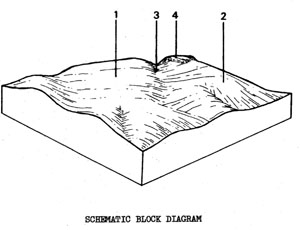 | Predominantly fairly deep soils (gently undulating plains) of unconsolidated Tertiary clays, sands, silts and gravels which are scattered throughout the north-central and northwestern parts of the Shire. There are also some broad crests in the Ors unit with Tertiary remnants; and these have been mapped as Tgn where they are large enough. On some of the higher crests there are areas of ferricrete (ironstone layers) with shallow red duplex soils. Patches of deep sand occur randomly in the landscape, particularly in the north-west of the Shire. The unit occupies 85.0 km2 or 12.1% of the Shire - the second largest unit. The main use of this land is grazing, with some sand and gravel extraction. Some of the poorer areas have been left forested with a low-quality timber. SOILS Although there may be differences in soil depth and the structure and mottling of the clay, the major soil of Tgn is fairly consistent. The description below refers to Component 1 and, in particular, describes the most common soil of the extensive undulating plains. |
Mottled Yellow Duplex Soils, Fine Structure
Factual Key: Dy 3.41/SL-FSL, 10-40 cm/tertiary sediments, 100-200 cm.
Horizon | Depth (cm) | Description |
A1 | 0-10 | Dark brown (7.5YR 3/4) when moist; sandy loam; weak subangular blocky 10 mm; consistence when slightly moist is firm; pH 5.0; abrupt boundary. |
A2 | 10-20 | Dull yellowish brown (10YR 5/4) when moist; sandy loam; apedal and massive; consistence when slightly moist is firm; 50% buckshot concentrated at A/B boundary; pH 6.0; abrupt boundary. |
B1 | 20-35 | Yellowish brown (10YR 5/6) when moist; few distinct red mottles; medium clay; strong angular blocky 2 mm; consistence when slightly moist is film; 4% buckshot; pH 5.5; diffuse boundary. |
B2 | 35-150 | Yellowish brown (10YR 5/6) when moist; with abundant distinct red mottles; medium clay; strong angular blocky 2 mm; consistence when slightly moist is firm; 4% buckshot; pH 5.5; diffuse boundary. |
C | 150+ | Weathering Tertiary sediments. |
| COMPONENT Proportion % | 1 70 | 2 15 | 3 15 | 4 2 |
| CLIMATE | ||||
| Rainfall(av.) mm | Annual 585 - 685 | |||
| Temperature(av.) °C | Annual 12 | |||
| GEOLOGY | ||||
| Age, rock | Tertiary; gravels, sands and clays | |||
| TOPOGRAPHY | ||||
| Landscape | Undulating plains and broad crest in the north of the Shire | |||
| Elevation (range) m | 220 - 370 | |||
| Local relief (av.) m | 3 | |||
| Drainage pattern | Dendritic | |||
| Drainage density km/km2 | 1.6 | |||
| Land form | Undulating plain | Undulating plain | Drainage lines | Remnant capping- ironstone |
| Position on land form | Well-drained non-sandy areas | Patches of deep sandy soil | Low lying areas | Some crests - especially near Orm |
| Slope (range) %, slope shape | 1-3 ; Convex and Straight | 1-3 ; Convex | 1-3 ; Concave | 2-4 ; Straight |
| NATIVE VEGETATION | ||||
| Structure | Low open forest - woodland | |||
| Dominant species | E. viminalis, E. obliqua, B. radiata, E. rubida, (E. pauciflora - Durdidwarrah area) Callitris columellaris in lower stratum | E. viminalis Pteridium esculentum | E. ovata | E. obliqua B. radiata Xanthorrhoea australis |
| SOIL | ||||
| Parent material | Unconsolidated gravel, sand and clay | Unconsolidated sand | Unconsolidated gravel, sand and clay | Ironstone (ferricrete) and sandy clays |
| Description | Mottled, yellow duplex soils, fine structure | Yellow sand soils, uniform texture | Mottled yellow duplex soils | Red duplex soils over ironstone |
| Factual key | Dy 3.41 | Uc 2.33 | Dy 3.42 | Dr 2.21 |
| Surface texture | Sandy clay loam to loamy sand | Sand | Clay loam, sandy clay loam | Sandy loam, loamy sand |
| Permeability | Moderate | High | Moderate | Moderate |
| Depth (range) m | 1.0 - 2.0 | 0.8 - 3.0 | 1.5 - 2.5 | 0.2 - 0.8 |
| LAND USE | ||||
Grazing, gravel extraction, mining | ||||
| SOIL DETERIORATION | ||||
| Critical land features | Hard setting surfaces, dispersibility, permeability | Low water holding capacity, low nutrient holding capacity | Seasonal high watertables | Hard setting surfaces |
| Processes | Leaching of salts, overland flow | Leaching | Hard setting surfaces, permeability Some accumulation of salts, overland flow, periodic waterlogging | Overland flow |
| Forms | Minor sheet erosion | Fertility decline Minor wind erosion | Sheet and rill erosion, minor gully erosion. Some salting, especially when adjacent to Ordovician sediments | Minor sheet and rill erosion |
Tgs - Plains with Duplex Soils on Tertiary Sediments - South of Maude
 | Gently undulating to flat plains throughout the southern half of the Shire. Having a total area of 95.4 i.e. 13.92% of the Shire, this is the largest unit mapped. The soils usually have a sandy loam surface layer and the yellow or red subsoil clay overlies unconsolidated clay, sand and gravel of marine Tertiary origin or occasionally isolated ironstone deposits. The main land use is grazing and cereal cropping, areas remain timbered and are used for recreation, sand and gravel extraction and low-quality forestry. SOILS Generally, the most common soil is that of Component 1. There are a few areas where the more sodic, poorer more erodible soil of Component 2 is more common (i.e. around Lethbridge township). The soil described below is representative of Component 1. |
Mottled Yellow Sodic Duplex Soils
Factual Key: Dy 3.43/FSL-FSCL, 15-50 cm/tertiary sediments, 80-180 cm.
Horizon | Depth (cm) | Description |
A1 | 0-20 | Dark brown (7.5YR 3/3.) when moist; loam fine sandy; hydrophobic; apedal and massive; consistence when dry is slightly hard; pH 7.0; clear boundary. |
A2 | 20-40 | Brown (7.5YR 4/3) when moist; sandy loam; hydrophobic; apedal and massive; consistence when dry is slightly hard; pH 7.0; abrupt boundary. |
B21 | 40-60 | Bright yellowish brown (10YR 6/6) when moist; with brown and red mottles; medium clay; strong subangular blocky 15 mm; consistence when moist is firm; 1% buckshot 5 mm; pH 6.0; clear boundary. |
B22 | 60-150 | Brown (10YR 4/6) when moist with red mottles; clay; strong angular blocky 2 mm; consistence when moist is firm; pH 9.0; clear boundary. |
C | 150-200+ | Bright yellowish brown (10YR 6/8) when moist; with large white mottles; clay; consistence when moist is friable; pH 9.0. |
| COMPONENT Proportion % | 1 80 | 2 10 | 3 9 | 4 1 |
| CLIMATE | ||||
| Rainfall(av.) mm | Annual 500 - 585 | |||
| Temperature(av.) °C | Annual 15 | |||
| GEOLOGY | ||||
| Age, rock | Tertiary unconsolidated sediments | |||
| TOPOGRAPHY | ||||
| Landscape | Undulating plains throughout the southern half of the Shire | |||
| Elevation (range) m | 27 - 206 | |||
| Local relief (av.) m | 12 | |||
| Drainage pattern | Dendritic | |||
| Drainage density km/km2 | 0.7 | |||
| Land form | Undulating plains | |||
| Position on land form | Upper plain | Drainage line | Lower plain | Sand ridge with ferricrete |
| Slope (range) %, slope shape | 2-5 ; Straight | 1-2 ; Concave | 1-5 ; Straight | 3-5 ; Convex |
| NATIVE VEGETATION | ||||
| Structure | Woodland to open forest | |||
| Dominant species | E. leucoxylon, Acacia pycnantha E. melliodora, Casuarina stricta, Dwarf E. viminalis dominates, some areas south) | E. camaldulensis | E. leucoxylon Acacia spp | E. viminalis, Acacia pycnantha. |
| SOIL | ||||
| Parent material | Unconsolidated clay, silt. sand and gravel | Unconsolidated sediments and recent alluvial deposits | Unconsolidated clay, silt, sand and gravel | Unconsolidated sediments and ferricrete |
| Description | Mottled yellow duplex and red duplex exile, both fine structured | Mottled yellow duplex. soils, fine structure | Mottled yellow sodic duplex soils, coarse structure | Mottled red duplex soils, acidic |
| Factual key | Dy3.43 – Dr3.43 | Dy 3.43 | Dy3.43 | Dr 3.21 |
| Surface texture | Fine sandy loam | Sandy loam | Sandy loam | Fine sandy loam |
| Permeability | Moderate | Moderate to low | Low | High |
| Depth (range) m | 1.0 - 2.0 | 1-5 - 2.5 | 2.0 | 0.7 - 1.8 |
| LAND USE | ||||
Cropping, grazing, low quality forestry, ironstone gravel extraction, town sites | Grazing, some cropping, town site | Grazing | ||
| SOIL DETERIORATION | ||||
| Critical land features | Hard setting surfaces | Seasonal high watertables Slope position | Dispersibility | Hard setting surfaces |
| Processes | Overland flow | Overland flow Periodic waterlogging | Overland flow, sub-surface flow | Overland flow |
| Forms | Minor sheet erosion | Minor gully erosion | Moderate gully erosion | Minor sheet erosion |
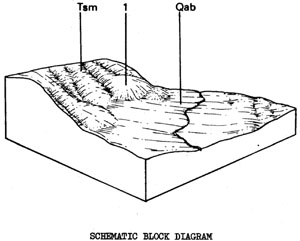
Tsm - Steep Valley Sides with Clay Soils on Variable Parent Materials
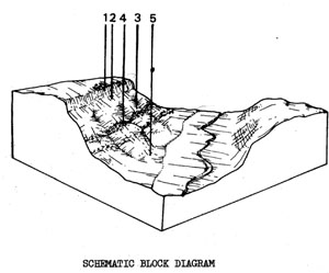 | Moderately to very steeply sloping sides of river gorges, e.g. along the southern stretches of the Moorabool River, mostly cut through Tertiary deposits. The total area of 25 km2 comprises 5.6% of the Shire. Because the gorge cuts through many geological strata, the nature of the surface material on the sides of the gorge can be extremely variable. At the top of the slope, there may be younger basalt capping (Quaternary). Below the younger basalt, there are Tertiary sediments, older basalt (Tertiary), more unconsolidated (Tertiary) sediments including limestone and some quartzite strata and, near the stream, there may be Ordovician slates and sandstones. The meandering of the river affects the steepness of the sides of the gorge and the topography is further complicated by the entrenching of subsidiary streams. The main land use depends on slope and soil, which change very rapidly along the sides of the gorge. A more detailed study at a larger scale would be essential to plan specific land uses for individual allotments, paying particular attention to the high landslip risk associated with the black clays. SOILS Throughout the unit, the most commonly encountered soil types are uniform black or chocolate, self-mulching clays (especially along the Moorabool) or sandy red duplex soils (similar to Tog). Where the soils become very shallow on steeper slopes, (especially over limestone) a grey-brown clay loam with white lime patches may occur. |
Black Clay Soils
Factual Key: Ug 5.1/LC-MC, 30-100 cm/lime, clay and sand, 30-100 cm.
Horizon | Depth (cm) | Description |
A11 | 0-5 | Brownish black (10YR 3/1) when moist; medium clay; strong angular blocky structure 2 mm; consistence when moist is plastic; pH 6.5; abrupt boundary. |
A12 | 5-50 | Black (10YR 2/2) when moist with few large brown mottles; heavy clay; strong angular blocky structure 5 mm with large vertical cracks; consistence when dry, very hard and wet, very plastic; pH 8.5; abrupt boundary. |
C | 50-200+ | Dark brown (10YR 3/4) when moist, with many faint brown mottles; medium clay, moderate sub-angular blocky structure, consistence when moist is plastic; containing 20A lime deposits 8 mm; pH 9.0. |
| COMPONENT Proportion % | 1 15 | 2 20 | 3 5 | 4 50 | 5 10 |
| CLIMATE | |||||
| Rainfall(av.) mm | Annual 500 - 610 | ||||
| Temperature(av.) °C | Annual 12 | ||||
| GEOLOGY | |||||
| Age, rock | Quaternary basalt | Tertiary unconsolidated sediments-gravel, sand and clay - some lime | Tertiary (older) basalt | Various Tertiary strata, unconsolidated sediments, limestone etc. | Ordovician slates and sandstones interbedded |
| TOPOGRAPHY | |||||
| Landscape | Steep river valley aides south of Maude | ||||
| Elevation (range) m | 30 - 183 | ||||
| Local relief (av.) m | 45 | ||||
| Drainage pattern | Dendritic | ||||
| Drainage density km/km2 | |||||
| Land form | Scarp | Sides of the river valley | |||
| Position on land form | Stony upper elope or crest | Upper slope or crest | Mid-slope | Mid-slope | Lower slope |
| Slope (range) %, slope shape | 20-60; Convex/straight | 10-50 ; Convex | 10-50 ; straight | 10-50 ; Straight/concave | 10-50 ; Straight/Concave |
| NATIVE VEGETATION | |||||
| Structure | Open forest | ||||
| Dominant species | E. leucoxylon, E. camaldulensis | (E. viminalis and Acacia mearnsii on sandy areas) | E. leucoxylon, some E. melliodora, E. viminalis | ||
| SOIL | |||||
| Parent material | In-situ weathered basalt | In-situ unconsolidated sediments with some areas of colluvial basalt | In-situ older basalt with colluvium from higher land | In-situ unconsolidated sediments and limestone, with colluvium from higher land. Some quartzite outcrops | In-situ slates and sandstone with colluvium |
| Description | Stony, shallow brown clay soils | Black clays or yellow duplex soils | Black clays or red-brown gradational or duplex, soils | Black clays with some are gradational or duplex soils and some sandy areas (Quartzite) | Mottled yellow gradational or duplex soils |
| Factual key | Db 1.11 or Ug 5.1 | Ug 5.1 or Dy 3.43 | Ug 5.1. Gn 3.11 | Ug 5.1, Dr 2.13, Dr 2.43, Uc | Gn 3.72 or Dy 3.42 |
| Surface texture | Clay loam | Clay to clay loam | Clay to clay loam | Mostly clay - some sandy areas | Fine sandy clay loam |
| Permeability | Moderate | Moderate to low | Moderate | Moderate | Moderate to low |
| Depth (range) m | 0.1- 0.5 | 0.5 - 1.2 | 0.3 - 1.0 | 0.3 - 2.0 | 0.3 - 1.0 |
| LAND USE | |||||
Grazing | Grazing, some cropping on gentler slopes | Grazing | |||
| SOIL DETERIORATION | |||||
| Critical land features | Steep slopes | Moderate to steep slopes, deep black clayey soils | Moderate to very steep slopes, dispersible clay | ||
| Processes | Undercutting, | Overland flows | Overland flow | ||
| Forms | Slumping, rock falls | Moderate landslip hazard, rilling on exposed soil | Moderate sheet and rill erosion | ||
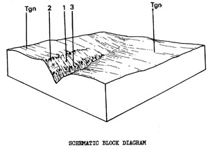
Tgnd - Plains with Duplex Soils on Tertiary Sediments. Drier than Tgn
 | Gently undulating terrain on Tertiary clay, sand and gravel deposits in the north of the Shire. The 24.5 km2 represents 3.5% of the study area. Tgnd is very similar to Tgn but the climate is drier and, in the north east, it is mainly associated with remnant Tertiary cappings on the broad crests of the steep Ordovician land (Orsd). The areas of ironstone and quartz gravels are more common, although in many cases, these deposits may not be deep or extensive enough to be of great commercial value. The soils are mostly moderate to well structured but are often poor in nutrient status. Also, the freely draining sandy soils, together with the high position in the landscape, can lead to low water retention for plant growth during dry periods. As a result, the land is used for grazing or is left as low, open, natural forest. SOILS The most common soil type is red mottled yellow duplex soil with a texture of sandy loam to loamy sand at the surface. This occurs mainly on Component 1, although the soils of Component 5 are similar but greyer and those of Component 4 have a high gravel content. |
Mottled Yellow Duplex Soils
Factual Key: Dy 3.41/SL-LS, 5-25 cm/unconsolidated clay, sand or gravel, 30-200 cm.
Horizon | Depth (cm) | Description |
A1 | 0-10 | Brownish black (10YR 3/1) when moist; loamy sand; apedal and massive; consistence when moist is friable; sometimes with quartz gravels 15 mm; pH 5.0; abrupt boundary. |
A2 | 10-20 | Greyish brown (10YR 5/2) when moist; loamy sand; apedal and massive; consistence when moist is friable; sometimes with quartz gravel 0-60%, 20 mm; pH 5.5; abrupt boundary. |
B | 20-100 | Yellowish brown (10YR 5/6) when moist with many fine red-brown mottles; medium clay moderate subangular blocky structure 5 mm; consistence when moist is firm sometimes with quartz gravel 0-40%, 20 mm; |
C | 100+ | Gravelly or sandy clay, etc. |
| COMPONENT Proportion % | 1 40 | 2 20 | 3 15 | 4 15 | 5 10 |
| CLIMATE | |||||
| Rainfall(av.) mm | Annual 550 - 630 | ||||
| Temperature(av.) °C | Annual 12 | ||||
| GEOLOGY | |||||
| Age, rock | Tertiary; gravels, sands and clays | ||||
| TOPOGRAPHY | |||||
| Landscape | Undulating plains and broad crests of Tertiary capping in the north of the Shire | ||||
| Elevation (range) m | 170 - 365 | ||||
| Local relief (av.) m | 30 | ||||
| Drainage pattern | Dendritic | ||||
| Drainage density km/km2 | 0.7 | ||||
| Land form | Lower crests and slopes | Sandy areas | Higher crests with ferricrete (ironstone) | Lower crests with quartz gravel | Drainage lines |
| Position on land form | - | - | - | - | - |
| Slope (range) %, slope shape | 1-5 ; Convex | 1-5 ; Convex | 1-5, Convex | 2-10 ; Convex | 1-5 ; Concave |
| NATIVE VEGETATION | |||||
| Structure | Low open forest | ||||
| Dominant species | E. macrorhyncha E. polyanthemos (E. obliqua) (E. camaldulensis near 'Bamganie') | E. viminalis E. leucoxylon Acacia mearnsii bracken (Casuarina and Callitris in some areas | E. pacrorhyncha E. polyanthemos E. leucoxylon E. goniocalyx E. obliqua Xanthorrhoea australis Hakea spp. | E. macrorhyncha E. obliqua E. polyanthemos E. leucoxylon E. sideroxylon Xanthorrhoea australis | E. macrorhyncha E. leucoxylon Leptospermum spp. Banksia marginate |
| SOIL | |||||
| Parent material | Unconsolidated sandy clays | Unconsolidated sands | Ferricrete (ironstone) | Gravels and gravelly clay and sands | Unconsolidated gravels, sand and clay |
| Description | Mottled yellow duplex soils, fine structure | Uniform sandy soils | Red duplex soils | Gravelly mottled yellow duplex soils | Mottled yellow duplex soils |
| Factual key | Dy 3.41 | Uc 2.21 or 2.33 | Dr 2.31 | Dy 3.41 | Dy 3.41 |
| Surface texture | Sandy loam - loamy sand | Sand | Loamy sand | Loamy sand - sandy loam | Sandy loam |
| Permeability | Moderate | High | High | Moderate | Moderate to low |
| Depth (range) m | 0.3 - 2.0 | 0.7 - 2.0 | 0.1 - 0.6 | 0.3 - 1.0 | 1.0 - 2.0 |
| LAND USE | |||||
Grazing, natural forest, recreation, sub-division | |||||
Sand extraction | Ironstone gravel extraction | Quartz-gravel extraction | |||
| SOIL DETERIORATION | |||||
| Critical land features | Limited permeability | Highly permeable sand | Limited permeability | Seasonal high watertable | |
| Processes | Surface runoff | Leaching | Surface runoff | Periodic waterlogging | |
| Forms | Minor sheet erosion | Nutrient decline | Minor sheet erosion | Surface compaction | |
Tgm - Slopes with Variable Clayey Soils on Tertiary Limestone and Basalt
 | Tgm Gentle to moderate slopes on variety of Tertiary materials in the Moorabool valley. There are only three areas, totalling 1.0 km2, or o.1% of the Shire. The main land use is cropping and, particularly on the black and chocolate clays, market gardens. There are probably many other small areas of Tgm scattered throughout the Tsm unit that were unmappable at the scale of this report. SOILS. The deep subsoils and soil parent material usually has a considerable lime content. The dominant soils are either self-mulching, dark clays, similar to those of Ten, or sandy red duplex soils with clay subsoils like those described below. The latter are usually formed when the soil parent material has a higher sand content. |
Red Duplex Soils
Factual Key: Dr 8.33/SL-FSL, 10-30 cm/unconsolidated sandy material and limestone, 60-150 cm
Horizon | Depth (cm) | Description |
A1 | 0-10 | Dark reddish-brown (5YR 3/3) when moist; fine sandy loam; apedal and massive; consistence when dry is slightly hard; pH 6.0; abrupt boundary. |
A2 | 10-15 | Dull reddish-brown (5YR 4/4) when moist; fine sandy loam; apedal and massive; consistence when dry is hard; pH 7.0; abrupt boundary. |
B | 15-150 | Dull reddish brown (5YR 4/3) when moist; heavy clay; strong angular blocky 50 mm breaking to 10 mm; consistence when dry is very hard; pH 8.5; abrupt boundary. |
C | 150+ | Limestone layers with sandy clay. |
| COMPONENT Proportion % | 1 100 | ||
| CLIMATE | |||
| Rainfall(av.) mm | Annual 510 - 570 | ||
| Temperature(av.) °C | Annual 12 | ||
| GEOLOGY | |||
| Age, rock | Tertiary limestone or basalt | ||
| TOPOGRAPHY | |||
| Landscape | Gentler slopes in the Moorabool Valley | ||
| Elevation (range) m | 60 - 170 | ||
| Local relief (av.) m | 30 | ||
| Drainage pattern | Dendritic | ||
| Drainage density km/km2 | 1.6 | ||
| Land form | Slopes | ||
| Position on land form | - | ||
| Slope (range) %, slope shape | 3-12% ; Straight | ||
| NATIVE VEGETATION | |||
| Structure | Open forest | ||
| Dominant species | E. leucoxylon, E. camaldulensis | ||
| SOIL | |||
| Parent material | Limestone, unconsolidated materials with lime, older basalt | ||
| Description | Black or chocolate, self-mulching clays on clayey parent material | or | Red duplex soils on sandier parent material |
| Factual key | Ug 5.1 | Dr 2.43 | |
| Surface texture | Light to medium clay | Sandy loam | |
| Permeability | Low to moderate | Moderate | |
| Depth (range) m | 1.0 - 2.0 | 1.0 - 2.0 | |
| LAND USE | |||
Cropping - some market gardening, grazing | |||
| SOIL DETERIORATION | |||
| Critical land features | Limited soil permeability, slope gradients | ||
| Processes | Overland flow, cultivation | ||
| Forms | Moderate sheet and rill erosion | ||
Tsc - Irregular Surfaces with Shallow Uniform Texture Soils on Tertiary Sedimentary Rock
 | Moderate to steep elopes and gorges associated with streams that have cut down through the Tertiary sediments. There are only three small areas in the north-west of the Shire, and the total of 0.3 km2 represents only 0.04% of the study area. In some places the stream has first cut through the basalt plain, and basalt may be found at the top of the scarp as a capping to the Tertiary sediments. Ironstone (ferricrete) outcrops occasionally occur at the top of the Tertiary sediments, while further down the slope there may be quartzite outcrops. The unit is mainly used for grazing and has a fairly high erosion hazard if the soil is exposed. SOILS The soils are shallow over the Tertiary clays, sands and gravels. Where there is basalt at the top of the scarp, colluvium from this source often makes the soils darker with well structured clays. A common soil on moderate slopes where basalt is not present is described below. |
Mottled Yellow Duplex Soils
Factual Key: Dy 3.41/SL-SCL, 10-20 cm/tertiary clay, sand and gravel, 30-120 cm.
Horizon | Depth (cm) | Description |
A1 | 0-10 | Brownish black (10YR 3/2) when moist; sandy loam; apedal and massive; consistence when slightly moist is firm; pH 6.0; clear boundary. |
A2 | 10-15 | Greyish yellow brown (10YR 5/2) when moist; sandy loam; apedal and massive; consistence when slightly moist is firm; pH 6.0; abrupt boundary. |
B | 15-45 | Dull yellow orange (10YR 6/5) when moist; light clay; moderate sub-angular blocky 3 mm; consistence when slightly moist is firm; pH 6.5; clear boundary. |
C | 45+ | Tertiary clay with gravel or sand. |
| COMPONENT Proportion % | 1 90 | 2 5 | 3 5 |
| CLIMATE | |||
| Rainfall(av.) mm | Annual 610 – 635 | ||
| Temperature(av.) °C | Annual 12 | ||
| GEOLOGY | |||
| Age, rock | Tertiary gravel, sands and clays and sometimes colluvium from basalt | Tertiary ironstone | Tertiary, quartzite |
| TOPOGRAPHY | |||
| Landscape | Gentle valley | ||
| Elevation (range) m | 320 - 350 | ||
| Local relief (av.) m | 10 | ||
| Drainage pattern | - | ||
| Drainage density km/km2 | - | ||
| Land form | Scarp | Rise | Outcrop |
| Position on land form | - | - | - |
| Slope (range) %, slope shape | 10-30 ; straight - concave | 2 ; straight | 2-10 ; straight |
| NATIVE VEGETATION | |||
| Structure | Open forest (?) | ||
| Dominant species | E. obliqua, E. viminalis | ||
| SOIL | |||
| Parent material | Unconsolidated gravels, sands and clays | Ironstone | Quartzite |
| Description | Mottled yellow duplex soils | Reddish shallow uniform soils | Brown shallow uniform soils |
| Factual key | Dy 3.41 | Um 1 | Um 1 |
| Surface texture | Sandy loam to sandy clay loam | Loam | Loam - sandy loam |
| Permeability | Moderate | High | High |
| Depth (range) m | 0.3 - 1.2 | 0.1 - 0.3 | 0.1 - 0.3 |
| LAND USE | |||
Grazing | |||
| SOIL DETERIORATION | |||
| Critical land features | Exposure, routing depth | ||
| Processes | Overland flow | Overland flow | |
| Forms | High sheet and rill erosion | High sheet, rill and wind erosion | |
Tcg - Steep Valley Sides with Duplex Soils - on Variable Tertiary Sediments
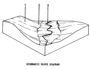 | Moderately to steeply eloping sides of the gorge associated with Bruce's Creek near Bannockburn. The total area of 3.6 km represents 0.596 of the Shire. The height and slope of the sides vary along the gorge; generally the height and slope decreases toward the north (Component 2 becomes more common) and the slopes are greater on the outside bends than on the inner. The inner bends, in fact, often have small flat terraces. The main land use is grazing, with some creels associated recreation. SOILS The soils vary with slope and position in the landscape but red duplex soils (described below) are common, especially on the upper slopes of Component 1. On the lower slopes, there is a dark, uniform, clay, similar to that described for Tem. On gentler slopes of Component 2, a yellow duplex soil similar to Tgs may occur and the alluvium of Component 3 has similar soils to Qyad. |
Red Duplex Soils
Factual Keys Dr 2.13/FSL-SL, 10-40 cm/unconsolidated sediments, 40-100 cm.
Horizon | Depth (cm) | Description |
A1 | 0-20 | Dark reddish-brown (5YR 3/3) when moist; sandy loam; apedal and massive; consistence when moist is friable; pH 6.0; abrupt boundary. |
B21 | 20-50 | Reddish brown (5YR 4/6) when moist; medium clay; moderate to strong angular blocky 5mm; consistence when moist is firm; pH 7.0; diffuse boundary. |
B22 | 50-60 | Reddish brown (5YR 4/6) when moist with fine yellow mottles; medium clay; moderate prismatic; structure 30 mm; consistence when dry is hard; soft accumulations of lime 2096; pH 8.0. |
C | 60+ | Sandy clay with lime (some areas - gravels or quartzite.) |
| COMPONENT Proportion % | 1 50 | 2 30 | 3 20 |
| CLIMATE | |||
| Rainfall(av.) mm | Annual 500 – 530 | ||
| Temperature(av.) °C | Annual 13 | ||
| GEOLOGY | |||
| Age, rock | Tertiary unconsolidated sediments with some limestone | ||
| TOPOGRAPHY | |||
| Landscape | Gorge associated with Bruce's Creek near Bannockburn | ||
| Elevation (range) m | 46 - 125 | ||
| Local relief (av.) m | 15 | ||
| Drainage pattern | Dendritic | ||
| Drainage density km/km2 | 4.6 | ||
| Land form | Scarps and steeper slopes | Moderate to gentle slopes | Creek alluvium and channel |
| Position on land form | Valley sides - mainly south of Bannockburn | Valley aides - mainly north of Bannockburn | Valley floor |
| Slope (range) %, slope shape | 15-30 ; Straight | 5-20 ; Straight | 0-3 ; Concave |
| NATIVE VEGETATION | |||
| Structure | Open forest | ||
| Dominant species | E. leucoxylon, E. viminalis, E. camaldulensis (lower slopes) | E. camaldulensis (some E. viminalis) | |
| SOIL | |||
| Parent material | Unconsolidated sediments including lime | Alluvium | |
| Description | Red duplex soils and dark clayey uniform soils | Yellow and some red duplex soils | Uniform soils (variable) |
| Factual key | Dr 2.13, Ug 5.1 | Mainly Um and Ug | |
| Surface texture | Sandy loam-clay | Fine sandy loam Variable Moderate | Variable |
| Permeability | Moderate | Moderate to low | Variable |
| Depth (range) m | 10 - 50 | 30 - 80 | 50 - 150 |
| LAND USE | |||
Grazing, natural forest | Recreation, some grazing | ||
| SOIL DETERIORATION | |||
| Critical land features | Steep slopes | Moderate slopes | Low situation affected by flooding from stream |
| Processes | Overland flow | Overland flow | Overland flow |
| Forms | Minor sheet and rill erosion | Minor sheet and rill erosion | Streambank erosion, siltation |
Tsd - Valley Sides with Duplex Soils on Tertiary Sediments
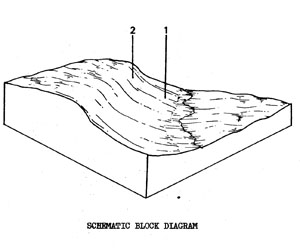 | Gentle to moderate slopes produced by shallow downcutting of streams mostly in the Tgs unit south-west of Bannockburn. There are only a few occurrences within the Shire and the 1.9 km2 represents only 0.3% of the study area. At the top of the slope there may be a layer of cemented sand and ferricrete just below the soil. Some of the streams have an associated elope on one side only; the land through which the stream cute having been eroded away on the other side. The main land use is native forest production and ironstone gravel extraction, with some areas of grazing on the lower slopes. The municipal tip is also located on one of the lower slopes. SOILS The soils at the top of the scarp are much redder and have much more ironstone gravel than those of the lower slopes, which progressively become browner, then yellow, down the slope. The latter soils (Component 1) slake readily and are also somewhat dispersible. |
Mottled Brown Duplex Soils
Factual Key: Db 2.43/FSL, 15-40 cm unconsolidated clay sand and gravel, 40-100 cm.
Horizon | Depth (cm) | Description |
A1 | 0-5 | Dark brown (7.5YR 3/3) when moist; hydrophobic, fine sandy loam; apedal and massive; consistence when dry is soft; pH 5.5; abrupt boundary. |
A2 | 5-25 | Dull brown (7.5YR 5/4) when moist; fine sandy loam; apedal and massive; consistence when dry is slightly hard; pH 6.0. |
B21 | 25-40 | Dark brown (7.5YR ¾) when moist; with common distinct brown mottles; light medium clay; weak angular-blocky 5 mm; consistence when dry is slightly hard; pH 8.0. |
| COMPONENT Proportion % | 1 75 | 2 25 |
| CLIMATE | ||
| Rainfall(av.) mm | Annual 500 – 550 | |
| Temperature(av.) °C | Annual 15 | |
| GEOLOGY | ||
| Age, rock | Tertiary unconsolidated sediments (gravel, sand and clay) with a ferruginous stratum at the top of the scarp | |
| TOPOGRAPHY | ||
| Landscape | Scarp of sandy creek | |
| Elevation (range) m | 60 - 100 | |
| Local relief (av.) m | 14 | |
| Drainage pattern | Dendritic | |
| Drainage density km/km2 | 1.3 | |
| Land form | Lower colluvial elope | Upper slope |
| Position on land form | - | - |
| Slope (range) %, slope shape | 3-15 ; Concave/straight | 10-30 ; Convex |
| NATIVE VEGETATION | ||
| Structure | Low open forest | |
| Dominant species | E. viminalis, E. leucoxylon Acacia pycnantha, Acacia mearnsii | E. viminalis, Casuarina spp. Acacia pycnantha |
| SOIL | ||
| Parent material | Colluvium | Ferricrete and ferruginous sands |
| Description | Mottled yellow or brown duplex soils | Gravelly red duplex soils |
| Factual key | Dy 3.43 Db 2.43 | Dr 2.21 |
| Surface texture | Fine sandy loam | Fine sandy loam |
| Permeability | Moderate | Moderate |
| Depth (range) m | 0.4 - 1.0 | 0.3 - 0.8 |
| LAND USE | ||
Gravel stripping (ironstone), natural forest - some grazing | ||
| SOIL DETERIORATION | ||
| Critical land features | Steep slopes | Moderate to gentle slopes |
| Processes | Overland flow | Overland flow |
| Forms | Moderate rill and gully erosion | Moderate sheet and rill erosion |
© State of Victoria (Agriculture Victoria) 1996 - .

This work, Victorian Resources Online, is licensed under a Creative Commons Attribution 4.0 licence. You are free to re-use the work under that licence, on the condition that you credit the State of Victoria (Agriculture Victoria) as author, indicate if changes were made and comply with the other licence terms.
The licence does not apply to ‘branding’ or some ‘images or photographs’ that may be owned by third parties. We ask you to seek prior approval to use images using the VRO feedback form. Access to higher quality images can also be provided on request.
This page was last updated on .