
Soils on Basaltic Terrain
Qbb - Steep-sided Valleys with Duplex Soil on Quaternary Basalt | Qbbd - Steep-sided Valley with Duplex Soils on Quaternary Basalt. Drier than Qbb | Qbc - Plains with Clay Soils on Quaternary Basalt | Qbcd - Plains with Clay Soils on Quaternary Basalt. Drier than Qbc | Qbf - Plain with Clay Soil and Duplex Soils and Quaternary Basalt | Qbg - Plains with Duplex Soils on Quaternary Basalt | Qbgd - Plains with Duplex Soil on Quaternary Basalt. Drier than Qbg | Qbgs - Stony Plains with Duplex Soils on Quaternary Basalt | Qbgw - Plains with Duplex Soils with a Sandy Horizon on Quaternary Basalt | Qbs - Stony Rises with Gradational Soils on Quaternary Basalt | Qbsd - Stony Rises with Gradational Soils on Quaternary Basalt. Drier than Qbs | Tbd - Slopes with Clay Soil on Tertiary Basalt
Qbg - Plains with Duplex Soils on Quaternary Basalt
 | Flat to gently undulating basaltic plains with poorly drained sodic duplex soils predominating. This extensive plain occurs in the north around Meredith and with a total area of 48 km2, represents 6.8% of the Shire. Qbg is similar to Qbgd but the climate is wetter. (The land is used mainly for grazing, with some cropping). Extensive flat or low lying areas are particularly poorly drained and are subject to seasonally high watertables and some surface ponding. SOILS The most common soil occurs in Component 1. The heavy clay subsoil is slowly permeable, highly expansive and may be 1 to 4 m thick. While the Factual Key classifies the soil on the relatively thin B1 horizon which is dark, the overall impression from a deep excavation is of a yellowish grey duplex soil. |
Mottled, Dark Grey Sodic Duplex Soils - Coarse Structure
Factual Key: Dd 2.43/CL, 10-60 cm/basalt, 30-400 cm
Horizon | Depth (cm) | Description |
A1 | 0-20 | Brownish black (10YR 3/2) when moist; clay loam; weak subangular blocky 7 mm; consistence when slightly moist is firm; pH 5.4; sharp boundary. |
A2 | 20-50 | Greyish yellow brown (10YR 5/2) when moist; clay loam; apedal and massive; consistence when slightly moist is firm; some buckshot gravel increasing to 60-80% at the A2/B21 interface - average size 4 mm; pH 6.0; sharp boundary. |
B21 | 50-100 | Brownish black (10YR 3/3) when moist; heavy clay with yellow mottling with a moderate sub-angular blocky 50 mm breaking down to a strong angular blocky 2 mm; consistence when slightly moist is extremely firm; pH 7.5; diffuse boundary. |
B22 | 100-200+ | Greyish yellow brown (10YR 4/2) when moist; heavy clay; strong subangular blocky 80 mm breaking down to a strong angular blocky 2 mm; consistence when slightly moist is extremely firm; may contain basalt floaters; pH 8.0. |
| COMPONENT Proportion % | 1 95 | 2 3 | 3 2 |
| CLIMATE | |||
| Rainfall(av.) mm | Annual 610 - 660 | ||
| Temperature(av.) °C | Annual 12 | ||
| GEOLOGY | |||
| Age, rock | Pleistocene, basalt | ||
| TOPOGRAPHY | |||
| Landscape | Extensive, slightly dissected plains in the north of the Shire | ||
| Elevation (range) m | 240 - 365 | ||
| Local relief (av.) m | 2 | ||
| Drainage pattern | Dendritic | ||
| Drainage density km/km2 | 0.5 | ||
| Land form | Plain | ||
| Position on land form | Long gentle upper slopes | Depression | Stony rise |
| Slope (range) %, slope shape | 1-3 ; Straight | 1-2 ; Straight | 2-5 ; Convex |
| NATIVE VEGETATION | |||
| Structure | Woodland (?) | ||
| Dominant species | E. ovata, E. viminalis, E, rubida, E. obliqua | E. viminalis, E. rubida, E. obliqua, E. ovata | |
| SOIL | |||
| Parent material | In-situ weathered rock | Alluvium | In-situ weathered rock |
| Description | Mottled dark-grey sodic duplex soils coarse structure | Black clay soils, uniform texture, coarse structure | Red shallow stony gradational soils |
| Factual key | Dd 2.43 | Ug 5.1 | Gn 3.11 |
| Surface texture | Clay loam | Clay | Clay loam |
| Permeability | Low | Low | High |
| Depth (range) m | 1.0 | 4.0 | 0.2 - 0.5 |
| LAND USE | |||
Grazing, occasional cropping (cereal) | Grazing | ||
| SOIL DETERIORATION | |||
| Critical land features | Hard setting surfaces, slowly .permeable subsoils | Clay soils in drainage lines Seasonal high watertables | Slopes |
| Processes | Overland flow, periodic waterlogging | Overland flow, periodic waterlogging | Overland flow, leaching |
| Forms | Surface compaction, minor sheet erosion | Surface compaction, minor rill erosion | Sheet erosion, nutrient decline |
Qbgd - Plains with Duplex Soil on Quaternary Basalt. Drier than Qbg
 | Flat to gently undulating basalt plains scattered throughout the southern two-thirds of the Shire. Total area is 29 km2, representing 4.1% of the Shire. Qbgd is similar to Qbg except that the climate is drier and River red gum (E. camaldulensis) is more common. The land is particularly poorly drained in the flatter areas, having seasonally high watertables and areas of surface ponding. It is used for grazing and cereal cropping. SOILS The major soil is that of Component 1. The heavy clay of the subsoil is impermeable, highly expansive and may be 0.5 to 3 m thick. While the Factual Key classifies the soil on the relatively thin B1 horizon which is dark, the overall impression from observation of a deep excavation is of the yellowish-grey clay of the duplex soil. |
Mottled Dark Grey Sodic Duplex Soils - Coarse Structure
Factual Key: Dd 2.43/CL, 10-60 cm/basalt, 30-400 cm
Horizon | Depth (cm) | Description |
A1 | 0-20 | Brownish black (10YR 3/2) when moist; clay loam; weak sub-angular blocky 7 mm; consistence when slightly moist is firm; pH 5.4; sharp boundary. |
A2 | 20-50 | Greyish yellow brown (10YR 4/2) when moist; clay loam; apedal and massive; consistence when slightly moist is firm; some buckshot gravel throughout the A2 increasing to 50-70% buckshot average size 4 mm at the A2/B1 interface; pH 6.0; sharp boundary. |
B21 | 50-80 | Brownish black (10YR 3/1) when moist; heavy clay with yellow mottling with a moderate subangular blocky 50 mm breaking to a strong blocky 2 mm; consistence when slightly moist is extremely firm; pH 7.5; diffuse boundary. |
B22 | 80-150+ | Greyish yellow brown (10YR 4/2) when moist; heavy clay; strong sub-angular blocky 80 mm breaking down to a strong angular blocky 2 mm; consistence when slightly moist is' extremely firm; may contain basalt floaters; pH 8.0. |
| COMPONENT Proportion % | 1 95 | 2 3 | 3 2 |
| CLIMATE | |||
| Rainfall(av.) mm | Annual 530 - 610 | ||
| Temperature(av.) °C | Annual 12 - 13 | ||
| GEOLOGY | |||
| Age, rock | Pleistocene, basalt | ||
| TOPOGRAPHY | |||
| Landscape | Extensive, slightly dissected plains | ||
| Elevation (range) m | 61 - 265 | ||
| Local relief (av.) m | 8 | ||
| Drainage pattern | Dendritic | ||
| Drainage density km/km2 | 0.7 | ||
| Land form | - | ||
| Position on land form | Long gentle upper slopes | Depression | Stony rise |
| Slope (range) %, slope shape | 1-3 ; Straight | 1-2 ; Straight | 2-5 ; Convex |
| NATIVE VEGETATION | |||
| Structure | Woodland ? | ||
| Dominant species | E. camaldulensis, E. leucoxylon, E. melliodora | E. camaldulensis | |
| SOIL | |||
| Parent material | In-situ weathered rock | Alluvium | In-situ weathered rock |
| Description | Mottled dark grey sodic duplex soils coarse structure | Black clay soils, uniform texture coarse structure | Red shallow stony gradational soils |
| Factual key | Bd 2.43 | Ug 5.1 | Gn 3 |
| Surface texture | Clay loam | Clay | Clay loam |
| Permeability | Low | Low | High |
| Depth (range) m | 1.0 - 3.0 | 0.2 - 0.5 | |
| LAND USE | |||
Grazing, cropping (cereal) | Grazing | ||
| SOIL DETERIORATION | |||
| Critical land features | Hard setting surfaces, slowly permeable subsoils | Seasonal high watertables, low lying areas | Gradient |
| Processes | Overland flow, periodic waterlogging | Overland flow, periodic waterlogging | Overland flow |
| Forms | Minor sheet erosion, surface compaction | Billing, minor gully erosion in disturbed soil. Salting | Minor sheet erosion |
Qbgw - Stony Plains with Duplex Soils on Quaternary Basalt
 | Flat to gently undulating basalt plains similar to Qbgd but with sandy topsoils. Several large areas occur in the southern half of the Shire. The total area is 27.0 km2, representing 3.9% of the study area. The sand in the topsoil does not originate from the basalt parent material, but is a wash and, in some cases a wind-blown addition. The subsoil is a heavy, sodic clay of low permeability and high shrink-swell potential (cracks on drying), often containing basalt floaters. It can be a problem for building foundations. The land has seasonally poor drainage - especially on the flatter areas. The main land use is grazing, with some cereal cropping. SOILS The most common soil type occurs on Component 1. The amount of sand in the A1 and A2 horizons vary. |
Mottled Dark-grey Sodic Duplex Soils - Coarse Structure
Factual Key: Db 2.43 (Some Dd 2.43)/LS-SCL, 20-50 cm/basalt 100-200 cm
Horizon | Depth (cm) | Description |
A1 | 0-15 | Greyish brown (7.5YR 4/2) when moist, loamy sand; apedal and massive; consistence when moist is friable; pH 4.5; clear boundary. |
A2 | 15-40 | Greyish yellow brown (101R 5/2) when moist, with brown rootline mottles; loamy sand; apedal single-grained; consistence when moist is loose; pH 4.0; abrupt boundary. |
B1 | 40-60 | Dark brown (10YR 3/3) when moist, with orange mottles; medium clay; moderate sub-angular blocky 30 mm; consistence when wet is plastic; pH (.0; gradual boundary. |
B2 | 40-100+ | Dark brown (10YR 3/3) when moist; with yellow mottles; heavy clay; moderate angular blocky 80 mm; consistence when moist - very plastic; when dry - very hard; may contain basalt floaters; pH 9.0. |
| COMPONENT Proportion % | 1 95 | 2 3 | 3 2 |
| CLIMATE | |||
| Rainfall(av.) mm | Annual 500 - 580 | ||
| Temperature(av.) °C | Annual 13 | ||
| GEOLOGY | |||
| Age, rock | Pleistocene, basalt | ||
| TOPOGRAPHY | |||
| Landscape | Slightly dissected plains throughout the southern part of the Shire | ||
| Elevation (range) m | 61 - 249 | ||
| Local relief (av.) m | 14 | ||
| Drainage pattern | Dendritic | ||
| Drainage density km/km2 | 0.6 | ||
| Land form | Long gentle slopes | Drainage line | Stony rise |
| Position on land form | Slopes | Depression | - |
| Slope (range) %, slope shape | 1-3 ; Straight | 1-2 ; Straight | 2-5 ; Convex |
| NATIVE VEGETATION | |||
| Structure | Woodland (?) | ||
| Dominant species | E. leucoxylon | ||
| SOIL | |||
| Parent material | In-situ weathered rock | Alluvium | In-situ weathered rock |
| Description | Mottled dark grey sodic duplex soils, coarse structure | Black clay soils, uniform texture, coarse structure | Red shallow stony gradational soils |
| Factual key | Db 2.33 and Db 2.43 | Ug 5.1 | Gn 3 |
| Surface texture | Sandy loam | Clay | Clay loam |
| Permeability | Moderate-low | Low | High |
| Depth (range) m | 1.0 - 3.0 | 0.2 - 0.5 | |
| LAND USE | |||
Grazing, occasional cropping (cereal) | Grazing | ||
| SOIL DETERIORATION | |||
| Critical land features | Hard setting surfaces, slowly permeable subsoils | Clay soils in drainage line | Slopes |
| Processes | Overland flow, periodic waterlogging | Overland flow, periodic waterlogging | Overland flow, leaching |
| Forms | Surface compaction, sheet erosion | Surface compaction, minor rill erosion | Sheet erosion, nutrient decline |
Qbb - Steep-sided Valley with Duplex Soil on Quaternary Basalt
 | Scarps and alluvial flats in the north of the Shire associated with creeks that have out into the basalt plain. The unit totals 7.7 km2, representing 1.1% of the Shire. The size of the alluvial flats is variable throughout the unit; where they are large enough, they have been mapped as a separate unit, Qya. The slopes of the scarps vary in steepness, but are generally rocky and have shallow stony soils: There may be some risk of landslips when unconsolidated sediments below the basalt are exposed by the scarp. Also, where the dark clayey soils are deep, slumping may occur particularly in batters. The main land use is grazing. This unit is similar to Qbbd but the climate here is wetter. SOILS The most common soil, an example. of which is described below, occurs on the slopes (Component 1). It is usually a brown duplex but there may be areas of a red gradational soils or black clays where the soil is deeper. |
Shallow Brown Duplex Soils
Factual Key: Db 1.11/CL, 20-40 cm/basalt, 10-45 cm
Horizon | Depth (cm) | Description |
A | 0-20 | Brownish black (7.5YR 3/2) when moist; clay loam; weak subangular blocky 5 mm; consistence when dry is slightly hard; 20% stones of parent material (4-30 cm average diameter); pH 6.0; abrupt boundary. |
B | 20-30 | Dark brown (10YR 3/3) when moist; medium clay; moderate to strong angular blocky 4 mm; consistence when dry is hard; 00% stones of parent material (10-50 cm average diameter) and 5% of buckshot; pH 6.0; abrupt boundary. |
R | 30+ | Weathering basalt. |
| COMPONENT Proportion % | 1 60 | 2 40 | |
| CLIMATE | |||
| Rainfall(av.) mm | Annual 610 - 660 | ||
| Temperature(av.) °C | Annual 12 | ||
| GEOLOGY | |||
| Age, rock | Pleistocene basalt | ||
| TOPOGRAPHY | |||
| Landscape | Scarps beside main creeks in the north of the Shire usually including the creek alluvium | ||
| Elevation (range) m | 200 - 350 | ||
| Local relief (av.) m | 15 | ||
| Drainage pattern | - | - | |
| Drainage density km/km2 | - | - | |
| Land form | Steep valley side with local rock outcrop | Creek bed and flood plain | |
| Position on land form | - | - | |
| Slope (range) %, slope shape | 10-35 ; Convex | 1-5 ; Straight | |
| NATIVE VEGETATION | |||
| Structure | Open forest | ||
| Dominant species | E. viminalis, E. ovata | ||
| SOIL | |||
| Parent material | In-situ weathered rock | Unconsolidated sedimentary and in-situ weathered rock | |
| Description | Shallow brown duplex or gradational soils | Black clay soils, uniform texture, coarse structure | |
| Factual key | Db 1.11 | Ug 5.1 | |
| Surface texture | Clay loam | Clay | |
| Permeability | Moderate | Low | |
| Depth (range) m | 0.3 - 1.2 | 1.0 - 2.0 | |
| LAND USE | |||
Grazing | |||
| SOIL DETERIORATION | |||
| Critical land features | Slope, hard setting surfaces | Seasonal high watertables Poorly drained site, low permeability | |
| Processes | Overland flow | Overland flow, periodic waterlogging | |
| Forms | Minor sheet and rill erosion, low landslip hazard | Streambank erosion, surface compaction | |
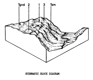
Qbsd - Stony Rises with Gradational Soils on Quaternary Basalt drier than Qbs
 | Low stony rises on basalt. There are several small patches in the south of the Shire but only one extensive area, which is to the west of Lethbridge. The total area of 7.3 km2 represents 1.0% of the Shire. The small areas of Qbsd occur as stony rises on the basalt plains or as isolated remnants of basalt in other units. The large area west of Lethbridge has a slightly higher elevation than the surrounding basalt and Tga units. The degree of surface stoniness varies considerably and many areas have been cleared to allow for grazing and some cropping. Rock piles and stone fences are common around these areas. Irrespective of surface stoniness, all areas have shallow black uniform soils, usually with large quantities of rock, overlying hard bedrock. The soils are not very permeable but drainage is better than in other gently sloping basalt units because there is surface runoff to surrounding lower land. SOILS The most common soil is found on both Components 1 and 2, and is usually a Ug 5.12, although others occasionally do occur. |
Stony Black, Clay Soils, Uniform Texture, Coarse Structure
Factual Key: Ug 5.12/LC-MC; 10-20 cm/basalt, 50-100 cm
Horizon | Depth (cm) | Description |
A1 | 0-10 | Black (10YR 2/1) when moist; light medium clay; strong angular blocky 10 mm; consistence when moist is firm; 5-70% surface stones; pH 7.0; clear boundary. |
B | 10-60 | Brown black (10YR 3/1) when moist; heavy clay; strong angular blocky 3 mm: consistence when wet, very plastic; 10-50% basalt stones and boulders; pH 8.5. |
R | 60+ | Basalt rock. |
| COMPONENT Proportion % | 1 90 | 2 10 |
| CLIMATE | ||
| Rainfall(av.) mm | Annual 500 - 600 | |
| Temperature(av.) °C | Annual 12 | |
| GEOLOGY | ||
| Age, rock | Pleistocene basalt | |
| TOPOGRAPHY | ||
| Landscape | Stony rise area west of Lethbridge | |
| Elevation (range) m | 110 - 235 | |
| Local relief (av.) m | 10 | |
| Drainage pattern | Dendritic | |
| Drainage density km/km2 | 0.2 | |
| Land form | Stony rise | Drainage line |
| Position on land form | Slopes | Depression |
| Slope (range) %, slope shape | 1-5 ; Convex | 1-2 ; Straight |
| NATIVE VEGETATION | ||
| Structure | Woodland ? | |
| Dominant species | E. camaldulensis | |
| SOIL | ||
| Parent material | In-situ weathered rock | In-situ weathered rock with some alluvium |
| Description | Stony black clay soil, uniform texture, coarse structure | Black clay soil, uniform texture, coarse structure |
| Factual key | Ug 5.12 or Ug 5.14 | Ug 5.1 |
| Surface texture | Clay | Clay |
| Permeability | Low | Low Low |
| Depth (range) m | 0.5 -.1.0 | 1.0 - 2.0 |
| LAND USE | ||
Grazing | ||
| SOIL DETERIORATION | ||
| Critical land features | Slope gradient | Slope gradient |
| Processes | Overland flow | Overland flow |
| Forms | Minor sheet erosion, nutrient decline | Minor rill erosion |
Qbc - Plains with Clay Soils on Quaternary Basalt
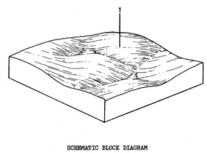 | Small areas of black, cracking, clay soils on gently undulating basalt plains in the northern section of the Shire. The unit covers only 0.3 km2 or 0.04% of the survey area - one of the smallest units. It is similar to Qbcd, but the climate is wetter. The land-use is mainly cereal cropping and grazing. The heavy clay soil retains moisture well but is difficult to work into a fine seedbed except at optimum moisture content. The unit generally has a low erosion hazard, and could be used more intensively. The clay, however, is highly expansive and has a high plasticity index - special foundations for constructions are required. SOILS The soil is fairly homogeneous throughout this unit. |
Black Clay Soils, Uniform Texture - Self Mulching
Factual Key: Ug 5.14/LC-MC, 10-30 cm/basalt, 80-160 cm
Horizon | Depth (cm) | Description |
A | 0-20 | Black (10YR 2/1) when moist; medium clay; strong angular blocky 15 mm; consistence when moist is very firm; pH 7.0; clear boundary. |
B | 20-80 | Brownish black (10YR 3/1) when moist; heavy clay; strong angular blocky 2 mm; consistence when wet, very plastic; occasional basalt stones and boulders; pH 8.5; diffuse boundary. |
C | 80-120 | Grey (2.5YR 4/0) when moist; heavy clay; strong angular blocky 1 mm; consistence when wet is very plastic; occasional basalt stones and boulders; pH 8.0. |
R | 120+ | Basalt rock at variable depth |
| COMPONENT Proportion % | 1 100 |
| CLIMATE | |
| Rainfall(av.) mm | Annual 650 - 685 |
| Temperature(av.) °C | Annual 12 |
| GEOLOGY | |
| Age, rock | Pleistocene, basalt |
| TOPOGRAPHY | |
| Landscape | Slightly dissected plains in the north of the Shire |
| Elevation (range) m | 228 - 267 |
| Local relief (av.) m | 5 |
| Drainage pattern | Dendritic |
| Drainage density km/km2 | 1.7 |
| Land form | Plain |
| Position on land form | - |
| Slope (range) %, slope shape | 2-10 ; Convex |
| NATIVE VEGETATION | |
| Structure | (?) |
| Dominant species | |
| SOIL | |
| Parent material | In-situ weathered rock |
| Description | Black clay soils. uniform texture, coarse structure - self mulching |
| Factual key | Ug 5.14 |
| Surface texture | Heavy clay |
| Permeability | Moderate |
| Depth (range) m | 0.8 - 1.6 |
| LAND USE | |
Cropping (cereal), occasional grazing | |
| SOIL DETERIORATION | |
| Critical land features | Slope |
| Processes | Overland flow |
| Forms | Minor sheet erosion |
Qbbd - Steep-sided Valleys with Duplex Soil on Quaternary Basalt. Drier than Qbb
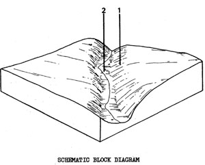 | Moderate to very steep scarps caused by creeks cutting into the basalt plain. Includes the alluvium of the creek unless these areas are sufficiently large to be mapped as a separate unit. There are about a dozen occurrences of the unit throughout the southern half of the Shire, including some sections along the stony lip of the Moorabool River near She Oaks. The total of 8.2 km2, represents 1.2% of the Shire. It is similar to Qbb in the north but the climate of Qbbd is drier. The slopes are usually stony. There is generally not much erosion evident despite the steep slopes because a protective grassland cover develops readily on the fertile, moderately permeable soils. Gullying will occur rapidly if the soil is exposed to concentrated runoff. Where the soils are deeper or the basalt overlies unconsolidated material, landslips may occur. Grazing and recreation are the main land uses. SOILS The soil description below is representative of Component 1. |
Shallow Brown Duplex Soils
Factual Key: Db 1.11/CL, 20-40 cm/basalt, 10-45 cm
Horizon | Depth (cm) | Description |
A | 0-20 | Brownish black (7.5YR 3/2) when moist; clay loam; weak subangular blocky 5 mm; consistence when dry is slightly hard; 20% stones of parent material (8 cm average size); pH 6.0; abrupt boundary. |
B | 20-30 | Dark brown (10YR 3/3) when moist; medium clay; moderate to strong angular blocky 4 mm; consistence when dry is hard; 80% stones of parent material (30 cm average size) and 5% of buckshot; pH 6.0; abrupt boundary. |
R | 30+ | Weathering basalt. |
| COMPONENT Proportion % | 1 70 | 2 30 |
| CLIMATE | ||
| Rainfall(av.) mm | Annual 510 - 580 | |
| Temperature(av.) °C | Annual 13 | |
| GEOLOGY | ||
| Age, rock | Pleistocene, basalt | |
| TOPOGRAPHY | ||
| Landscape | Scarp beside main creek including the river channel in places | |
| Elevation (range) m | 30 - 198 | |
| Local relief (av.) m | 38 | |
| Drainage pattern | Dendritic | |
| Drainage density km/km2 | 1.2 | |
| Land form | Scarp with local rock outcrop | Creek bed |
| Position on land form | Slope | Flood plain |
| Slope (range) %, slope shape | 10-30 ; Convex | 1-3 ; Straight |
| NATIVE VEGETATION | ||
| Structure | Woodland (?) | |
| Dominant species | E. camaldulensis | |
| SOIL | ||
| Parent material | In-situ weathered rock | Unconsolidated sedimentary and in-situ weathered rock |
| Description | Shallow brown duplex or gradational soils | Black clay soils, uniform texture, coarse structure |
| Factual key | ||
| Surface texture | Clay loam | Clay |
| Permeability | High | Low |
| Depth (range) m | 0.5 - 1.5 | 1.0 - 2.5 |
| LAND USE | ||
Grazing | ||
| SOIL DETERIORATION | ||
| Critical land features | Steep slope, hard setting surfaces | Poorly drained site, low permeability |
| Processes | Overland flow, sub surface flow | Overland flow, periodic waterlogging |
| Forms | Minor sheet and rill erosion, low landslip hazard | Streambank erosion, surface compaction |
Tbd - Slopes with Clay Soils on Tertiary Basalt
 | Isolated crests and slopes near Maude, with moderate to gentle gradients, on Tertiary basalt (older, well weathered basalt). The total area of 1.3 km2, amounts to (only) 0.2% of the Shire. The black clayey soils, being fertile and having good water holding capacity, are suited to the common uses of cropping and market gardening. However, they do require optimum moisture for seedbed preparation and, once cultivated, deep rilling can occur very rapidly. Under grazing, those soils grow good pasture and, being well protected, are quite stable. SOILS The most common soil type (described below) is a uniform, black, cracking clay. There are, however, odd areas of chocolate or red-brown gradational soils. |
Dark Uniform Clay Soils
Factual Key: Ug 5.1 / LC-MC, 10-70 cm/older basalt, 10-80 cm.
Horizon | Depth (cm) | Description |
A11 | 0-20 | Brownish black (7.5YR 3/2) when moist; light medium clay; moderate subangular blocky, 5mm; consistence when moist is friable; pH 8.0. |
A12 | 20-50 | Brownish black (7.5YR 3/2) when moist; light medium clay; strong subangular blocky; consistence when moist is friable1 pH 8.5. |
C | 50+ | Rotting basalt (greenish grey) with lime. |
| COMPONENT Proportion % | 1 50 | 2 45 | 3 5 |
| CLIMATE | |||
| Rainfall(av.) mm | Annual 560 - 600 | ||
| Temperature(av.) °C | Annual 12 | ||
| GEOLOGY | |||
| Age, rock | Tertiary basalt | ||
| TOPOGRAPHY | |||
| Landscape | Isolated occurrences of gentle to moderate slopes near Maude | ||
| Elevation (range) m | 170 - 190 | ||
| Local relief (av.) m | 15 | ||
| Drainage pattern | Dendritic | ||
| Drainage density km/km2 | 1 | ||
| Land form | Crest | Slopes | Drainage line |
| Position on land form | Highest | Medium | Lowest |
| Slope (range) %, slope shape | 1-5 ; Convex | 5-15 ; Convex-Straight | 1-3 ; Concave |
| NATIVE VEGETATION | |||
| Structure | Woodland ? | ||
| Dominant species | E. leucoxylon | ||
| SOIL | |||
| Parent material | In-situ weathered rock | ||
| Description | Dark uniform clays and sodic chocolate gradational soils | Dark uniform clays and sodic chocolate gradational soils | Yellow mottled dark sodic duplex soils, coarse structure |
| Factual key | Ug 5.1 - Gn 3.12 | Ug 5.1 - Gn 3.12 | Dd 2.43 |
| Surface texture | Clay - clay loam | Clay - clay loam | Clay loam |
| Permeability | Moderate | Moderate | Low |
| Depth (range) m | 0.5 - 1.0 | 0.3 - 0.8 | 1 - 1.5 |
| LAND USE | |||
Cropping - grazing | Grazing | ||
| SOIL DETERIORATION | |||
| Critical land features | Slope gradient, soil permeability | Slope gradient, soil permeability | Seasonal high watertable Soil permeability, sodic soil, position on landscape |
| Processes | Overland flow | Overland flow | Overland flow, period waterlogging |
| Forms | Moderate sheet erosion when fallowed | Moderate sheet erosion | Surface compaction |
Qbf - Plain with Clay Soil and duplex Soils and Quaternary Basalt
 | Extensive flat to gently undulating plains located in the centre of the Shire, along the Midland Highway. Having a total area of 46 km2, it occupies 6.6% of the Shire. Black cracking clays, although sporadic in occurrence, are more common than in Qbgd. Their occurrence may be related to the depth of bedrock. Cropping and grazing are the main uses, with the black cracking clays favoured for cropping. SOILS The soil description for Component 2 (the black uniform clay) is the same as for Map Unit Qbcd. The soil description below refers to Component 1. |
Mottled, Dark Sodic Duplex Soils - Coarse Structure
Factual Key: Dd 2.43/CL, 10-60 cm/basalt, 30-400 cm
Horizon | Depth (cm) | Description |
A1 | 0-20 | Brownish black (10YR 3/2) when moist; clay loam; weak subangular blocky 7 mm; consistence when slightly moist is firm; pH 6.0; sharp boundary. |
A2 | 20-50 | Greyish yellow brown (10YR 5/2) when moist; clay loam; apedal and massive; consistence when slightly moist is firm; buckshot gravel increases to 40-70% at the A2/B21 interface; pH 6.0; sharp boundary. |
B21 | 50-110 | Brownish black (10YR 3/1) when moist; heavy clay with yellow mottling with a moderate subangular blocky 50 mm breaking down to a strong angular blocky 2 mm; consistence when slightly moist is extremely firm; pH 7.5; diffuse boundary. |
B22 | 110+ | Greyish yellow brown (10YR 4/2) when moist; heavy clay; strong subangular blocky 80 mm breaking down to a strong angular blocky 2 mm; consistence when slightly moist is extremely firm; pH 8.0 |
| COMPONENT Proportion % | 1 50 | 2 40 | 3 10 |
| CLIMATE | |||
| Rainfall(av.) mm | Annual 510 - 630 | ||
| Temperature(av.) °C | Annual 13 | ||
| GEOLOGY | |||
| Age, rock | Pleistocene, basalt | ||
| TOPOGRAPHY | |||
| Landscape | Plain in the centre of Survey Area along the Midland Highway | ||
| Elevation (range) m | 60 - 260 | ||
| Local relief (av.) m | 2 | ||
| Drainage pattern | Dendritic | ||
| Drainage density km/km2 | 0.4 | ||
| Land form | Plain | ||
| Position on land form | Plain | Depression lines | |
| Slope (range) %, slope shape | 1-3 ; Straight | 1-2 ; Concave | |
| NATIVE VEGETATION | |||
| Structure | Woodland (?) | ||
| Dominant species | E. camaldulensis, E. leucoxylon, E. melliodora | ||
| SOIL | |||
| Parent material | In-situ weathered rock | Alluvium mainly from basalt | |
| Description | Mottled dark sodic duplex soils, coarse structure | Black clay soils, uniform texture, coarse structure | Black cracking clays, coarse structure |
| Factual key | Dd 2.43 | Ug 5.1 | Ug 5.1 |
| Surface texture | Clay loam | Light to medium clay | Medium clay |
| Permeability | Very low | Very low | Very low |
| Depth (range) m | 1.0 - 2.0 | 0.5 - 1.0 | 1.5 - 2.5 |
| LAND USE | |||
Cropping and grazing | Grazing | ||
| SOIL DETERIORATION | |||
| Critical land features | Hard setting surfaces | ||
| Processes | Overland flow | ||
| Forms | Minor sheet erosion | ||
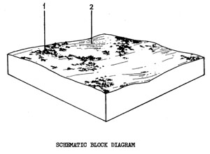
Qbs - Stony Rises with Gradational Soils on Quaternary Basalt
 | Stony rises on the basalt plains in the north of the Shire. There are only a few localities large enough to be mapped separately at this scale; smaller stony areas elsewhere have been identified by using the symbol “st”. The total area of 0.3 km2 represents only 0.04% of the total study area. The soil is relatively fertile but the surface basalt stones and boulders generally limit its use to grazing. SOILS The soils of this unit are generally very shallow (Um). When soil fills deep crevices in the rock, a Gn (as described) or a Db soil may develop. In extreme cases, a grey heavy clay (in the B22 horizon) may be found. |
Red Shallow Stony Gradational Soils
Factual Key: Gn 3.11/L-LC, 5-40 cm/basalt, 5-70 cm.
Horizon | Depth (cm) | Description |
A | 0-15 | Brownish black (5YR 3/2); when moist; gravelly loam; weak subangular blocky 5 mm; consistence when moist is friable; 5% small stones (basalt); pH 5.5; diffuse boundary. |
B | 15+ | Dark reddish brown (5YR 3/4) when moist; clay loam to light clay; strong angular blocky 1 mm; consistence when moist is friable; 40-60% stones (basalt); pH 6.0. |
| In many instances the B horizon is only present where the soil is deep in crevices in the basalt. | ||
| COMPONENT Proportion % | 1 100 |
| CLIMATE | |
| Rainfall(av.) mm | Annual 610 - 660 |
| Temperature(av.) °C | Annual 12 |
| GEOLOGY | |
| Age, rock | Pleistocene basalt |
| TOPOGRAPHY | |
| Landscape | Scattered stony areas in the north of the Shire |
| Elevation (range) m | 270 - 340 |
| Local relief (av.) m | 1 |
| Drainage pattern | - |
| Drainage density km/km2 | - |
| Land form | Stony areas |
| Position on land form | - |
| Slope (range) %, slope shape | 1-4 ; concave scarps, straight tops |
| NATIVE VEGETATION | |
| Structure | Woodland ? |
| Dominant species | E. viminalis |
| SOIL | |
| Parent material | In-situ weathered rock |
| Description | Red shallow stony gradational soils |
| Factual key | Gn 3.12 |
| Surface texture | Clay loam |
| Permeability | High |
| Depth (range) m | 0.1 - 1 |
| LAND USE | |
Grazing | |
| SOIL DETERIORATION | |
| Critical land features | Slope, shallow permeable soil |
| Processes | Overland flow; leaching |
| Forms | Low sheet erosion, nutrient decline |
Qbcd - Plains with Clay Soils on Quaternary Basalt. Drier than Qbc
 | Gently sloping areas of black uniform, self-mulching clays on basalt. There are four areas (near She Oaks) totalling 1.1 km2 and comprising 0.1% of the Shire. This unit supports similar land uses to Qbc; however, the climate here is drier. The black soils are quite fertile and are often used for onion growing and other cropping. Sheet erosion of fallow land can occur. During the summer, deep cracks appear as the clay dries out and shrinks; the magnitude of this shrink-swell property can be a problem for foundation construction. SOILS As there is only one component, the soil description below represents the whole unit. |
Black Clay Soils, Uniform Texture - Self-Mulching
Factual Key: Ug 5.14/LC-MC, 10-30 cm/basalt, 80-160 cm
Horizon | Depth (cm) | Description |
A | 0-20 | Black (10YR 2/1) when moist; medium clay; strong angular blocky 15 mm; consistence when moist is firm; pH 7.0; clear boundary. |
B | 20-80 | Brownish black (10YR 3/1) when moist; heavy clay; strong angular blocky 2 mm; consistence when wet, very plastic; occasional basalt stones and boulders; pH 8.5; diffuse boundary. |
C | 80-120 | Grey (2.5YR 4/0) when moist; heavy clay; strong angular blocky 1 mm; consistence when wet is very plastic; occasional basalt stones and boulders; pH 8.0. |
R | 120+ | Basalt rock. |
| COMPONENT Proportion % | 1 100 |
| CLIMATE | |
| Rainfall(av.) mm | Annual 610 - 630 |
| Temperature(av.) °C | Annual 2 |
| GEOLOGY | |
| Age, rock | Pleistocene, basalt |
| TOPOGRAPHY | |
| Landscape | Slightly dissected plains |
| Elevation (range) m | 185 - 251 |
| Local relief (av.) m | 3 |
| Drainage pattern | Dendritic |
| Drainage density km/km2 | 1.7 |
| Land form | Plain |
| Position on land form | - |
| Slope (range) %, slope shape | 1-4; Convex |
| NATIVE VEGETATION | |
| Structure | (?) |
| Dominant species | |
| SOIL | |
| Parent material | In-situ weathered rook |
| Description | Black clay soils, uniform texture, coarse structure - self mulching |
| Factual key | Ug 5.14 |
| Surface texture | Heavy clay |
| Permeability | Moderate |
| Depth (range) m | 0.8 - 1.5 |
| LAND USE | |
Market garden (onions), cropping (cereal), occasional grazing | |
| SOIL DETERIORATION | |
| Critical land features | Slope |
| Processes | Overland flow |
| Forms | Minor sheet erosion |
Qbbd - Steep-sided valley with Duplex Soils on Quaternary Basalt
| Moderate to very steep scarps caused by creeks cutting into the basalt plain. Includes the alluvium of the creek unless these areas are sufficiently large to be mapped as a separate unit. There are about a dozen occurrences of the unit throughout the southern half of the Shire, including some sections along the stony lip of the Moorabool River near She Oaks. The total of 8.2 km2, represents 1.2% of the Shire. It is similar to Qbb in the north but the climate of Qbbd is drier. The slopes are usually stony. There is generally not much erosion evident despite the steep slopes because a protective grassland cover develops readily on the fertile, moderately permeable soils. Gullying will occur rapidly if the soil is exposed to concentrated runoff. Where the soils are deeper or the basalt overlies unconsolidated material, landslips may occur. Grazing and recreation are the main land uses. SOILS The soil description below is representative of Component 1. |
Shallow Brown Duplex Soils
Factual Key: Db 1.11/CL, 20-40 cm/basalt, 10-45 cm
Horizon | Depth (cm) | Description |
A | 0-20 | Brownish black (7.5YR 3/2) when moist; clay loam; weak subangular blocky 5 mm; consistence when dry is slightly hard; 20% stones of parent material (8 cm average size); pH 6.0; abrupt boundary. |
B | 20-30 | Dark brown (10YR 3/3) when moist; medium clay; moderate to strong angular blocky 4 mm; consistence when dry is hard; 80% stones of parent material (30 cm average size) and 5% of buckshot; pH 6.0; abrupt boundary. |
R | 30+ | Weathering basalt. |
| COMPONENT Proportion % | 1 70 | 2 30 |
| CLIMATE | ||
| Rainfall(av.) mm | Annual 510 - 580 | |
| Temperature(av.) °C | Annual 13 | |
| GEOLOGY | ||
| Age, rock | Pleistocene, basalt | |
| TOPOGRAPHY | ||
| Landscape | Scarp beside main creek including the river channel in places | |
| Elevation (range) m | 30 - 198 | |
| Local relief (av.) m | 38 | |
| Drainage pattern | Dendritic | |
| Drainage density km/km2 | 1.2 | |
| Land form | Scarp with local rock outcrop | Creek bed |
| Position on land form | Slope | Flood plain |
| Slope (range) %, slope shape | 10-30 ; Convex | 1-3 ; Straight |
| NATIVE VEGETATION | ||
| Structure | Woodland (?) | |
| Dominant species | E. camaldulensis | |
| SOIL | ||
| Parent material | In-situ weathered rock | Unconsolidated sedimentary and in-situ weathered rock |
| Description | Shallow brown duplex or gradational soils | Black clay soils, uniform texture, coarse structure |
| Factual key | ||
| Surface texture | Clay loam | Clay |
| Permeability | High | Low |
| Depth (range) m | 0.5 - 1.5 | 1.0 - 2.5 |
| LAND USE | ||
Grazing | ||
| SOIL DETERIORATION | ||
| Critical land features | Steep slope, hard setting surfaces | Poorly drained site, low permeability |
| Processes | Overland flow, sub surface flow | Overland flow, periodic waterlogging |
| Forms | Minor sheet and rill erosion, low landslip hazard | Streambank erosion, surface compaction |
Qbgs - Stony Plains with Duplex Soil on Quaternary Basalt
 | Flat to gently undulating, stony, basalt plains, mainly in the south-east corner. The 62 km2 total area represents 8.9% of the Shire; the third-largest unit. The most striking feature is the quantity of surface stones. In less extreme cases, these have often been picked up to allow for agriculture and grazing and put in piles or used for stone fences. Apart from the black clayey soils which may occur where the surface is particularly rocky, the soil is similar to, but stonier than in Qbgd. In both cases, however, the clay has low permeability, high plasticity and high shrink-swell potential. The most common land use is grazing. SOILS The most common soil occurs on Component 1. |
Stony Mottled Dark Grey Duplex Soils - Coarse Structure
Factual Key: Dd 2.43/CL-LC, 10-30 cm/basalt, 50-100 cm
Horizon | Depth (cm) | Description |
A1 | 0-10 | Brownish black (10YR 3/2) when moist; clay loam; weak subangular blocky 5 mm; consistence when dry is hard; surface stones 1 to 30%; pH 6.0; abrupt boundary. |
A2 | 10-15 | Greyish yellow brown (10YR 5/3) when moist; clay loam; apedal and massive; consistence when dry is hard; 1-25% basalt stones; pH 6.0; abrupt boundary. |
B21 | 15-35 | Brownish black (10YR 3/1) when moist; heavy clay; moderate subangular blocky 40 mm; consistence when slightly moist is very firm; 1-25% basalt stones; pH 7.5; diffuse bGreyish yellow-brown (10YR 4/2) when moist; heavy clay; moderate subangular blocky 60 mm; consistence when slightly moist is very firm; 1-60% basalt atones; pH 8.5.oundary. |
B22 | 35-60+ |
| COMPONENT Proportion % | 1 75 | 2 30 | 3 5 |
| CLIMATE | |||
| Rainfall(av.) mm | Annual 500 - 560 | ||
| Temperature(av.) °C | Annual 13 | ||
| GEOLOGY | |||
| Age, rock | Pleistocene, basalt | ||
| TOPOGRAPHY | |||
| Landscape | Stony plains south of Shire | ||
| Elevation (range) m | 30 - 85 | ||
| Local relief (av.) m | 7 | ||
| Drainage pattern | Dendritic | ||
| Drainage density km/km2 | 0.4 | ||
| Land form | Stony plain | Plain | Drainage line |
| Position on land form | Upper slope (?) | Lower slope (?) | Depression |
| Slope (range) %, slope shape | 1-4 ; Convex | 1-3 ; Straight | 1-2 ; Straight |
| NATIVE VEGETATION | |||
| Structure | Woodland ? | ||
| Dominant species | E. camaldulensis | ||
| SOIL | |||
| Parent material | In-situ weathered rock | In-situ weathered rook | Alluvium |
| Description | Stony, mottled dark grey sodic duplex soils, coarse structure | Mottled dark grey sodic duplex soils, coarse structure | Black clay soil; uniform textures coarse structure |
| Factual key | Dd 2.43 | Dd 2.43 | Ug 5.1 |
| Surface texture | Clay loam | Clay loam | Clay |
| Permeability | Low | Low | Low |
| Depth (range) m | 0.5-1.0 | 1.0-2.0 | 1.5 |
| LAND USE | |||
Grazing | |||
| SOIL DETERIORATION | |||
| Critical land features | Hard Betting surfaces, slowly permeable subsoils | Hard setting surfaces, slowly permeable subsoils | Clay soils in drainage lines |
| Processes | Overland flow | Overland flow, periodic waterlogging | Overland flow |
| Forms | Minor sheet erosion, surface compaction | Minor sheet erosion, surface compaction | Minor sheet erosion, surface compaction |
© State of Victoria (Agriculture Victoria) 1996 - .

This work, Victorian Resources Online, is licensed under a Creative Commons Attribution 4.0 licence. You are free to re-use the work under that licence, on the condition that you credit the State of Victoria (Agriculture Victoria) as author, indicate if changes were made and comply with the other licence terms.
The licence does not apply to ‘branding’ or some ‘images or photographs’ that may be owned by third parties. We ask you to seek prior approval to use images using the VRO feedback form. Access to higher quality images can also be provided on request.
This page was last updated on .