
Soils on Older Consolidated Sediments
Org - Ordovician Plain | Orr - Ordovician Hills (North) | Ors - Ordovician Steep Hill | Pem - Permian Sediments (Moist ) | Per - Permian Sediments
Pem - Permian Sediments (Moist)
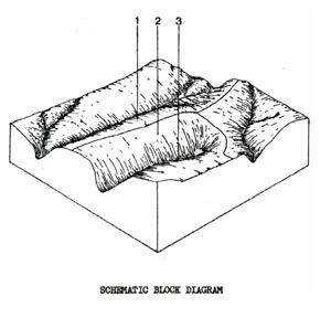 | There is only one location of this unit in the Shire of Ballan. It is an isolated outcrop of Permian tillite in the Wombat forest, north-west of Mt. Blackwood. It differs from the other areas of Permian tillite in the survey area by having a wetter climate and deep red soils. Also the candlebark gum (E. rubida) is replaced by messmate (E. obliqua) in this unit. This area is still forested although part of it is used for rural retreats. The unit only occupies 0.19% of the survey area (1.8 km2) |
PEM Red Mottled, Yellow Duplex Soils
Factual Key Dy 3.41/FSL, 25-45/Permian tillite, 50-150
Horizon | Depth (cm) | Description |
A1 | 0-5 | Brownish black (10YR 3/2) when moist; fine sandy loam; apedal & massive; consistence when moist is friable; pH 5.0; abrupt boundary. |
A2 | 5-30 | Dull yellow orange (10YR 6/3) when moist; with few fine yellow mottles; fine sandy loam; apedal & massive; consistence when moist is firm; pH 5.5; clear boundary. |
B1 | 30-60 | Bright yellowish brown (10YR 6/6) when moist; with abundant prominent yellow mottles; light medium clay; weak sub-angular blocky 20 mm; consistence when moist is firm; pH 5.0; abrupt boundary. |
B2 | 60-120 | Bright yellow brown (10YR 6/6) when moist; with few distinct red mottled; medium clay; strong angular blocky 4 mm; consistence when moist is firm; pH 5.0; abrupt boundary. |
R | 120-150 | Weathering tillite. |
| COMPONENT Proportion % | 1 | 2 | 3 |
10 | 80 | 10 | |
| CLIMATE | |||
| Rainfall(av.) mm | 760 – 810 | ||
| Temperature(av.) °C | - | ||
| Seasonal growth limitations | - | ||
| GEOLOGY | |||
| Age, rock | Permian tillite | ||
| TOPOGRAPHY | |||
| Landscape | Broad crests of gentle tillite in the Wombat Forest | ||
| Elevation (range) m | 570 – 640 | ||
| Local relief (av.) m | 8 | ||
| Drainage pattern | Dendritic | ||
| Drainage density km/km2 | 0.9 | ||
| Land form | Undulating Plains | ||
| Position on land form | Crest | Slopes | Depression line |
| Slope (range) %, slope shape | 0 – 4; Convex | 3 – 15; Convex | 1 – 3; Straight |
| NATIVE VEGETATION | |||
| Structure | Open forest | ||
| Dominant species | E. obliqua, E. radiata, E. ovata, E. viminalis | E. ovata, E. obliqua, E. radiata, E. viminalis | E. ovata, E. viminalis, E. obliqua, E. radiata |
| SOIL | |||
| Parent material | In-situ weathered rock | In-situ weathered rock | Alluvium-silt, clay sand & quartz |
| Description | Yellow shallow gradational soils | Red mottled yellow duplex soils | Dark brown gradational soils |
| Surface texture | Clay loam | Clay loam | Clays |
| Permeability | Moderate – high | Moderate – high | Moderate – low |
| Depth (range) m | 0.50 | 1.50 | 2 |
| LAND USE | |||
Forestry, urban sub-division (bush blocks) | |||
| SOIL DETERIORATION | |||
| Critical land features | Slopes | Steep slopes | Moderate permeability, dispersibility |
| Processes | Overland flow, leaching | Overland flow, leaching | Overland flow, sub-surface flow, waterlogging |
| Forms | Sheet & rill erosion, nutrient decline | Sheet & rill erosion | Gully erosion, compaction. |
Per - Permian Sediments
 | This unit represents 0.65% of the survey area and covers 6.0 km2. The main locations are on the south side of the Greendale fault at Greendale and around Pykes Creek Reservoir. There is one notably poor subdivision on this unit north of Greendale on erodible shallow soils. The unit is mainly used for grazing although parts of it are still timbered. There appears to be a climatic difference between this unit and Pem (Permian Sediments (Moist) in the Wombat forest. |
PER Yellow Duplex Soils
Factual Key Dy 3.41/CL-FSCL, 10-30/Permian tillite, 30-120
Horizon | Depth (cm) | Description |
A1 | 0-10 | Greyish yellow brown (10YR 4/2) when moist; clay loam, weak sub-angular blocky 2 mm; consistence when slightly moist is friable; pH 6.0; abrupt boundary. |
A2 | 10-20 | Dull yellowish brown (10YR 5/4) when moist: with few fine yellow mottles; clay loam; weak sub-angular blocky; consistence when dry is hard, when wet is spewy; pH 6.5; abrupt boundary. |
B1 | 20-50 | Yellowish brown (10YR 5/6) when moist; with abundant distinct brown & grey mottles; medium clay; weak sub-angular blocky 50 mm; consistence when dry is slightly hard; pH 6.0; clear boundary. |
B2 | 50-100 | Orange (7.5YR 6/6) when moist; with abundant prominent grey & red mottles; medium clay; weak sub-angular blocky 50 mm breaking down to strong angular blocky 2 mm; consistence when dry is hard; pH 6.0; clear boundary. |
C | 100+ | Weathering tillite gravelly clay. |
| COMPONENT Proportion % | 1 | 2 |
95 | 5 | |
| CLIMATE | ||
| Rainfall(av.) mm | 685 – 736 | |
| Temperature(av.) °C | - | |
| Seasonal growth limitations | - | |
| GEOLOGY | ||
| Age, rock | Permian tillite | |
| TOPOGRAPHY | ||
| Landscape | Hills in the Greendale area | |
| Elevation (range) m | 390 – 500 | |
| Local relief (av.) m | 12 | |
| Drainage pattern | Dendritic | |
| Drainage density km/km2 | 0.8 | |
| Land form | Undulating plains | |
| Position on land form | Crests, gentle slopes & lower slopes | Scarps & steep slopes |
| Slope (range) %, slope shape | 2 – 10; Convex | 15 – 35; Straight |
| NATIVE VEGETATION | ||
| Structure | Open forest | |
| Dominant species | E. rubida, E. ovata, E. radiata, E. viminalis | |
| SOIL | ||
| Parent material | In-situ weathered rock | |
| Description | Yellow duplex soil | Yellow, shallow, gravelly gradational soils |
| Surface texture | Loam | Clay loam |
| Permeability | Moderate – low | Moderate |
| Depth (range) m | 1 | 0.5 |
| LAND USE | ||
Grazing, urban sub-division | ||
| SOIL DETERIORATION | ||
| Critical land features | Hard setting surfaces, drainage | Slopes, dispersibility, hard setting surfaces |
| Processes | Overland flow | Overland flow, sub-surface flow, seepage |
| Forms | Sheet erosion | Severe landslips, sheet, rill & gully erosion |
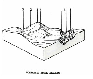
Org - Ordovician Plain
 | This unit consists of the gentler Ordovician country and has been separated from Ors on the basis of slope, vegetation, and soils. The unit is scattered down the east and west sides of the Shire and occupies 5.4% of the survey area (50.1 km2). It is mainly used for grazing and cereal cropping but. some parts are still forested |
ORG Red Mottled, Yellow Duplex Soils
Factual Key Dy 3.41/CL-L, 10-40/Weathering Ordovician Sediments
Horizon | Depth (cm) | Description |
A1 | 0-10 | Brownish black (10YR 3/2) when moist; clay loams; apedal & massive; consistence when dry is hard; pH 5.8; sharp boundary. |
A2 | 10-30 | Greyish yellow brown (10YR 4/2) when moist; clay loam; apedal hydrophobic massive; consistence when dry is very hard; pH 5.8; sharp boundary. |
B | 30-150 | Yellowish brown (10YR 5/6) when moist; red mottling; medium clay; strong angular blocky 2 mm; consistence when dry is very hard; pH 5.5; with 4% gravel. |
| COMPONENT Proportion % | 1 | 2 | 3 |
10 | 85 | 5 | |
| CLIMATE | |||
| Rainfall(av.) mm | 630 - 760 | ||
| Temperature(av.) °C | - | ||
| Seasonal growth limitations | - | ||
| GEOLOGY | |||
| Age, rock | Ordovician, slate & sandstone | ||
| TOPOGRAPHY | |||
| Landscape | Slightly dissected plain | ||
| Elevation (range) m | 421 | ||
| Local relief (av.) m | 10 | ||
| Drainage pattern | Dendritic | ||
| Drainage density km/km2 | 3.9 | ||
| Land form | Rolling plain | ||
| Position on land form | Crest | Long gentle slope | Drainage line |
| Slope (range) %, slope shape | 1 – 3; Convex | 3 – 9; Straight | 1 – 3; Concave |
| NATIVE VEGETATION | |||
| Structure | Woodland | Open forest | |
| Dominant species | E. obliqua, E. radiata | E. viminalis, E. obliqua | E. ovata, E. obliqua |
| SOIL | |||
| Parent material | In-situ weathered rock | In-situ weathered rock | Alluvium clay, silt, sand and gravel |
| Description | Shallow stony red gradational soil | Red mottled yellow duplex soil | Mottled yellow & red gradational soil |
| Surface texture | Gravelly loam | Loamy clay | Clay loam |
| Permeability | High | Moderate – Low | Low – Moderate |
| Depth (range) m | 0.6 | 1 | 2 |
| LAND USE | |||
Grazing with some forestry and cropping (cereal) | |||
| SOIL DETERIORATION | |||
| Critical land features | Hard setting surfaces, dispersibility | Hard setting surfaces | Moderate dispersibility, poorly drained site, hard setting surfaces |
| Processes | Overland flow, leaching of salts | Overland flow, leaching of salts | Overland flow, accumulation of salts |
| Forms | Sheet and rill erosion, compaction | Sheet and rill erosion, gully erosion, compaction | Salting, gully erosion |
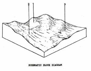
Ors - Ordovician Steep Hill
 | This unit consists of steep Ordovician hills and deeply incised valleys scattered throughout the survey area. A good example of this unit is the steep portion of the Brisbane Ranges on the west side of the Rowsley Fault. The main land use is forestry which is also the most Suitable use as this unit is highly erodible. Some parts of the unit are used for grazing. The unit occupies 10.67% of the Shire and covers an area of 98.9 km2. |
Red Mottled, Yellow Gradational Soils Fine Structure
Factual Key Gn 3.71/CL, 5-15/Weathered ordovician sediments 30-100
Horizon | Depth (cm) | Description |
A | 0-8 | Brown (7.5YR 4/3) when moist; gravelly clay loam; apedal, massive & hydrophobic; consistence when dry is hard; pH 5.5; diffuse boundary. |
B1 | 8-30 | Bright reddish brown (5YR 5/6) when moist with abundant red brown mottles; light medium clay; moderate angular blocky 3 mm; consistence when moist is firm; pH 5.8; diffuse boundary with colluvial stones. |
B2 | 30-50 | Reddish brown (5YR 4/6) when moist with abundant red mottles; medium clay; strong angular blocky 3 mm; consistence when moist is firm; pH 6.0; diffuse boundary. |
B/C | 50-60 | As B2 with 60-80% weathering. Ordovician sedimentary rock. |
R | 60+ | Ordovician rock. |
| COMPONENT Proportion % | 1 | 2 | 3 | 4 |
2 | 48 | 3 | 45 | |
| CLIMATE | ||||
| Rainfall(av.) mm | 660 – 710 | |||
| Temperature(av.) °C | - | |||
| Seasonal growth limitations | - | |||
| GEOLOGY | ||||
| Age, rock | Ordovician, slates and sandstones | |||
| TOPOGRAPHY | ||||
| Landscape | Hilly areas throughout the Shire | |||
| Elevation (range) m | 425 | |||
| Local relief (av.) m | 65 | |||
| Drainage pattern | Dendritic | |||
| Drainage density km/km2 | 7.6 | |||
| Land form | Hill | |||
| Position on land form | Moist protected slopes | Dry exposed slopes | Drainage line | Crest |
| Slope (range) %, slope shape | 15 ; Straight | 15 ; Straight | 3 ; Concave | 3 ; Convex |
| NATIVE VEGETATION | ||||
| Structure | Tall open forest | Open forest | ||
| Dominant species | E. obliqua, E. ovata, E. radiata, E. viminalis | E. dives, E. obliqua, E. viminalis, E. radiata | E. radiata, E. viminalis, E. obliqua | E. obliqua, E. dives, E. viminalis, E. radiata |
| SOIL | ||||
| Parent material | In-situ weathered rock | In-situ weathered rock | Alluvium, clay, silt, sand, gravel | In-situ weathered rock |
| Description | Red mottled yellow gradational or duplex soils, fine structure | Red mottled yellow gradational or duplex soils, fine structure | Black gradational soil (variable) | Shallow stony red & yellow gradational soil |
| Surface texture | Fine sandy loam | Fine sandy loam | Clay loam | Gravelly loam |
| Permeability | High | High | Moderate – Low | High |
| Depth (range) m | 1 | 1 | >1 | 0.5 |
| LAND USE | ||||
Mainly forestry, grazing | ||||
| SOIL DETERIORATION | ||||
| Critical land features | Steep slopes, hard setting surfaces | Steep slopes, hard setting surfaces | Moderate permeability, hard setting surfaces, dispersibility | Moderate slopes, hard setting surfaces |
| Processes | Overland flow | Overland flow | Overland flow, subsurface flow, waterlogging | Overland flow |
| Forms | Sheet and rill erosion | Sheet and rill erosion, compaction | Gully erosion, compaction | Sheet and rill erosion, compaction |
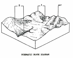
Orr - Ordovician Hills (North)
 | This is the second largest unit in the survey area, occupying 25.45% of the Shire and covering 236.0 km2. It is located to the north of the Greendale fault and is used for softwood plantations, forestry, recreation, mining, water supply protection, grazing and some cereal cropping. The erosion hazard of this unit is high and therefore careful management is required. Scattered throughout the unit are patches of Gn or Dr finely pedal red soils (Component 2) which may owe the origins to remnants of Tertiary, iron rich soils. The presence of fragments of fractured ferricrete are often associated with these profiles. These soils are more permeable and stable than the yellow soils. |
Yellow Duplex Soil
Factual Key Dy 3.41/FSL, 10-30/Weathered slates, 80-150.
Horizon | Depth (cm) | Description |
A1 | 0-15 | Brownish black (10YR 3/1) when moist; fine sandy loam; apedal and massive; consistence when slightly moist is firm; pH 5.0; clear boundary. |
A2 | 15-20 | Greyish yellow brown (10YR 5/2) when moist; and dull yellow orange (10YR 7/2) when dry; fine sandy loam; apedal and massive; consistence when slightly moist is firm; pH 5.0; abrupt boundary. |
B1 | 20-40 | Dull yellow orange (10YR 6/3) when moist; light clay; moderate sub-angular blocky 3mm; consistence when slightly moist is firm; pH 5.5; clear boundary. |
B2 | 40-100 | Dull yellow orange (10YR 1/3) when moist; faint and distinct red brown mottle; silty clay; strong angular blocky 3mm; consistence when slightly moist is firm; pH 5.5; clear boundary. |
C | 100+ | Weathering slates. |
| COMPONENT Proportion % | 1 | 2 | 3 | 4 |
20 | 15 | 60 | 5 | |
| CLIMATE | ||||
| Rainfall(av.) mm | 760 – 1000 | |||
| Temperature(av.) °C | - | |||
| Seasonal growth limitations | - | |||
| GEOLOGY | ||||
| Age, rock | Ordovician, slates and sandstone | |||
| TOPOGRAPHY | ||||
| Landscape | Hills at northern end of Shire | |||
| Elevation (range) m | 670 | |||
| Local relief (av.) m | 45 | |||
| Drainage pattern | Dendritic | |||
| Drainage density km/km2 | 5.9 | |||
| Land form | Hills | |||
| Position on land form | Crest & steep slopes | Slopes with deep soil | Slopes with shallow soil | Drainage line |
| Slope (range) %, slope shape | 5 – 20; Convex | 5 – 20; Straight | 5 – 30; Straight | 1 – 4 ; Concave |
| NATIVE VEGETATION | ||||
| Structure | Open forest | |||
| Dominant species | E. radiata, E. dives, E. rubida, E. obliqua | E. viminalis, E. obliqua, E. radiata, E. rubida (some E. cypellocarpa) | E. obliqua, E. radiata, E. rubida, E. dives, E. viminalis | E. ovata, E. obliqua, E. rubida, E. radiata |
| SOIL | ||||
| Parent material | In-situ weathered rock | In-situ weathered rock | In-situ weathered rock | Alluvium, colluvium clay, silt, sand and gravel |
| Description | Shallow stony brown gradational soils | Red duplex and red gradational soils, fine structure | Yellow duplex and yellow gradational soils | Brown gradational soil |
| Surface texture | Gravelly loam | Fine sandy loam to Clay loam | Fine sandy loam to Clay loam | Clay loam |
| Permeability | High | High | Moderate – High | Moderate |
| Depth (range) m | 0.5 | 2 | 1 | 2 |
| LAND USE | ||||
Soft wood plantations, some grazing, cropping | ||||
| SOIL DETERIORATION | ||||
| Critical land features | Steep slopes | Slopes | Slopes | Moderate permeability, dispersibility |
| Processes | Overland flow, leaching | Overland flow, leaching | Overland flow, leaching | Overland flow, subsurface waterlogging |
| Forms | Sheet & rill erosion, nutrient decline | Sheet erosion, nutrient decline | Sheet & rill erosion, nutrient decline | Gully erosion, compaction |
© State of Victoria (Agriculture Victoria) 1996 - .

This work, Victorian Resources Online, is licensed under a Creative Commons Attribution 4.0 licence. You are free to re-use the work under that licence, on the condition that you credit the State of Victoria (Agriculture Victoria) as author, indicate if changes were made and comply with the other licence terms.
The licence does not apply to ‘branding’ or some ‘images or photographs’ that may be owned by third parties. We ask you to seek prior approval to use images using the VRO feedback form. Access to higher quality images can also be provided on request.
This page was last updated on .