
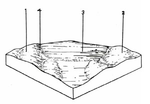
Soils on Basaltic Terrain
Tbs - Tertiary Basalt - Steep | Tgn - Upper Tertiary Plains | Tgp - Lower Tertiary Sediments - Gentle | Tsc - Upper Tertiary Scarps | Tsp - Lower Tertiary Sediments - Steep
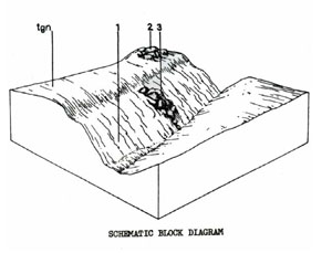
Tgn - Upper Tertiary Plains
 | This unit consists of fairly deep soils on unconsolidated Tertiary sands, clays and gravels in a gently undulating plain scattered throughout the central and southern parts of the Shire. The unit occupies 7.38% of the survey area or 68.4 km2. The main uses of these areas are grazing and sand and gravel extraction. Some of the poorer areas have been left forested with low quality timber. Some extensive flat areas to the south of the Shire are poorly drained (as component 3). Also in the South of the Shire, there are some outcrops of quartzite of pedological origin. |
TGN Red Mottled Yellow Duplex Soils
Factual Key Dy 3.41/SL-FSL, 10-40/tertiary sediments, 100-150
Horizon | Depth (cm) | Description |
A1 | 0-10 | Dark brown (7.5YR 3/4) when moist; sandy loam; weak sub-angular blocky 10 mm; consistence when slightly moist is firm; pH 5.0; abrupt boundary. |
A2 | 10-20 | Dull yellowish brown (10YR 5/4) when moist; sandy loam; apedal & massive; consistence when slightly moist is firm; 50% buckshot concentrated at A/B boundary; pH 6.0; abrupt boundary. |
B1 | 20-35 | Yellowish brown (10YR 5/6) when moist; few distinct red mottles; medium clay; strong angular blocky 2 mm; consistence when slightly moist is firm; 4% buckshot; pH 5.5; diffuse boundary. |
B2 | 35-150 | Yellowish brown (10YR 5/6) when moist; with abundant distinct red mottles; medium clay; strong angular blocky 2 mm; consistence when slightly moist is firm; 4% buckshot; diffuse boundary. |
C | 150+ | Weathering tertiary sediments. |
| COMPONENT Proportion % | 1 | 2 | 3 | 4 |
70 | 2 | 15 | 13 | |
| CLIMATE | ||||
| Rainfall(av.) mm | 650 – 900 | |||
| Temperature(av.) °C | - | |||
| Seasonal growth limitations | - | |||
| GEOLOGY | ||||
| Age, rock | Tertiary; gravels, sands and clays | |||
| TOPOGRAPHY | ||||
| Landscape | Plains | |||
| Elevation (range) m | 400 | |||
| Local relief (av.) m | 3 | |||
| Drainage pattern | Dendritic | |||
| Drainage density km/km2 | 4.4 | |||
| Land form | Undulating plain | Undulating plain | Flat plain | Drainage lines |
| Position on land form | Well drained non-sandy areas | Patches of deep sandy soil | Poorly drained non-sandy areas | Low lying areas |
| Slope (range) %, slope shape | 1 – 3; Convex | 1 – 3; Convex | 0 – 2; Flat | 1 – 3;; Concave |
| NATIVE VEGETATION | ||||
| Structure | Low open forest – woodland | |||
| Dominant species | Callitris columellaris in lower stratum (south of Shire area) E. viminalis, E. obliqua, E. radiata, E. rubida, E. ovata, (E. pauciflora – Durdidwarrah area) | Pteridium esculentum, E. viminalis | E. ovata | E. ovata |
| SOIL | ||||
| Parent material | Unconsolidated gravel, sand and clay | Unconsolidated sand | Unconsolidated gravel, sand and clay | Unconsolidated gravel, sand and clay |
| Description | Red mottled, yellow duplex soil, fine structure | Yellow sand soil, uniform texture | Yellow sodic duplex soil, coarse structure | Mottled yellow duplex soil |
| Surface texture | Sandy clay loam to loamy sand | Sand | Clay loam | Clay loam, sandy clay loam |
| Permeability | Moderate | High | Low | Moderate |
| Depth (range) m | 2 | 2 | 2 | 2 |
| LAND USE | ||||
Grazing, gravel, extraction, mining | ||||
| SOIL DETERIORATION | ||||
| Critical land features | Hard setting surfaces, dispersibility, permeability | Low water holding capacity, low nutrient holding capacity | Hard setting surfaces, permeability | Hard setting surfaces, permeability |
| Processes | Leaching of salts, overland flow | Leaching | Leaching of salts, overland flow | Some accumulation of salts, overland flow |
| Forms | Sheet and rill erosion, gully erosion | Fertility decline | Surface compaction, sheet erosion | Sheet and rill erosion, minor gully erosion. Salting, especially when adjacent to ordovician sediments. |
Tgp - Lower Tertiary Sediments - Gentle
 | This unit consists of gentle rises and elopes in the Parwon Valley with brown sodic duplex soils derived from Tertiary sands and silt clay. It has been separated from Tsp on the basis of gentler slopes, soil type and vegetation. The unit covers 0.85% of the Shire or 7.9 km2. It is used mainly for grazing although some parts have been cropped for cereals. The erosion hazard is moderately high but is much less than for Tsp. |
TGP Brown Sodic Duplex Soils
Factual Key Dy 3.43/FSL, 10-30/tertiary sediments
Horizon | Depth (cm) | Description |
A1 | 0-15 | Greyish yellow brown (10YR 4/2) when moist; fine sandy loam; hydrophobic; apedal & massive; consistence when dry is very hard; pH 6.5; clear boundary. |
A2 | 15-25 | Greyish yellow brown (10YR 5/2) when moist; with few faint yellow mottles; fine sandy loam; apedal & massive; consistence when dry is very hard & when wet is spewy; pH 6.5; clear boundary. |
B1 | 25-55 | Dull yellow (2.5YR 6/4) when moist; with abundant & distinct yellow mottles; sandy clay; weak prismatic 150 mm; breaking down to weak sub-angular blocky 30 mm; consistence when slightly moist is hard; 3% buckshot 5 mm; pH 8.5; abrupt boundary. |
B2 | 55-85 | Greyish yellow (2.5YR 7/2) when moist with abundant and prominent yellow mottles; sandy clay; weak prismatic 150 mm breaking down to moderate sub-angular blocky 30 mm; consistence when slightly moist is hard; pH 9.0; clear boundary. |
C | 85+ | Unconsolidated tertiary sediments (yellow mottled white silty clay). |
| COMPONENT Proportion % | 1 |
100 | |
| CLIMATE | |
| Rainfall(av.) mm | 500 – 630 |
| Temperature(av.) °C | - |
| Seasonal growth limitations | - |
| GEOLOGY | |
| Age, rock | Tertiary sand & silty clay |
| TOPOGRAPHY | |
| Landscape | Gentle rises & slopes in the Parwan Valley |
| Elevation (range) m | 240 – 270 |
| Local relief (av.) m | 40 |
| Drainage pattern | Dendritic |
| Drainage density km/km2 | 0.3 |
| Land form | Undulating plains |
| Position on land form | - |
| Slope (range) %, slope shape | 3 – 10 ; Convex |
| NATIVE VEGETATION | |
| Structure | Woodland (?) |
| Dominant species | E. leucoxylon, E. melliodora |
| SOIL | |
| Parent material | In-situ weathered rock |
| Description | Brown sodic duplex soils |
| Surface texture | Fine sandy loam |
| Permeability | Moderate |
| Depth (range) m | 1 |
| LAND USE | |
Grazing, some cereal cropping | |
| SOIL DETERIORATION | |
| Critical land features | Hard setting surfaces, dispersible sub-soils |
| Processes | Overland flow, movement of salt |
| Forms | Sheet, gully, tunnel erosion |
Tsc - Upper Tertiary Scarps
 | The unit is composed of the level upper surface of late Tertiary sediments which have been partially buried by the Quaternary lava flow and later exposed where streams have cut down through the basalt due mainly to rejuvenation associated with faulting, or where the more recent lava has terminated. The unit is mainly used for grazing and has a high erosion hazard. The unit extends over 17.0 km2 or 1.83% of the survey area. Soils Due to the variability of the parent material and, in places, to the influence of the colluvium from the basalt cap there is a wide spectrum of soils. A very strong volcanic influence can be inferred by the very dark clayey, well-structured horizons. |
TSC Black Uniform Soils
Factual Key Ug 5.11/Mc, 50-70/Volcanic colluvium over tertiary gravels.
Horizon | Depth (cm) | Description |
| A11 | 0-25 | Brownish black (10YR 2/2) when moist; medium clay; strong sub-angular blocky 3mm; (self-mulching); consistence when dry is hard; pH 6.5; clear boundary. |
| A12 | 25-60 | Brownish black (10YR 2/2) when moist; medium clay; moderate prismatic breaking into moderate sub-angular blocky 3 mm; consistence when dry is very hard; 5% of stones; pH 7.0; clear boundary. |
| BC | 60-190 | Dark brown (10YR 3/3) when moist; medium clay; moderate to angular blocky 3 mm; 70% stones; pH 7.5; clear boundary to tertiary gravels. |
| COMPONENT Proportion % | 1 | 2 | 3 |
85 | 5 | 10 | |
| CLIMATE | |||
| Rainfall(av.) mm | 650 - 900 | ||
| Temperature(av.) °C | - | ||
| Seasonal growth limitations | - | ||
| GEOLOGY | |||
| Age, rock | Tertiary gravel, sands & clays plus colluvium from basalt | Tertiary ironstone | Tertiary, quartzite |
| TOPOGRAPHY | |||
| Landscape | Original Tertiary plain, partially buried by Quaternary lava flow | ||
| Elevation (range) m | 243 | ||
| Local relief (av.) m | 10 | ||
| Drainage pattern | - | ||
| Drainage density km/km2 | - | ||
| Land form | Scarp | Rise | Outcrop |
| Position on land form | - | - | - |
| Slope (range) %, slope shape | 30 ; Straight – concave | 2 ; Straight | 1 ; Straight |
| NATIVE VEGETATION | |||
| Structure | Open forest (?) | ||
| Dominant species | E. obliqua, E. viminalis, E. radiata | ||
| SOIL | |||
| Parent material | Alluvial & colluvial basalt and unconsolidated gravels, sands and clays | Ironstone | Quartzite |
| Description | Black Uniform Soils | Reddish Shallow Uniform Soil | Brown Shallow Uniform Soil |
| Surface texture | Clay | Loam | Loam |
| Permeability | Moderate | High | High |
| Depth (range) m | 1 | 0.10 | 0.10 |
| LAND USE | |||
Grazing, occasional cropping (market garden) | Grazing | ||
| SOIL DETERIORATION | |||
| Critical land features | Slopes | Exposure, rooting depth | |
| Processes | Overland flow | Overland flow | |
| Forms | Sheet and rill erosion | Sheet, rill and wind erosion | |
Tsp - Lower Tertiary Sediments - Steep
 | This unit is the deeply dissected plain of the Parwan Valley with isolated hills, some of which have volcanic capping. The unit contains some of the most serious soil erosion in Victoria and as it is in a water supply catchment needs special management. The unit covers 32.2 km2 or 3.47% of the survey area. It is used for grazing although some parts should revert to forestry. Soils The presence of many active landslips and the influence of colluvium from the basalt cap at the top of the scarp has produced a soil which can be extremely variable over short distances. The soil described is one showing some basalt influence. |
TSP Shallow Sodic Gradational Soils, Coarse Structure
Factual Key Gn 3.13/CL-LC, 5-15/Tertiary sediments, 30-50
Horizon | Depth (cm) | Description |
A | 0-13 | Dark brown (7.5YR 3/3) when moist; light clay; moderate sub-angular blocky 5 mm; consistence when slightly moist is firm; 15% of gravel; pH 6.0; clear boundary. |
B | 13-35 | Dark brown (10YR 3/3) when moist; clay; strong angular blocky 25 mm; consistence when moist is firm; 2% weak accumulations of organic matter; pH 8.5; diffuse boundary. |
C | 35-150+ | Dull yellow orange (10YR 6/3) when moist; silty clay; pH 9.0. |
| COMPONENT Proportion % | 1 |
100 | |
| CLIMATE | |
| Rainfall(av.) mm | 500 – 630 |
| Temperature(av.) °C | - |
| Seasonal growth limitations | - |
| GEOLOGY | |
| Age, rock | Tertiary sands & silty clays |
| TOPOGRAPHY | |
| Landscape | Deeply dissected plain with isolated hills, some of which have volcanic capping |
| Elevation (range) m | 240 – 400 |
| Local relief (av.) m | 130 |
| Drainage pattern | Dendritic |
| Drainage density km/km2 | 1 |
| Land form | Closely dissected plain |
| Position on land form | Crests and slopes |
| Slope (range) %, slope shape | 15 – 35; Concave |
| NATIVE VEGETATION | |
| Structure | Woodland (?) |
| Dominant species | E. leucoxylon, E. melliodora, E. microcarpa |
| SOIL | |
| Parent material | In-situ weathered rock |
| Description | Shallow sodic gradational soil, coarse structure |
| Surface texture | Light clay |
| Permeability | Moderate |
| Depth (range) m | 1 |
| LAND USE | |
Grazing | |
| SOIL DETERIORATION | |
| Critical land features | Slope, structure, dispersibility, hard-setting surface |
| Processes | Leaching, overland flow, sub-surface flow, movement of salt |
| Forms | Severe landslip, sheet, gully, tunnel erosion |
Tbs - Tertiary Basalt - Steep
 | This unit consists of the steeply dissected Tertiary basalt plain in the Greendale area and around Pykes Creek Reservoir. The area has quite good black clay soils which are presently used for grazing and in gentler sloping areas, some cereal cropping. The latter could possibly be used more intensively. The unit represents 1.07% of the Shire and covers 9.9 km2. |
TBS Black Clay Soils Uniform Texture Coarse Structure,
Factual Key Ug 5.12/LC-MC, 5-20/Basalt, 25-50
Horizon | Depth (cm) | Description |
A11 | 0-5 | Brownish black (7.5YR 2/2) when moist; light medium clay; strong angular blocky 3 mm (self-mulching); consistence when moist is friable; pH 5.5; clear boundary. |
A12 | 5-25 | Brownish black (7.5YR 2/2) when moist; medium clay; strong angular blocky 5 mm; consistence when moist is friable; pH 6.5; clear boundary. |
25+ | Weathering basalt. |
| COMPONENT Proportion % | 1 | 2 |
90 | 10 | |
| CLIMATE | ||
| Rainfall(av.) mm | 685 – 736 | |
| Temperature(av.) °C | - | |
| Seasonal growth limitations | - | |
| GEOLOGY | ||
| Age, rock | Tertiary basalt | |
| TOPOGRAPHY | ||
| Landscape | Deeply dissected plains in the Greendale area | |
| Elevation (range) m | 400 – 550 | |
| Local relief (av.) m | 40 | |
| Drainage pattern | Dendritic | |
| Drainage density km/km2 | 1.8 | |
| Land form | Scarps & slopes | Stony areas |
| Position on land form | - | Localised surface capping |
| Slope (range) %, slope shape | 8 – 50 ; Convex | 1 – 3 ; Convex |
| NATIVE VEGETATION | ||
| Structure | Open forest (?) | |
| Dominant species | E. viminalis, E. ovata | |
| SOIL | ||
| Parent material | ||
| Description | Black clay soils, uniform texture, coarse structure | Red shallow gradational soil |
| Surface texture | Clay | Clay loam |
| Permeability | Moderate | High |
| Depth (range) m | 1 | <1 |
| LAND USE | ||
Grazing; cropping (cereal) | Grazing | |
| SOIL DETERIORATION | ||
| Critical land features | Slopes, permeability | Slopes |
| Processes | Overland flow – Subsurface flow | Overland flow |
| Forms | Sheet erosion – Landslip | Sheet erosion |
© State of Victoria (Agriculture Victoria) 1996 - .

This work, Victorian Resources Online, is licensed under a Creative Commons Attribution 4.0 licence. You are free to re-use the work under that licence, on the condition that you credit the State of Victoria (Agriculture Victoria) as author, indicate if changes were made and comply with the other licence terms.
The licence does not apply to ‘branding’ or some ‘images or photographs’ that may be owned by third parties. We ask you to seek prior approval to use images using the VRO feedback form. Access to higher quality images can also be provided on request.
This page was last updated on .