ESAS10c
Location: Inverleigh
Australian Soil Classification: Vertic, Mottled-Subnatric, Grey SODOSOL
Land Use: Cropping.

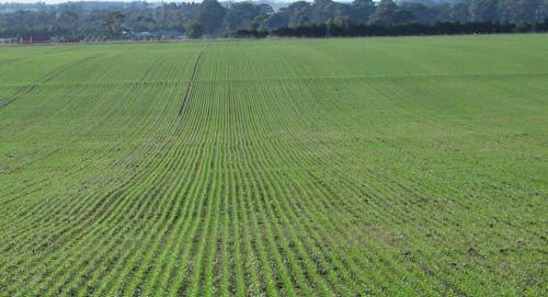
ESAS10c Landscape
Soil Profile Morphology:
Surface Soil
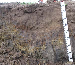
| A1 | 0-20 cm | Fine sandy clay loam; pH 5.6; changing to: |  ESAS10c Profile | |
| A2 | 20-40 cm | Sandy clay loam; pH 5.9; wavy change to: | ||
| Subsoil | ||||
| B21 | 40–55 cm | Brown (7.5YR4/2) with red (10R4/6) mottles; medium heavy clay; strong coarse blocky structure, parting to medium blocky structure, parting to fine blocky structure; pH 6.2; changing to: | ||
| B22 | 55-100 cm | Light brownish grey (2.5Y6/2) with brownish yellow (10YR6/6) mottles; heavy clay; strong very coarse prismatic, parting to moderate coarse blocky structure; small slickensides evident; contains a few (2%) soft manganiferous stains; dark stains along prismatic structure; pH 7.9. | ||
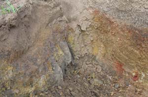
 ESAS10c and ESAS10b Soil profile variability. ESAS10c is on the left and ESAS10b is on the right. | ||||
Soil Profile Characteristics:
pH | Salinity Rating | |||
Surface (A1 horizon) | Moderately acid | Low | Sodic | None1 |
Subsoil (B21 horizon) | Slightly acid | Low | Sodic | Slight2 |
Deeper Subsoil (at 55-100 cm) | Slightly alkaline | Low | Strongly Sodic | Moderate2 |

| The surface is moderately acid. The subsoil is slightly acid becoming slightly alkaline in the deeper subsoil. | The salinity rating for the whole profile is low. |
|
|
Horizon | Horizon Depth (cm) | pH (water) | pH CaCl2 | EC (dS/m) | Exchangeable Aluminium mg/kg | Exchangeable Cations | |||
Ca | Mg | K | Na | ||||||
meq/100g | |||||||||
A1 | 0-20 | 5.6 | 4.9 | 0.11 | <10 | 1.9 | 1 | 0.4 | 0.32 |
A2 | 20-40 | 5.9 | 4.6 | 0.1 | 26 | 1.2 | 2.1 | 0.24 | 1 |
B21 | 40-55 | 6.2 | 5.1 | 0.23 | 12 | 3.9 | 9.9 | 0.97 | 5 |
B22 | 55-100 | 7.9 | 6.7 | 0.22 | 3.4 | 9.1 | 0.6 | 5.4 | |
Horizon | Horizon Depth (cm) | Oxidisable Organic Carbon % | Total Nitrogen % | Exchangeable Acidity meq/100g | Field Capacity pF2.5 | Wilting Point pF4.2 | Coarse Sand (0.2-2.0 mm) | Fine Sand (0.02-0.2 mm) | Silt (0.002-0.02 mm) | Clay (<0.002 mm) |
A1 | 0-20 | 0.83 | 0.067 | 4.6 | 15.8 | 4.7 | 36 | 38 | 10 | 15 |
A2 | 20-40 | 0.61 | <0.05 | 5.8 | 17.0 | 8.4 | 35 | 30 | 12 | 20 |
B21 | 40-55 | 15 | 46.5 | 38.1 | 10 | 9 | 3 | 73 | ||
B22 | 55-100 | 37.9 | 19.0 | 24 | 21 | 9 | 42 |
Profile Described By: Mark Imhof (July 2008).


