
3.1.1 Deeply dissected upland plateaux of the Southern Uplands
|
The crest of the Otway Ranges has relatively low topography, reflecting the initial flat-topped structural block before recent uplift. This moderately dissected plateau forms a drainage divide which trends north-east from Moonlight Head through Lavers Hill to Mount Chapple (550 m), then easterly to Mount Sabine (583 m), and north-east to parallel the coast through the highest point at Mount Cowley (686 m) to Anglesea. | 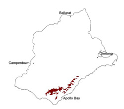 |
Soil-landform unit | Original unit ID | Unit description | Area (km2) |
| Mount Sabine L.S. | Rolling hills (top of the Otway Range) | 94 | |
| Beech Forest L.S. | Rolling hills (crest of the Otway Range) | 144 |
© State of Victoria (Agriculture Victoria) 1996 - .

This work, Victorian Resources Online, is licensed under a Creative Commons Attribution 4.0 licence. You are free to re-use the work under that licence, on the condition that you credit the State of Victoria (Agriculture Victoria) as author, indicate if changes were made and comply with the other licence terms.
The licence does not apply to ‘branding’ or some ‘images or photographs’ that may be owned by third parties. We ask you to seek prior approval to use images using the VRO feedback form. Access to higher quality images can also be provided on request.
This page was last updated on .