
Heytesbury Soil and Land Management
Heytesbury Soil Pits | Landslides | Related Studies | HDLN Soil & Water Action Program - Soil Assessment Component June 2008
| Heytesbury and District Landcare Network Soil and Water Dairy Action Program | 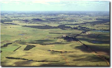 Aerial view of the Heytesbury region. | |
The Heytesbury region was settled as part of a returned soldier program. Dairying has become a major activity in the area and a significant contributor to the State’s dairying industry. The region consists of dissected plains exposing a range of land types with different topography, lithology and soils. This results in a range of responses to land use and climate. The intensification of land use in conjunction with land types has resulted in increased nutrient loads in the lower reaches of the Curdies River. There has been a response by the local community to improve the efficiency of land use (predominantly dairying) in relation to land type. Also to reduce the nutrient imprint on the local environment, starting with the Scotts Creek/Cooriemungle catchment. This program was developed by the Heytesbury and District Landcare Network (HDLN) (external link) in conjunction with the former Department of Primary Industries (DPI), Dairy Australia(DA) (external link) and the Corangamite Catchment Management Authority (CCMA) (external link).It aimed to provide dairy farmers in the area with a coordinated package of information, resources and incentives to help them improve the sustainability of their farming systems, and to also increase the adoption of best management practices through incentives to improve soil and water quality, technical advice, field days, trials and demonstrations, and a soil quality assessment and management program. |
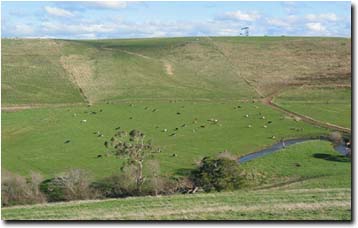
Curdies Valley near Cobden.
© State of Victoria (Agriculture Victoria) 1996 - .

This work, Victorian Resources Online, is licensed under a Creative Commons Attribution 4.0 licence. You are free to re-use the work under that licence, on the condition that you credit the State of Victoria (Agriculture Victoria) as author, indicate if changes were made and comply with the other licence terms.
The licence does not apply to ‘branding’ or some ‘images or photographs’ that may be owned by third parties. We ask you to seek prior approval to use images using the VRO feedback form. Access to higher quality images can also be provided on request.
This page was last updated on .